Environmental Impact Statement Chapter 2.0 Need for the Project
Table of contents
Accessibility
This digital version of the EIS is designed to be accessible to all users, providing screen reader compatibility, keyboard navigation, and described images. If you require additional assistance or have specific accessibility needs, please contact us at lightrailtowoden@act.gov.au or call 1800 956 409.
2.0 Need for the Project
This chapter describes the strategic context and need for the Project. It also outlines the Project's objectives and key benefits.
2.1 Overview
For thousands of years, the Canberra region's landscape of mountains, watercourses, valleys, hills and ridges have defined the movement of people. The meaning of Canberra is'meeting place' and the name of the city recognises the region's role and significance for different Aboriginal people (Thunderstone, 2020). Significant pathways were formed as people moved from place to place through transitional cultural boundaries following river and creek corridors and the ridges and spurs of hills and mountains. Pathways were the means of access across the region as well as a physical and visual link to major spiritual and gathering places.
In the early twentieth century, the Griffins laid out an urban form within a bush setting connected by roads and public transport routes. As new districts such as the Woden Valley were developed by the National Capital Development Commission, relatively long and narrow movement corridors connected defined activity centres. These movement corridors were typically defined by the natural features separating the districts.
Over time, the challenge of moving more people more efficiently along established transport corridors with minimal impact on the surrounding landscape and environment has been exacerbated by population growth. Canberra's population is projected to grow beyond half a million people in the coming years, and to be more than 750,000 by 2060 - an increase of more than 330,000 people compared with 2021 data (ACT Government, 2022). With this population growth will come increased demands on Canberra's transport networks, as its residents travel between home, work and a diverse range of social and recreational destinations. Without a strategic view of integrated land use and transport planning that includes delivery of additional transport capacity, Canberra's existing transport networks, particularly its road networks, will face increasing levels of congestion, reduced safety and efficiency, and decreased amenity as the population increases. These impacts will constrain the city's economic growth and prosperity as well as reduce its desirability and liveability.
In response to these challenges, the ACT Government in close collaboration with Commonwealth agencies such as the National Capital Authority (NCA), has adopted a strategic vision for Canberra and the ACT based on:
- Strategic land use planning delivered through the National Capital Plan (NCP), the Territory Plan and associated District Strategies and the ACT Planning Strategy 2018, that provide a framework for land use planning and development integrated and coordinated with timely infrastructure delivery
- Comprehensive infrastructure planning through the ACT Transport Strategy 2020 and the ACT Infrastructure Plan (Transport sector update, 2024) to complement the strategic land use planning vision for the city
- Recognition, particularly through the ACT Transport Strategy 2020 and ACT Infrastructure Plan, of the need to provide a diverse and resilient transport system that includes both improvements to the road network, and alternative public transport options, including non-road dependent modes such as light rail infrastructure
- A commitment to reducing the ACT's greenhouse gas emissions and contributions to climate change, delivered in part by a modal shift from a current reliance on motor vehicles for transport to less greenhouse gas intensive public transport options
- A desire to maintain and improve Canberra's liveability and prosperity by recognising the mobility, accessibility and reliability needs of its population, particularly in relation to efficient transport networks.
Further details of the integrated land use and transport planning context for the future of Canberra and the Project are provided in Section 2.2.
2.2 Strategic land use and transport planning policy context
The ACT Government, in collaboration with Commonwealth agencies such as the NCA, has developed a series of integrated land use and transport planning policies and initiatives targeted at maintaining Canberra as a prosperous, liveable and desirable city, and recognising its significant place as the nation's capital. Key strategies, policies and plans that provide a framework for land use and transport planning in Canberra and across the ACT are summarised in Section 2.2.1 to 2.2.4.
Statutory planning processes, including the assessment and approvals processes under legislation such as the Environment Protection and Biodiversity Conservation Act 1999 (Cth) (EPBC Act), the Planning Act 2023 (ACT) (Planning Act) and the Australian Capital Territory (Planning and Land Management) Act 1988 (Cth) (PALM Act) are discussed in Chapter 8 (Legislation and policy).
In relation to planning and delivery of transport infrastructure, these strategies, policies and plans present a series of key themes, including:
- Providing high quality, safe, convenient, and efficient transport
- Providing access to key destinations, such as employment hubs, social services, and tourist destinations
- Improving transport to support the development of compact urban centres
- Maximising accessibility to public transport
- Improving public transport use to reduce greenhouse gas emissions
- Delivering light rail as a sustainable transport option, and catalyst for urban renewal and economic development.
Delivering a light rail network in Canberra is one part of a broader response to key ACT Government transport policies and strategies, aimed at providing a diverse, resilient and sustainable transport network to support Canberra's future growth and prosperity.
2.2.1 The National Capital Plan
The NCP is the strategy and blueprint giving effect to the Australian Government's interests and intentions for planning, designing, and developing Canberra and the ACT. It is prepared and delivered by the NCA under the PALM Act and is focused on planning and development matters of national significance.
The NCP includes provisions in three key areas that are relevant to the Project:
- The Statement of Planning Principles that aim to give effect to the objectives of the NCP to ensure that Canberra and the Territory are planned and developed in accordance with their national significance, including:
- Productivity: ensure that infrastructure supports the development of Canberra's National Capital functions
- Sustainability: ensure the development of a city that both respects environmental values and reflects national concerns with the sustainability of Australia's urban areas
- Liveability: enhance and preserve Canberra's symbolic and unique design and role as the National Capital
- Accessibility: support a connected and equitable multi-modal transport system
- Land use plans and general land use controls
- Requirements applicable to Designated Areas, particularly the Central National Area and Main Avenues.
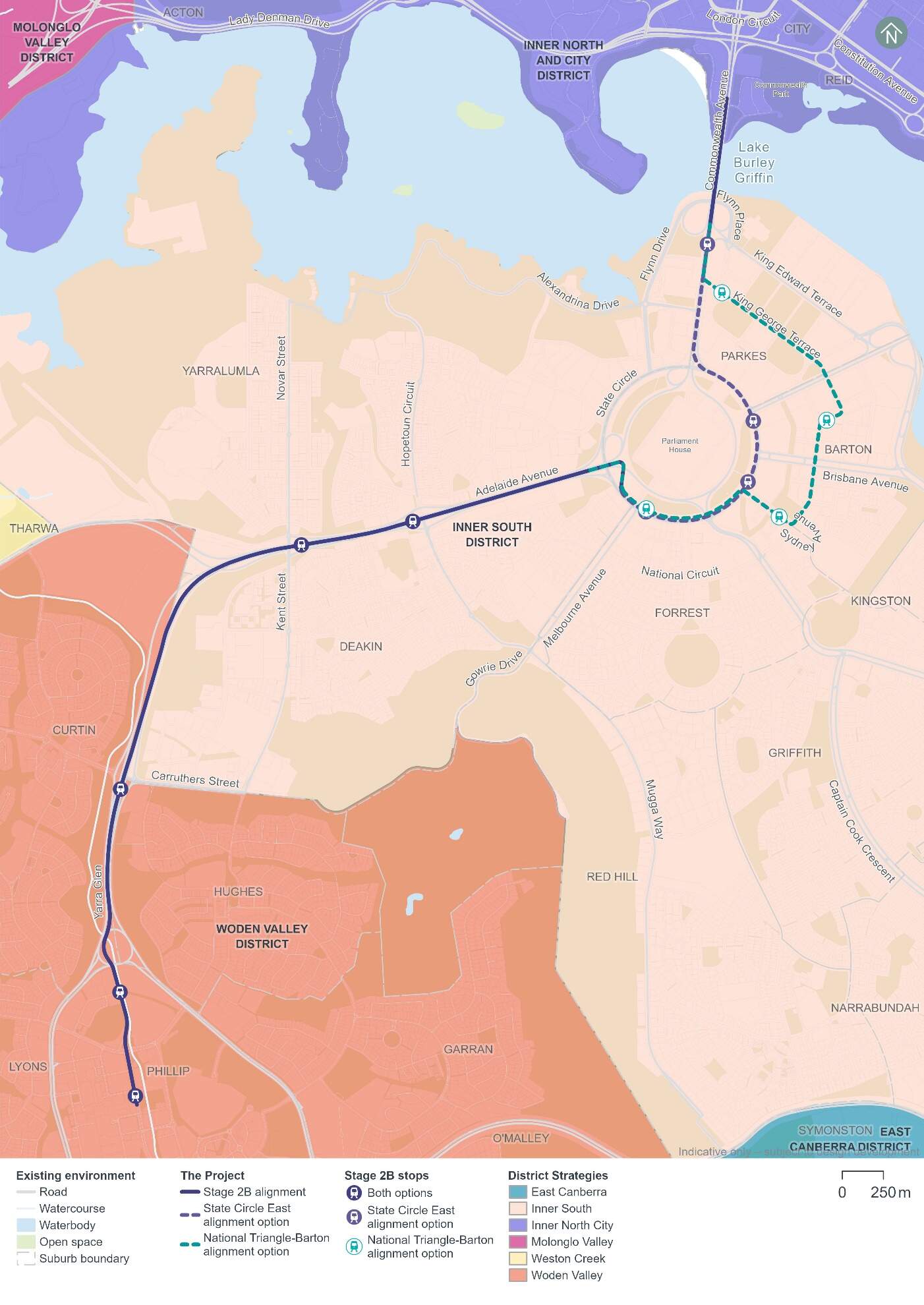
The NCP sets out the locations of an inter-town public transport system within the Territory, including a public transport route along Commonwealth Avenue, State Circle and Adelaide Avenue. The State Circle East alignment option is consistent with this corridor. The NCP policies provide for the reservation of a route to develop a segregated public transport service such as light rail with priority right of way to link major employment nodes, and a corridor between the city centre, town centres and major employment nodes.
Both Project alignment options would affect land within Designated Areas regulated under the NCP and would be subject to planning principles, policies, and the requirements of the NCP. The Project would require a Works Approval from the NCA for development proposed within the Designated Areas. Further information on approvals required for the Project, including a future Works Approval, are discussed in Section 8.1 of Chapter 8 (Legislation and policy). The consistency of the Project with the NCP, including alignment with its provisions relating to public transport corridors, is detailed in Section 11.8 of Chapter 11 (Project-wide issues).
2.2.2 ACT Transport Strategy 2020
The ACT Transport Strategy 2020 sets the ACT Government's objectives for developing Canberra's transport network (ACT Government, 2020). The strategy establishes three principal outcomes for Canberra's public transport network which would be supported by extending the Light Rail network, including:
- Managing congestion
- Reducing emissions
- Supporting a compact and efficient city.
A key concept within this strategy includes the 30-minute city concept, to ensure all Canberrans can travel around Canberra in an efficient way.
The strategy highlights the positive outcomes of light rail and specifically identifies the Project as a key priority investment in further developing the public transport network. The strategy recognises that the Project would be a catalyst for the transformation and revitalisation of Adelaide Avenue.
2.2.3 ACT Infrastructure Plan
The ACT Infrastructure Plan 2019 (Infrastructure Plan) provides a framework for how the ACT Government will build new and renew established infrastructure to cater for a city of 500,000 people (ACT Government, 2019b). The Infrastructure Plan is a comprehensive, multi-decade plan detailing over $14 billion worth of infrastructure investments, with a focus on health, education, transport, and community services.
Delivering the Project is a key priority for the Infrastructure Plan as it recognises the Project as a key enabler of more sustainable and efficient transport for Canberra.
The ACT Infrastructure Plan update (Transport) was released in 2024 (ACT Government, 2024). It includes a transport sector update and commitments to progress the planning and approvals for Light Rail to Woden as a priority project, including preparation of this EIS. The plan also identifies several other transport improvement projects, including road, public transport, and active travel enhancements.
2.2.4 Other key strategic plans, policies, and guidelines
The Project has and would continue to be designed and planned with consideration of the NCP and the Territory Plan. Further details on the Project's consistency with statutory requirements, including under the NCP and Territory Plan, are provided in Chapter 8 (Legislation and policy). Other key strategic plans, policies and guidelines relevant to the Project are listed in Table 2-1.
Section 7.2 of Chapter 7 (Sustainability) also provides an overview of key strategies and documents that are relevant to the Project's sustainability approach.
| Guiding policy documents | |
|---|---|
|
|
ACT Planning Strategy 2018 The ACT Planning Strategy 2018 (Planning Strategy) is the key strategic document for managing growth and change in the ACT (ACT Government, 2019a). A key priority of the Planning Strategy is improving Canberra's public transport network, by encouraging uptake, supporting sustainable transport options, encouraging active travel, and planning for a compact and efficient city. Delivering the Project forms part of two actions under the Planning Strategy, those being:
|
|
|
ACT Wellbeing Framework The ACT Government's Wellbeing Framework highlights factors contributing to Canberrans' wellbeing and liveability. A key domain is 'access and connectivity'. The Project supports this domain and others like social interaction, access to community services, housing options, efficient transport, and low-carbon transport. Section 3 of Technical Report 6 - Socioeconomic provides an overview of how the Project addresses the wellbeing domains identified in the Framework. |
|
|
City Renewal Authority 2025 Strategic Plan The City Renewal Authority 2025 Strategic Plan focuses on revitalising central Canberra in the designated City Renewal Precinct. The Plan aims to achieve the following objectives, which the Project would support:
The Plan focuses on the renewal of areas in and around the city which include City Hill and the Acton Waterfront. |
|
|
District Strategies: Inner North and City District Strategy 2023 There are nine strategic districts considered under the Territory Plan, each with its own corresponding strategic planning document. The aim of each document is to guide how each district within Canberra will change and grow towards 2038 and beyond to 2050. The Inner North and City District Strategy 2023 is one of nine district strategies that captures the area centrally located just north of Lake Burley Griffin, and includes the Canberra City Centre (City Centre), as shown in Figure 2-1 (EPSDD, 2023a). The Project would provide greater connection to Commonwealth Park and the Acton Waterfront which are identified as key destinations within the Strategy. The Strategy also states that the community values Light Rail Stage 1 (LRS1), and that the extension is a key opportunity for growth and change within the district. |
|
|
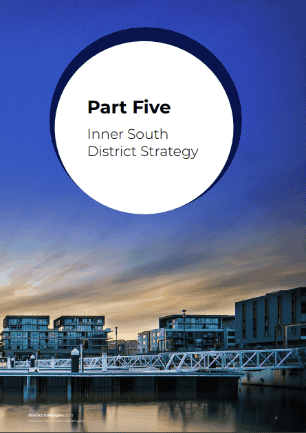
District Strategies: Inner South District Strategy 2023 The Inner South District Strategy 2023 captures the area extending from the Fyshwick Industrial precinct in the east to Yarralumla and Deakin in the west, as shown in Figure 2-1 (EPSDD, 2023b). The State Circle East alignment option would provide connections to key destinations identified in this Strategy including the National Library of Australia, Albert Hall, Lennox Gardens, National Archives, Parliament House, John James Memorial Hospital, and the Royal Australian Mint. The National Triangle- Barton alignment option would provide connections to these destinations as well as Old Parliament House including the Museum of Australian Democracy, Questacon, the National Portrait Gallery of Australia, the High Court of Australia, and the National Gallery of Australia. The Project is identified as a key opportunity for transformation within the district that would enhance accessibility to employment and reduce traffic congestion. |
|
|
District Strategies: Woden District Strategy 2023 The Woden District Strategy 2023 captures the area towards the southern part of the city and contains Woden Town Centre, as shown in Figure 2-1 (EPSDD, 2023c). The Project would provide connections to all nine key destinations identified within this strategy, including the Woden Interchange, Canberra Hospital and Woden Shopping Centre. Further, the Project is identified as a catalysing initiative for the district, including support for planned growth at key sites and change areas including Woden town centre, Woden North and North Curtin, and would act as the north-south alignment of Canberra's public transport network. The strategy emphasises that, as redevelopment occurs in Woden District, consideration will be given to plan and enhance the network of green spaces and waterways (the blue-green network), thereby protecting environmental and cultural values and enhancing their sustainability and resilience to climate change (p. 25). Initiatives of relevance to the Project, and how the Project would respond to these, are described below: 1.1 Enhance connectivity corridors for priority areas of grassland and woodland and areas of threatened species and nature reserves including between Red Hill Nature Reserve and Yarralumla Creek tributaries and Scrivener Creek and connection between Oakey Hill Nature Reserve and Yarralumla Creek. A Public Domain Master Plan (refer to Appendix I) has been prepared to outline the urban design vision for the Project, based on a landscape-led approach to design. The Public Domain Master Plan includes design guidance to promote positive biodiversity outcomes. As outlined in the Public Domain Master Plan, opportunities for habitat enhancement, connectivity and the rehabilitation of disturbed areas with locally endemic trees, shrubs, and native grasses would be explored as part of ongoing design development. Biodiversity sensitive urban design (BSUD) opportunities are discussed further below in relation to initiative 1.5. 1.4 Undertake more detailed planning for the Yarralumla Creek corridor as an enhanced blue-green network connection, landscape feature and public park, aligned with planning for light rail corridor. The Project would be aligned alongside Yarralumla Creek, within a dedicated light rail corridor adjacent to existing open space. Planning for the Project has and would continue to apply BSUD and water sensitive urban design (WSUD) opportunities, as discussed further below in relation to initiative 1.5. 1.5 Implement enhanced water sensitive urban design (WSUD) and biodiversity sustainable urban design (BSUD) and improved tree canopy cover and permeability as part of all future development planning in the district, including around the town centre and light rail corridor. Section 3.13 and Section 3.14 of the Public Domain Master Plan (refer to Appendix I) outline the Project's approach to implementing BSUD and WSUD. Examples of BSUD considerations applied across the Project include:
Examples of WSUD considerations applied across the Project include:
BSUD and WSUD opportunities would continue to be investigated as part of ongoing design development. |
|
|
Canberra: A Statement of Ambition 2016 Canberra: A Statement of Ambition 2016 outlines a plan for developing a compact and competitive city, which attracts and retains talented people, has a diversified economy, delivers high-quality metropolitan infrastructure, and embraces a digital mindset (CMTEDD, 2016). Building the Light Rail network is specifically identified as a key urban renewal task, that will be critical to meeting the needs of a growing population, developing compact urban centres, and boosting sustainable growth by improving transport options, settlement patterns and employment opportunities. |
|
|
The Griffin Legacy 2007 In 2007, the NCA prepared The Griffin Legacy - A Policy Framework 2007 as a major strategy to unlock the potential of Canberra's Central National Area, its landscape setting, and approaches. The Project responds to key Griffin Legacy propositions including linking the City Centre to the Central National Area, extending the City Centre to Lake Burley Griffin, reinforcing Canberra's main avenues as primary corridors for transport, and the development of improved linkages with high quality and efficient public transport networks. Furthermore, wire-free technology would be implemented around the National Triangle to minimise potential visual impacts. |
|
|
Transport Canberra - Light Rail Network 2015 The Transport Canberra - Light Rail Network 2015 plan is Transport Canberra and City Services' (TCCS) vision for light rail that showcases Canberra as a prosperous, sustainable, and liveable city (Transport Canberra and City Services, 2015a). The plan highlights that the City to Woden corridor is a high priority corridor, that is highly valued by public transport passengers. It highlights that providing light rail within this corridor would support the role and identity of Woden Town Centre and provide economic opportunities at key centres along and adjacent to the corridor. The ACT Infrastructure Plan update (Transport) was released in 2024 and identifies that a Light Rail Network Strategy (an in-progress refresh to the 2015 Light Rail Network Plan) is planned and will incorporate lessons learned from Light Rail Stage 1 (now operating), and reflect updated land use and transport planning ideas since the Light Rail Network Plan was originally published in 2015-16. This refresh will inform and guide the necessary pre-feasibility studies and investigations that will develop confidence for an alignment that can connect more parts of Canberra into a wider light rail network. |
|
|
Public Transport Improvement Plan 2015 The Public Transport Improvement Plan 2015 sets out how TCCS will deliver the ACT Government's vision for a quality public transport system that is convenient and easy to use, efficient, affordable, reliable, and integrated (Transport Canberra and City Services, 2015b). The Plan emphasises that the light network wouldbe pivotal for delivering a modern transport system, and that it would play a pivotal role in building the next stage of Canberra's public transport network. Furthermore, the plan emphasises that the Project would support economic development opportunities along and adjacent to the alignment. |
|
|
Light Rail Sustainability Policy 2021 An overarching Light Rail Sustainability Policy 2021 has been developed for Light Rail to Woden (MPC, 2021). This Policy sets the themes and key objectives for sustainability and resilience for development and operation of Light Rail to Woden. The Policy aims to capture themes from ACT policies and best practice guidelines to underpin planning and design decision making. The Policy identifies commitments against sustainability themes to drive sustainable outcomes in Project development. The adoption of such commitments assists to successfully deliver targets and initiatives to address themes under the Sustainability Policy for the Project. The Project's approach to sustainability is discussed further in Chapter 7 (Sustainability). |
|
|
Transport for a Sustainable City 2012-2031 Transport for a Sustainable City 2012-2031 is the ACT Government's plan that establishes mode share targets and frames an integrated transport and land use approach to create a cleaner, more sustainable Canberra (EPSDD, 2012). A key action within the plan includes planning for high-capacity public transport such as light rail. Key messages from the Canberra community included within the plan highlighted that the community generally supports a shift from car dependency to more sustainable options, such as light rail. Additional objectives within the plan include managing travel demand, by promoting sustainable transport options. |
|
|
ACT Climate Change Strategy 2019-2025 The ACT Climate Change Strategy 2019-2025 outlines the ACT Government's response to climate change (EPSDD, 2019). Specifically, it details how the ACT Government aims to reach a 50-60 percent reduction in emissions by 2025 and establishes the foundations for reaching net zero emissions by 2045. The Strategy strongly focuses on reducing emissions from transport, since it was one of the largest sources of emissions in 2020, in the ACT. The Strategy specifically identifies the Project as a key objective for increasing public transport use and reducing emissions in the ACT from private vehicle use. |
|
|
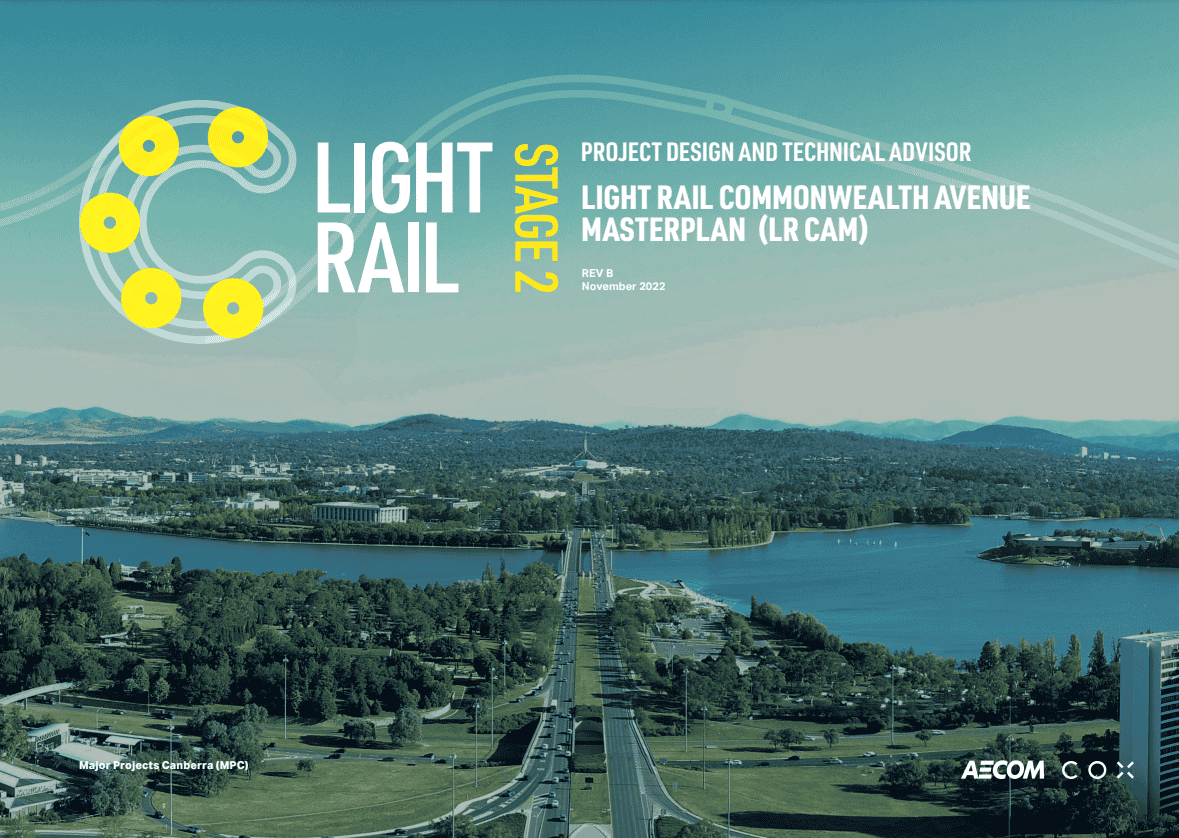
The Light Rail Commonwealth Avenue Masterplan 2022 The Light Rail Commonwealth Avenue Masterplan (LRCAM) seeks to deliver on the Griffins' vision for Commonwealth Avenue as a 'Main Avenue', direct and efficient providing lines for 'rapid transit' between principal destinations of the city (AECOM, 2022a). LRCAM is a companion document to the Commonwealth Avenue Landscape Heritage Advice and the Commonwealth Avenue Landscape Structure Plan. |
|
|
Outdoor Lighting Policy 2012 The Outdoor Lighting Policy 2012 provides detailed conditions for the planning, design, and development of lighting in Designated Areas of the NCP (NCA, 2012). The Policy seeks to ensure that the planning, design, and operation of outdoor lighting balances the needs of people and the environment and strengthens the role that lighting plays in the understanding and appreciation of the National Capital and Canberra's urban landscape. The Project has considered the requirements of this Policy as part of ongoing design development, and preparation of the Public Domain Master Plan (refer to Appendix I of this EIS). |
|
|
Tree Management Policy 2021 The Tree Management Policy 2021 details the approach to the management of NCA urban trees and treescape and the Lindsay Pryor National Arboretum (NCA, 2021). Three key targets of the Policy include increasing tree canopy cover to 40 percent by 2030, improving age diversity of the treescape and improving existing diversity of species. The Project would consider the requirements of this Policy as part of design development. |

2.3 Current and future challenges in Canberra
This section identifies current and future challenges faced in Canberra and how these challenges have helped frame the Project objectives (refer to Section 2.4.3) that have been developed to respond to the strategic land use and transport needs of the city. The Project benefits discussed in Section 2.5.2 demonstrate how the Project responds to these current and future challenges.
Continued growth in population will lead to increased travel demand across the ACT. Australian Bureau of Statistics (ABS) data (ABS, 2021) highlights that car travel is the predominant mode of commuting in Canberra. Given the existing low residential densities and dispersed nature of activity centres and employment in Canberra, the majority of this forecast travel demand growth is expected to be via private vehicle travel, resulting in increased traffic demand on the ACT road network. Over time, with no major infrastructure additions or land use changes, arterial roads including within the City to Woden corridor are likely to become significantly more congested, impacting journey times and reliability for trips by motor vehicle and public transport bus services.
Without a strategic view of integrated land use and transport planning that includes measures to increase and improve transport network capacity, increased demands placed on the existing transport networks across Canberra, including those through the City to Woden corridor, will lead to:
- Traffic congestion and constraints on the existing public transport network (buses) that relies on the road network
- Constraints on sustainable city development associated with traffic congestion and increased travel times across the road network
- Limits on the ability to achieve net zero carbon emissions through continued reliance on motor vehicle transport, and increased emissions associated with inefficient travel through a congested road network
- Decreases in wellbeing, accessibility and liveability in the nation's capital, driven by increased congestion and deteriorating safety and amenity along congested road corridors.
2.3.1 Traffic congestion and constraints on existing public transport
In 2022, just under 1.6 million weekday vehicle trips were made within a study area defined in the ACT & Queanbeyan Household Travel Survey 2022 (Sift Research, 2023). ABS data (ABS, 2021) highlights that travelling by car is the dominant method of travel to work in Canberra. By the 2030s these commuter car trips are forecast to increase by one third.
If the high proportion of private vehicle trips continues unchanged into the future, traffic congestion will significantly worsen as the city's population increases (ACT Government 2020). In 2016, the daily cost of congestion was around $800,000 which will increase to around $1.5 million in 2031 and the cost of public transport crowding will also rise (ACT Transport Strategy 2020, (ACT Government, 2020)).
Public transport in Canberra is currently provided by a bus network and the existing light rail line between Gungahlin and the City (LRS1). Despite the broad coverage of the bus network, there is a limit to its capacity to meet the needs of a growing city and to support its projected population growth. This is not only related to the comparatively smaller capacity of buses compared with light rail, but also because the bus network directly relies on the road network that is becoming increasingly congested as a result of population growth.
Without changes in government policy to alter trip behaviours and patterns, coupled with major transport infrastructure investment, future development within the City to Woden corridor is anticipated to lead to a decline in traffic speeds, increasing travel time and reducing access to employment opportunities, community facilities, and social and recreational activities. Projected future road network conditions (with and without the Project) are discussed further in Technical Report 1 - Traffic and transport.
2.3.2 Sustainable city development
Sustainable city development seeks to minimise urban sprawl by planning for new housing at higher densities in areas with high levels of transport accessibility, thereby reducing reliance on greenfield development and private vehicle use into the future. The low residential densities and the dispersed nature of activity centres and employment in Canberra currently do little to improve productivity of the Canberra economy, reduce car dependency, sustain efficient public transport operations or reduce greenhouse gas emissions. Low densities result in increased car dependency, placing upward pressure on per capita costs for providing public transport and community services over larger areas and raising social exclusion and service access issues.
The District Strategies (Volume 1 - Metropolitan context and big drivers) (ACT Government, 2023) highlight the need to meet housing requirements based on expected population increases with reference given to ACT Treasury population projections released in 2023 indicating a need for 100,000 new homes by 2050.
Without measures to increase and improve transport network capacity that support sustainable city development, projected population growth will exacerbate these problems, leading to greater urban sprawl, avoidable land use inefficiencies and high costs of infrastructure provision.
2.3.3 Net zero carbon emissions
The ACT Government has committed to reducing carbon emissions from 1990 levels by 100% by 2045. The Climate Change Strategy (EPSDD, 2019) states that transport is one of the largest sources of emissions for the ACT, and reductions in this sector will require active participation from the whole community.
High car use, combined with population growth is likely to lead to increased adverse environmental impacts, including air quality impacts (ACT Government, 2024). In 2022-2023, transport was the highest source of greenhouse gas emissions for the ACT, providing 65% of the total emissions for the year (ACT Government, 2023).
2.3.4 Wellbeing and accessibility
One of Canberra's strategic advantages is that the city offers access to employment and other key services generally within a 30-minute commute. However, the ACT and Queanbeyan Household Travel Survey (Swift Research, 2022) indicates that in 2022 Canberrans spent 70 minutes commuting to and from work on average per day. Minimising the amount of time spent travelling for work on a daily basis, and improving the reliability of travel, contributes to wellbeing.
Wellbeing is also linked to social connection and social inclusion and the ability to easily travel to connect with family, friends and the community. As discussed above, public transport in Canberra is heavily reliant on the road network that is becoming increasingly congested as a result of population growth, making connection with family and friends and the community challenging, especially where people have an increased reliance on the public transport network to make those connections.
A failure to continue to improve public transport infrastructure is unsustainable for a growing city in the long term and does not support key wellbeing and accessibility needs of the community.
2.4 Project need and strategic alternatives considered
2.4.1 Overarching strategic need
Strategic investment in city-shaping infrastructure is needed to address the current and future challenges of Canberra's growing population, traffic congestion, public transport reliability, mobility, access and wellbeing. In response to these challenges, the ACT Government, in collaboration with Commonwealth agencies such as the NCA, have developed and committed to a series of integrated land use and transport planning strategies aimed at supporting growth and prosperity as well as maintaining and improving the wellbeing and liveability of the national capital.
A key component of the response to Canberra's current and future challenges is planning for and delivery of a robust, sustainable and efficient transport network. This includes a series of complementary initiatives and projects focused on well planned development, improvements to road network capacity and efficiency, and provision of a comprehensive public transport network. To mitigate the impacts of future growth on the road network, the ACT Government is considering a mix of transport improvement projects, including road, public transport, and active travel enhancements, many of which are discussed in the ACT Infrastructure Plan update (Transport) (ACT Government, 2024). Non-road dependent transport infrastructure such as light rail, is considered a fundamental part of managing future road network congestion.
2.4.2 Project need
The combination of an increasing population, low residential densities and the dispersed nature of activity centres and employment in Canberra provides challenges for growth, including increased road vehicle use and road network congestion that has an overall impact on the productivity of the Canberra economy.
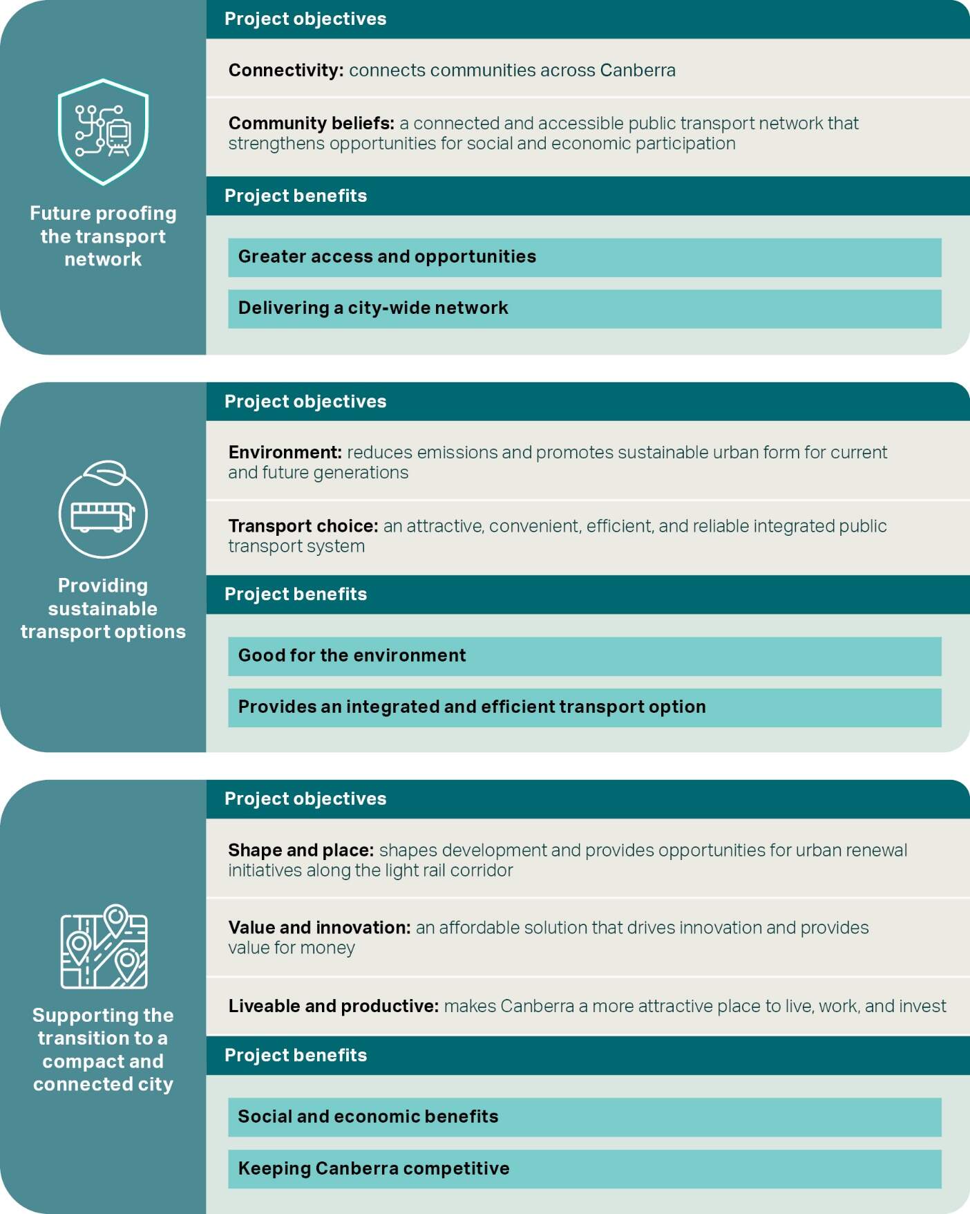
Recognising the challenges identified in Section 2.3, the needs for the Project have been identified as:
- Future-proofing the transport network by providing public transport infrastructure that responds to current needs and provides strategic capacity for non-road based transport given future growth assumptions
- Providing sustainable transport options that contribute to reaching net zero greenhouse gas emissions and providing public transport that utilises renewable energy
- Supporting the transition to a compact and connected city by providing more public transport closer to existing local, group and town centres as well as key sites and potential future change areas to limit urban sprawl and reduce car use, helping to mitigate the impacts of a growing Canberra population.
These needs for the Project are discussed further below. Their relationship with the Project objectives (refer to Section 2.4.3) and benefits (refer to Section 2.5.2) is shown in Figure 2-2.
Future-proofing the transport network
Traffic forecasting and modelling has been carried out to assess the performance of the road network in the future, both with and without the Project. Without changes in government policy to alter trip behaviours and patterns, coupled with major transport infrastructure investment, future development within the City to Woden corridor is anticipated to lead to a decline in traffic speeds, increasing travel time and impeding access to employment opportunities, community facilities, and social and recreational activities. As a result, by 2031 the ACT would face a highly congested road network during weekday peak hours. Due to this peak hour congestion, some drivers may choose to travel earlier or later to avoid delays. Without intervention, most intersections along the north-south transport corridor are expected to deteriorate to a poor level of service with significant traffic delays over the coming decades.
The Project would provide additional transport capacity along this north-south transport corridor, and would provide a choice for travellers to avoid anticipated future road network congestion. It has been planned and designed as a dedicated light rail route to take advantage of existing major transport corridors, particularly along the main avenues of Commonwealth Avenue, State Circle and Adelaide Avenue.
The Project would increase the people-carrying capacity of the City to Woden corridor, providing capacity for an additional 2,400 person trips per hour in each direction (in comparison, major avenues currently provide an estimated capacity for around 4,000 to 4,400 vehicles per hour). The Project would also enhance existing public transport services by providing a reliable and attractive option between Commonwealth Park and Woden that is less affected by forecast traffic congestion, compared to buses that share road space with general traffic. By providing a dedicated public transport option that avoids shared running with road vehicles and is part of an integrated and robust transport network, the Project would directly respond to an increasingly congested road network and the potential adverse impacts arising from that congestion.
Wellbeing would be improved through increased amenity associated with attractive and well designed, gender sensitive infrastructure. Improved active travel infrastructure and bike and scooter parking at stops would encourage interchange with light rail and would promote a more active lifestyle and improved health and wellbeing. Further details of social benefits are discussed in socioeconomic assessment sections in Part B (Environmental impact assessment) and Technical Report 6 - Socioeconomic.
City-shaping public transport would make Canberra more accessible. It would provide an opportunity to connect existing local, group and town centres as well as key sites and potential future change areas by providing light rail stops at locations that promote public transport integration. Public transport services integration (bus and light rail) would be further developed closer to the opening date of the Project, with opportunities to optimise it over time.
Stop locations that generate new public transport catchments would not only bring public transport closer to where people live, they would provide access to areas of significant job growth in the National Triangle and Barton (e.g. the National Security Precinct) and would connect to destinations not adequately served by the current rapid public transport network. Improved access to employment precincts would give people access to different kinds of jobs.
Access to transport and the ability to travel more easily between locations would also promote social inclusion, allowing for greater connections with family, friends, and the community. Accessibility is particularly important for people who cannot or do not want to drive a car such as tourists, students, and those with mobility restrictions. Without action to deliver responsive transport network improvements, mobility, accessibility and reliability challenges are likely to impact the quality of life that residents, students, and workers currently enjoy.
Providing sustainable transport options
Traditionally road network congestion would be addressed through duplication of roads or building new road corridors. However, to complement planning, transport and climate change management strategies, the approach to integrated land use and transport planning in the ACT (refer to Section 2.2) includes moving more people by increasing public transport capacity utilising light rail where practicable within existing road reserves. This offers the best opportunity for the ACT to sustainably increase transport capacity while offering alternative sustainable travel choices and responding to the strategic planning drivers and objectives identified in the District Strategies under the ACT Planning Strategy.
The Project aims to support compact and efficient growth within the City to Woden corridor. Combined with other planned infrastructure projects it would provide additional transport capacity and provide a reliable travel alternative for Canberrans living in, working in or visiting places along the corridor. Connecting centres over a 25 km Light Rail network (which would be achieved with the combination of LRS1, LRS2A and the Project) would offer Canberra a plan to reduce predicted private vehicle based congestion, and release capacity for a broader range of road users, while improving journey time reliability for public transport users.
The Project would also provide a lower carbon intensity transport option compared with private motor vehicle use on the existing road network. Over time, road network congestion leading to less efficient travel and longer travel times would contribute to a relative increase in transport-related carbon emissions. By providing a more efficient transport option separate to a congested road network, the Project would contribute to the achievement of the ACT's target of a net zero carbon footprint.
Supporting the transition to a compact and connected city
The ACT Planning Strategy (ACT Government, 2019a) includes a strategic direction to drive a 'compact and efficient city' to support sustainable urban growth by working towards delivery of up to 70% of new housing within the existing urban footprint, and by concentrating development in areas located close to the city centre, town and group centres and along key transit corridors. District Strategies (refer to Table 2-1) identify 'change areas' and 'key sites' for renewal and 'potential urban regeneration areas' that may be suitable for a range of residential and non-residential uses (including consideration of education, health, and recreation facilities).
The Project supports the ACT Planning Strategy and District Strategies, including support for planned growth at key sites and change areas including Woden town centre, Woden North and North Curtin, that seek to manage these challenges by providing opportunities for urban intensification in centres and along public transport corridors, maintaining compact urban form and limiting urban sprawl. Transitioning to a more compact and connected city by improving public transport along central corridors identified in the ACT Transport Plan is critical to alleviating the pressure of a growing Canberra population.
The District Strategies (Volume 1 - Metropolitan context and big drivers) (ACT Government, 2023) identifies 'Strategic movement to support city growth' as one of the five big drivers and objectives of district planning. Legislated and potential future light rail corridors (that align with the ACT Transport Strategy) are key factors in delivering the city-shaping infrastructure to support planned growth.
The District Strategies (Volume 1 - Metropolitan context and big drivers) also identifies the combined Stage 1 and Stage 2 Light Rail network as a transformative opportunity for the ACT to capitalise on its urban structure and centres hierarchy, creating a central mass-transit corridor from Gungahlin to Woden, allowing Canberrans to travel to key destinations including employment centres north to south, along the line in a single trip.
2.4.3 Strategic alternatives considered
A review of the strategic alternatives to the Project has been carried out considering the current and future challenges for Canberra and the need for the Project as outlined in the sections above. As identified in Section 2.2, various strategic planning documents identify light rail as the preferred transport option to address future network congestion between Woden and the City.
Notwithstanding, the following strategic alternatives have been considered:
- Do nothing
- Do minimum - rapid bus augmentation
- Rapid bus - major intervention
- Project case (integrated public transport network with light rail between Woden and the City).
Do nothing
The do nothing alternative would rely on the continued operation of the existing rapid bus network, which includes T2 bus priority lanes on Yarra Glen and Adelaide Avenue.
The primary mode of commuting in Canberra is via private vehicle, which is expected to continue into the future. With projected population growth, this will therefore lead to increased travel demand on the road network. A do-nothing alternative would result in an increasingly congested transport network over time and would fail to provide additional sustainable and reliable transport alternatives from Commonwealth Park to Woden. A do nothing alternative would provide no improvement in transport connectivity, capacity or transport choice.
In relation to the current and future challenges for Canberra outlined in Section 2.3:
- Traffic congestion and constraints on existing public transport network: A do-nothing alternative would further exacerbate traffic congestion on the road network and an associated deterioration in travel times is expected to lead to a spreading of peak traffic periods as motorists seek to avoid travel constraints. Without intervention most intersections along the north-south transport corridor are expected to deteriorate to a poor level of service with significant traffic delays over the coming decades
- Sustainable city development: A do nothing alternative would not respond to planned growth as contemplated by the guiding policy documents outlined in Section 2.2. The do nothing alternative would be inconsistent with the District Plans and strategies and Canberra: A Statement of Ambition 2016 (ACT Government, 2016) that highlight the reliance on the light rail network to support Canberra's urban renewal objectives. As land uses continue to evolve and intensify, particularly within the Barton and Woden precincts, and as travel demand increases and continues to expand from its focus on Civic alone, the existing structure and service offering of the public transport system would become increasingly out of step with public expectations
- Net zero carbon emissions: The approach to integrated land use and transport planning in the ACT discussed in Section 2.2 includes moving more people by increasing public transport capacity. A do nothing alternative would not achieve this objective and would reinforce private motor vehicle use on the existing road network, a higher carbon intensive transport option compared with public and active transport. Over time, road network congestion is forecast to lead to less efficient travel and longer travel times, and would contribute to a relative increase in transport-related carbon emissions
- Wellbeing and accessibility: A do nothing alternative would not improve wellbeing, amenity nor accessibility. It would not provide an opportunity to deliver attractive, well designed and gender sensitive infrastructure and supporting landscape outcomes. It would not encourage active travel and interchange opportunities with public transport that are required to promote a more active lifestyle and improved health and wellbeing. Further, a do nothing alternative would not provide improved access to employment, education and recreation precincts, including access to significant jobs growth in National Triangle and Barton (e.g. the National Security Precinct) or destinations not adequately served by the current rapid public transport network.
Furthermore, the do nothing alternative has the potential to decrease levels of customer satisfaction and result in an inability to effectively meet the transport demand with the available public transport options. A do nothing alternative would not provide a catalyst for building more vibrant precincts and places, or would it encourage business growth and tourism. With increasingly longer journey times and poorer reliability forecast for the road network, a do nothing alternative cannot deliver the broader economic benefits for Canberra as it would not attract increased investment to the area nor support an overall improvement in productivity.
Do minimum - rapid bus augmentation
The impacts presented for the do nothing alternative generally apply to augmented rapid bus scenarios that use the existing road network and bus priority lanes in the corridor. An augmented rapid bus scenario assumes an upgrade to the current bus fleet to a fully electric fleet operating in the corridor with larger capacity vehicles and/ or increased service frequency. As this scenario would rely on the existing road network, future bus travel would be subject to increasing road network congestion constraints with corresponding impacts on public transport reliability and travel times.
While potentially supporting growth in the shorter term it is unlikely in the longer term that an augmented rapid bus network would achieve the capacity and reliability requirements that can be achieved by light rail, which would be wholly separated from an increasingly congested future road network.
Rapid bus - major intervention
This strategic alternative assumes additional capital investment for new bridges, dedicated off road busways, new bus vehicles and associated depot and maintenance facilities. While improved public transport reliability could be achieved through extension of bus priority lanes through the City to Woden corridor (Commonwealth Avenue, Melrose Drive, Launceston Street), dedicated off-road busways or bus improvements as part of a broader suite of land use, transport planning and infrastructure delivery initiatives would have its own impacts, likely to include heritage and broader landscape impacts.
By its nature, this alternative would still need to integrate with the existing road network and travel time and reliability benefits would therefore still be limited by the performance of the road network, and ultimately its increasing congestion and travel time impacts.
Large capacity rapid buses with onboard guidance systems (i.e. 'trackless trams') have not been contemplated, since these are oversize and overweight vehicles which the road network is not designed for, nor are the vehicles permitted to operate on them.
Ultimately this strategic alternative would rely heavily on the continued operation and functionality of existing transport networks. According to the Light Rail Five Years On: Benefits Realisation Report 2024, 43% of passengers using LRS1 have never previously used the bus network, indicating a preference for light rail as a transportation option (Transport Canberra and City Services, 2024).
No intervention on its own is going to holistically address the future road network challenges forecast for Canberra (and this is a matter for broader whole-of-Government coordination beyond just the Project). This is reflected in the ACT Infrastructure Plan update - Transport (ACT Government, 2024), which identifies project priorities identified beyond the current budget, noting that these projects are indicative and may change in response to community preferences, shifts in demand for services and the availability of funding.
Project case (integrated public transport network with light rail between Woden and the City)
The Project case would deliver a light rail extension from Commonwealth Park to Woden, integrated with rapid and local bus services as well as other modes of travel. The Project case builds on the benefits already evidenced on LRS1 and expected for LRS2A. Combined, LRS1 and LRS2 would provide direct connections between Canberra's north and Woden.
More specifically, the Project case would provide a sustainable and reliable transport option from Commonwealth Park to Woden. It would increase the people-carrying capacity of the transport corridor that best meets the needs of anticipated population growth, including planned growth within the corridor. Each light rail vehicle can provide up to three times the capacity of a rapid bus that uses the existing road lanes. Light rail would therefore increase the people-carrying capacity of the corridor by an additional 2,400 trips per hour in each direction.
By operating in its own corridor, light rail would also be less affected by traffic congestion, compared to buses that share road space with general traffic. Separation of light rail from increasing road network congestion means that light rail would provide journey time reliability into the future, irrespective of the performance of the future road network.
In providing additional public transport capacity capable of supporting planned growth in the corridor, that is integrated with other transport modes, that is less affected by increasing congestion, and that has well-designed, accessible stops, the Project case provides the best opportunity to encourage those using private vehicles to make a more sustainable travel choice.
The Project case responds to planned growth proposed in the guiding policy documents outlined in Section 2.2, in particular the District Plans and strategies and Canberra: A Statement of Ambition 2016 (CMTEDD, 2016) that highlight the reliance on light rail network to support Canberra's urban renewal task. As land uses continue to evolve and intensify, particularly within the Barton and Woden precincts, and travel demand increases and continues to expand from its focus on Civic alone and provide opportunities at centres such as Deakin, Dickson and Gungahlin, a new public transport service offering with connections to the broader system would better meet customer expectations. The enhanced legibility of the light rail network supports urban renewal objectives and the promotion of a more liveable and connected city.
The result would be potentially improved levels of customer satisfaction and the subsequent ability to effectively meet the transport demand with new public transport options and capacity. This strategic alternative would also support economic benefits that come with increased investment and associated productivity uplift. As light rail is zero-emissions, it would also reduce greenhouse gas emissions from the transport sector along with reduced noise and improved air quality.
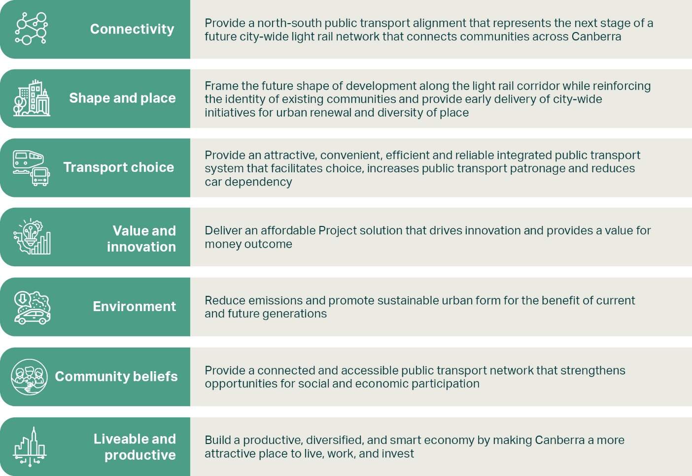
2.5 Project objectives and benefits
2.5.1 Project objectives
The ACT Government made a clear commitment in Canberra: A Statement of Ambition 2016 (CMTEDD, 2016) and the City Plan 2014 (ACT Government, 2014) to construct the light rail network to help achieve its vision for Canberra.
The Project objectives presented in Figure 2-3 have been developed to respond to the NCP, the Territory Plan and other strategic plans, policies and guidelines and guide the Project's contribution to the ACT Government's vision for Canberra. They also consider and respond to the identified transport challenges faced by Canberrans now and into the future.
2.5.2 Project benefits
The key benefits of the Project are outlined in Figure 2-2 and would include:
- Greater access and opportunities: The Project would connect people with Canberra's lakeside, cultural institutions, festivals, education and events precincts. It would support vibrant towns and local centres which can house Canberra's growing population while limiting extra pressure on the transport network or green spaces on the edges of Canberra
- Delivering a city-wide network: Canberra's population growth requires a transport network that provides choice by linking the city and suburbs. The Project would create a frequent and reliable transport option that better connects major town centres and residential employment hubs, including direct connection for North Woden and Inner South districts
- Good for the environment: Light Rail Stage 1 is fully electric and connected to the ACT grid, which has been 100% renewable since 2019. Travel by light rail is free of greenhouse gas emissions, making it one of the cleanest travel options in Canberra and providing an attractive alternative to car travel
- Provides an efficient transport option: In comparison to buses, light rail provides greater capacity to move passengers, making it a more efficient transportation option by moving more people with fewer vehicles
- Social and economic benefits: Construction of the Project would support local jobs, while facilitating further job creation into the future. The Project would support an estimated peak construction workforce of around 900 to 1000 people (as identified in Section 6.6.2 of Chapter 6 (Construction)), as well as additional jobs during the pre-construction period (such as advisory and professional services roles), and in the Project operations phase. In operation, the Project is also estimated to deliver broader economic benefits for Canberra by improving overall productivity due to improved journey time reliability and reduced congestion delays. Design principles for the Project, including gender sensitive urban design principles, would contribute to creating attractive spaces that foster a safer and more inclusive public transport experience
-
Keeping Canberra competitive: Linking Canberra's north and south, the Project would support reliable and efficient transport that:
- Provides direct connections to key activity centres outlined in the NCP including Woden Town Centre, West Deakin, the city (and when combined with LRS1 and LRS2A, Gungahlin Town Centre) as well as group centres as defined in the ACT District strategies
- Is a catalyst for building more vibrant precincts and places
- Encourages business growth and tourism
- Attracts and retains the best talent and businesses
- Increases trip capacity per hour, providing Canberrans with an alternative to reduce pressure on existing networks
- Transports people of all abilities safely, including people using mobility aids and prams
- Supports active travel over greater distances, with users being able to have a bike or scooter on board comfortably.
Social and economic benefits from the construction and operation of the Project are further evaluated in the socioeconomic assessment sections in Part B (Environmental impact assessment) and Technical Report 6 - Socioeconomic. Based on design maturity, key benefits are expected to include employment and training opportunities; improved wellbeing and safety associated with inclusive urban design, and increased public transport accessibility providing more equitable access to jobs, businesses and social facilities. A detailed business case would be developed following completion of necessary planning approvals outlined in Chapter 8 (Legislation and policy). This approach enables the scope and alignment to be well defined prior to government considering an investment decision. The process would be undertaken in accordance with the Capital Framework and include consideration of technical studies, options analysis, delivery model assessment, economic analysis (including cost-benefit assessment and Wellbeing Impact Assessment) to support an investment decision.
2.6 Related and complementary projects
The Project would extend and complement the benefits of the existing light rail network, as described in the following sections.
2.6.1 Light Rail Stage 1
LRS1 is the first stage of the Light Rail network in Canberra, which became operational in 2019. The alignment is a 12 km route that acts as the primary transport corridor connecting Canberra's northern suburbs of Gungahlin with the City. LRS2 (LRS2A and the Project) would further consolidate and build on the benefits realised by LRS1.
Since the introduction of LRS1 in 2019, light rail has demonstrated its effectiveness as an attractive and reliable public transport option. LRS1 has achieved high levels of customer satisfaction, attracted more people to public transport, moved more people through the corridor at peak hours, reduced congestion and contributed to economic and residential growth.
The benefits of LRS1 have been highlighted recently with the release of Light Rail Five Years On: Benefits Realisation Report 2024 (Transport Canberra and City Services, 2024). In the roughly five years since operations between Gungahlin and the City commenced, some of the benefits identified include:
- Over 16.5 million light rail passenger trips
- Approximately 99.98% of on-time light rail services
- Approximately 43% new public transport passengers (i.e. not previously used the bus network)
- Reduction of motor vehicle traffic at the Northbourne and Macarthur Avenue intersection by 18%
- Increase in business growth by 26.4% in the Gungahlin district (Gungahlin Place to EPIC and Racecourse stops) between 2018-2022 and by 19.7% in the Canberra and Central district (Phillip Avenue to Alinga Street) along the corridor over the same period
- Approximate 20% share of all public transport patronage in the ACT
- Approximate 95% passenger satisfaction rating with Transport Canberra light rail services.
2.6.2 Light Rail Stage 2A
LRS2A is an approximately 1.7 km extension to the first stage of light rail from Alinga Street to Commonwealth Park and will better connect the City to Lake Burley Griffin. LRS2A is the first stage of the light rail extension from the City to Woden. LRS2A will frame the future shape of development along the London Circuit-Commonwealth Avenue corridor, supporting the activation of underutilised land around City West, City Hill and the Acton Waterfront and enabling the delivery of city-wide initiatives for urban renewal and diversity of place. The raising of London Circuit (RLC project) between Edinburgh Avenue and Constitution Avenue to provide a new at-grade, signalised intersection with Commonwealth Avenue, forms part of the LRS2A project as facilitating works.
Extending the light rail network along London Circuit will bring the network closer to businesses along London Circuit and the Australian National University. LRS2A is scheduled to be operational by 2027.