Managing flood risks for the M1 extension to Raymond Terrace
Consultation Closed – Thank You for Your Feedback
Community consultation on operational flood impacts for the M1 Pacific Motorway extension to Raymond Terrace is now closed. Held from 3 August to 1 September 2025, this consultation aimed to inform the community about how flood behaviour may change once the motorway is complete and fully operational.
We appreciate everyone who took the time to review the information and share their thoughts. Your feedback has helped us understand community perspectives and will be considered as we continue to engage with stakeholders and deliver the project in a way that respects the flood-prone nature of the Hunter River floodplain.
Operational flood behaviour for the M1 Pacific Motorway extension to Raymond Terrace
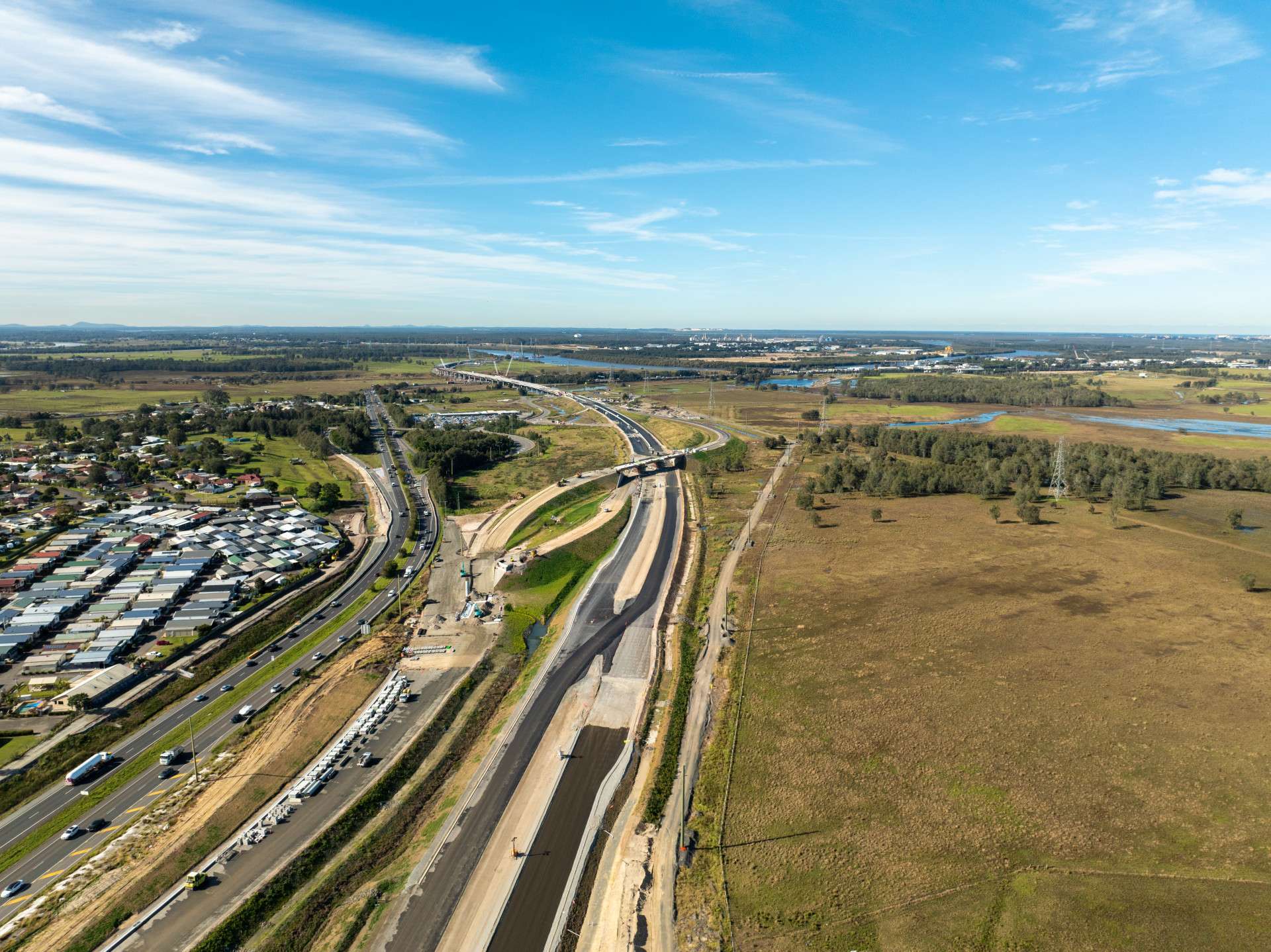
Transport for NSW is delivering the M1 Pacific Motorway extension to Raymond Terrace in a way that respects the flood-prone nature of the Hunter River floodplain while ensuring better outcomes for local communities and the environment.
Throughout the development and design of the project, the team has made a series of refinements to minimise any changes to local flood behaviour, while also enhancing the community’s overall flood resilience.
These refinements include:
Building a 2.6-kilometre viaduct: Spanning the Hunter River floodplain, the viaduct replaces a previously proposed embankment, improving water flow and reducing flood storage impacts.
Shifting the project alignment: Moving the motorway closer to the New England Highway minimises disruptions to nearby wetlands and reduces flood risks in sensitive areas.
Lowering maintenance track heights: This adjustment limits flood level increases on rural and natural land near the project site.
These efforts demonstrate how we’ve balanced engineering and safety goals with environmental and community priorities.
Video: Flood management planning for the M1 extension to Raymond Terrace
M1 Pacific Motorway extension to Raymond Terrace
Flood model validation and independent review
Our updated flood model was developed using the latest hydrologic data from the Hunter River catchment. We tested various design scenarios to predict the project’s impact on flood behaviour.
This model, verified as a reliable tool for current flood management, has undergone independent review. An independent hydrologist, approved by the NSW Department of Planning, Housing and Infrastructure, reviewed both the model and its outputs, endorsing the findings presented in the Flood Design Report, available here:


Resources and further information
We are actively engaging with stakeholders impacted by potential changes to flood conditions. Property owners and residents directly affected by these changes will be contacted by Transport for NSW and may receive invitations to discuss mitigation options. We aim to work collaboratively with these stakeholders to ensure flood impacts are managed and mitigated.
If you have not been contacted directly by the M1 extension team, this means the impact at your property is within the project’s quantitative design limits - the maximum levels of water rise (afflux) or other flood-related changes that are considered negligible or within safe, allowable ranges as defined under the project’s approval.
We encourage you to explore the resources on this page to see how we’re managing flood risks during construction and water on site more broadly.