


In March 2021, the project received its first major planning approval for the project concept between Westmead and the Sydney CBD and major construction work between Westmead and The Bays. To view this information, visit ‘Map Layers’
Sydney Metro is now seeking approval for further major civil construction work, including station excavation and tunnelling, between The Bays and Sydney CBD.
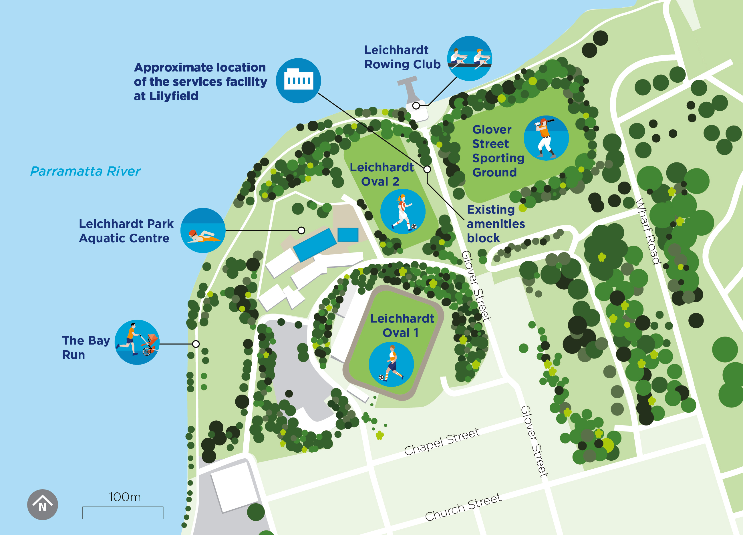
Sydney Metro is undertaking early planning on a preferred location for a services facility in Lilyfield which is required to support operation of Sydney Metro West. Following a comprehensive evaluation, a preferred site has been identified on Glover Street in Lilyfield which would be in the vicinity of the current amenities block to the side of Leichhardt Oval 2.
This site would meet technical requirements, including direct emergency access from the Sydney Metro West tunnels, while avoiding impacts to the nearby sporting fields and residential properties.
It would also avoid directly impacting the Bay Run which would remain open throughout construction. Driveway and footpath access would also remain open, including to the Leichhardt Rowing Club. Full access to the sporting fields would also be maintained.


Hunter Street Station East and Hunter Street Station West
Learn more about Hunter Street Station over station development
Hunter Street Station East
Hunter Street Station West

Sydney Metro West does not currently have any planning applications on exhibition.
Visit sydneymetro.info to learn more about Sydney Metro West and sign up for email alerts.
Call us on 1800 612 173 to talk to one of our dedicated place managers.
Email your queries to sydneymetrowest@transport.nsw.gov.au and we will get back to you.
To make a submission please CLICK HERE to visit DPIE’s Major Projects website and create a user account.
To make a submission to the Sydney Metro team regarding the REF please CLICK HERE



A change of 1 dBA or 2 dBA in the level of a sound is di fficult for most people to detect.
A 3–5 dBA change corresponds to a small but noticeable change in loudness.
A 10 dBA change corresponds to an approximate doubling or halving in loudness.
Anyone may make a submission, in any language, about the Environmental Impact Statement, to The Department of Planning, Industry and Environment.
Your submission must reach The Department by Friday 26 June 2020.
Visit planningportal.nsw.gov.au/major-projects to learn how to make a submission.
Community members are invited to submit their feedback on the proposal to Sydney Metro by emailing sydneymetrowest@transport.nsw.gov.au or writing to:
Sydney Metro West
PO BOX K659
Haymarket NSW 1240
Your submissions should reach Sydney Metro by 29 May 2020 and include:
Anyone may make a submission, about the proposed project corridor, to The Department of Planning, Industry and Environment.
Your submission must reach The Department by Friday 26 June 2020.
Visit planningportal.nsw.gov.au/major-projects to learn how to make a submission.
Hello and welcome to the virtual information room for Sydney Metro West.
It’s now time to have your say. We have set up this room to help you learn more about important aspects of the project.
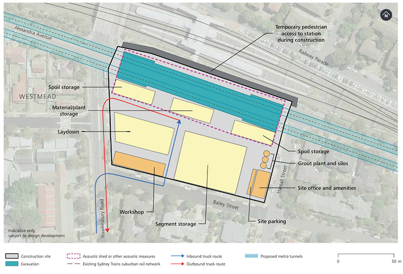
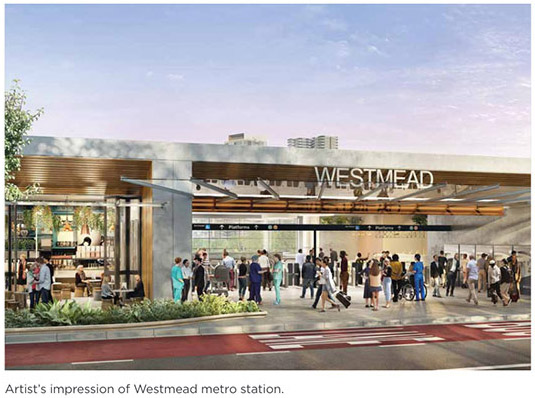
The proposed Westmead metro station would be located on the eastern side of Hawkesbury Road, south of the existing Westmead Station. The station would have one entrance on Hawkesbury Road.
New metro platforms would be located next to the existing Westmead station, providing an easy above-ground interchange with the T1 Western Line and T5 Cumberland Line. The new station would also provide customers with easy access to Parramatta Light Rail, T-way buses and other bus services.
As well as connecting customers to the Westmead health, education, and employment hub, the new metro station would service residential areas experiencing growth and renewal in both north and south Westmead.
Construction site map
Indicative construction timeframe for Stage 1 works*


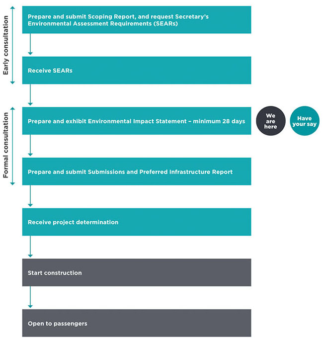
The environmental assessment process for Sydney Metro West will be staged in recognition of the size of the project. This includes:
The concept application (this approval) seeks approval for construction and operation of a Sydney Metro line from Westmead to the Sydney CBD. Specific construction works as they relate to the Concept would be assessed as part of separate planning approvals.
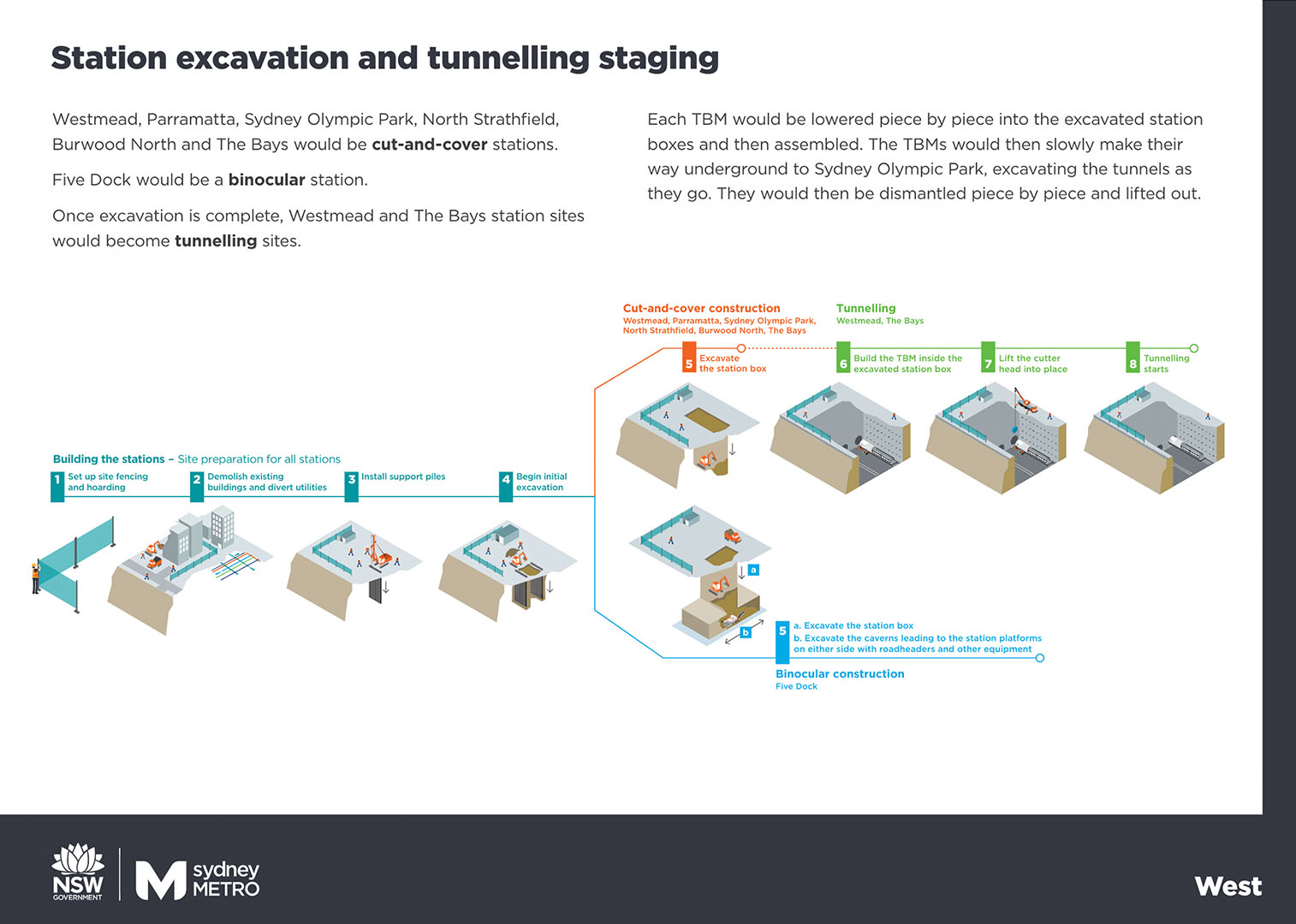
The Stage 1 application (this approval) seeks approval for all major civil construction works between Westmead and The Bays, including station excavation and tunnelling.
The Stage 2 application (future approval) is expected to seek approval for all stations, depots and rail systems between Westmead and The Bays.
The Stage 3 application (future approval) is expected to seek approval for all major civil construction works including station excavation, tunnels, stations, depots and rail systems between The Bays and the Sydney CBD Station.
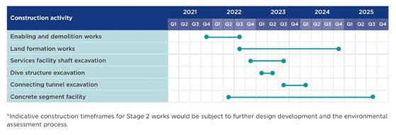
Stage 1 works would take around five years to complete. This timeframe does not include works that are planned to be assessed as part of the Stage 2 and Stage 3 applications.
Environmental assessment staging

The Concept and Stage 1 planning process
Sydney Metro is Australia’s biggest public transport project, revolutionising the way Sydney travels.
Metro services started in May 2019 on the Metro North West Line between Rouse Hill and Chatswood.
The line is being extended into the city and beyond to Bankstown by 2024, when Sydney will have 31 Sydney Metro stations and 66 kilometres of new metro rail.
As part of the NSW Government’s Transport cluster, Sydney Metro is responsible for the planning, construction, delivery and operation of metro rail services.
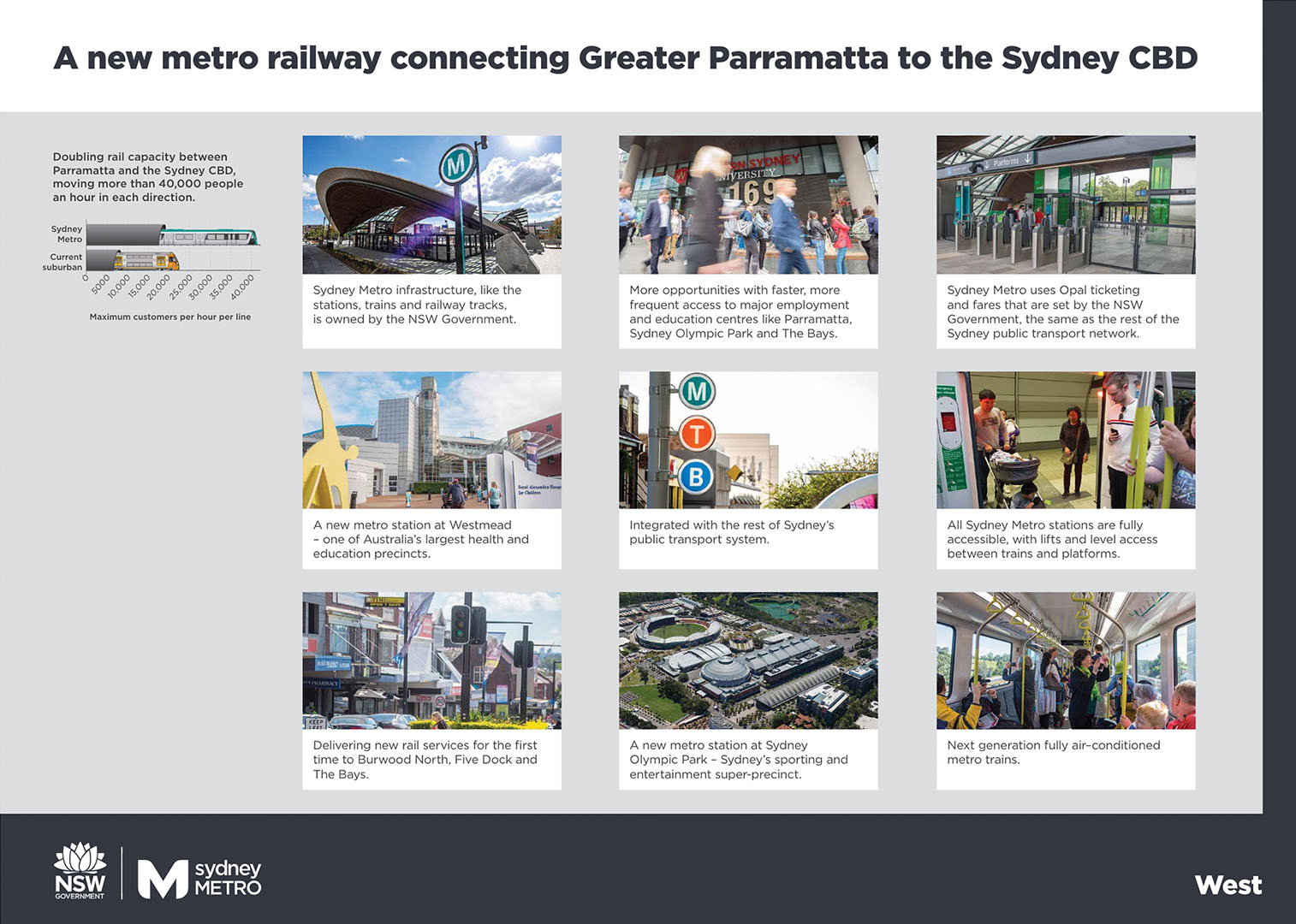
The Sydney Metro West project will support a growing city and deliver world-class metro services to more communities.
This new underground railway will connect Greater Parramatta and the Sydney central business district (CBD). This once-in-a-century infrastructure investment will transform Sydney for generations to come, doubling rail capacity between the two CBDs, linking new communities to rail services and supporting employment growth and housing supply.
The locations of seven proposed metro stations have been confirmed at Westmead, Parramatta, Sydney Olympic Park, North Strathfield, Burwood North, Five Dock and The Bays.
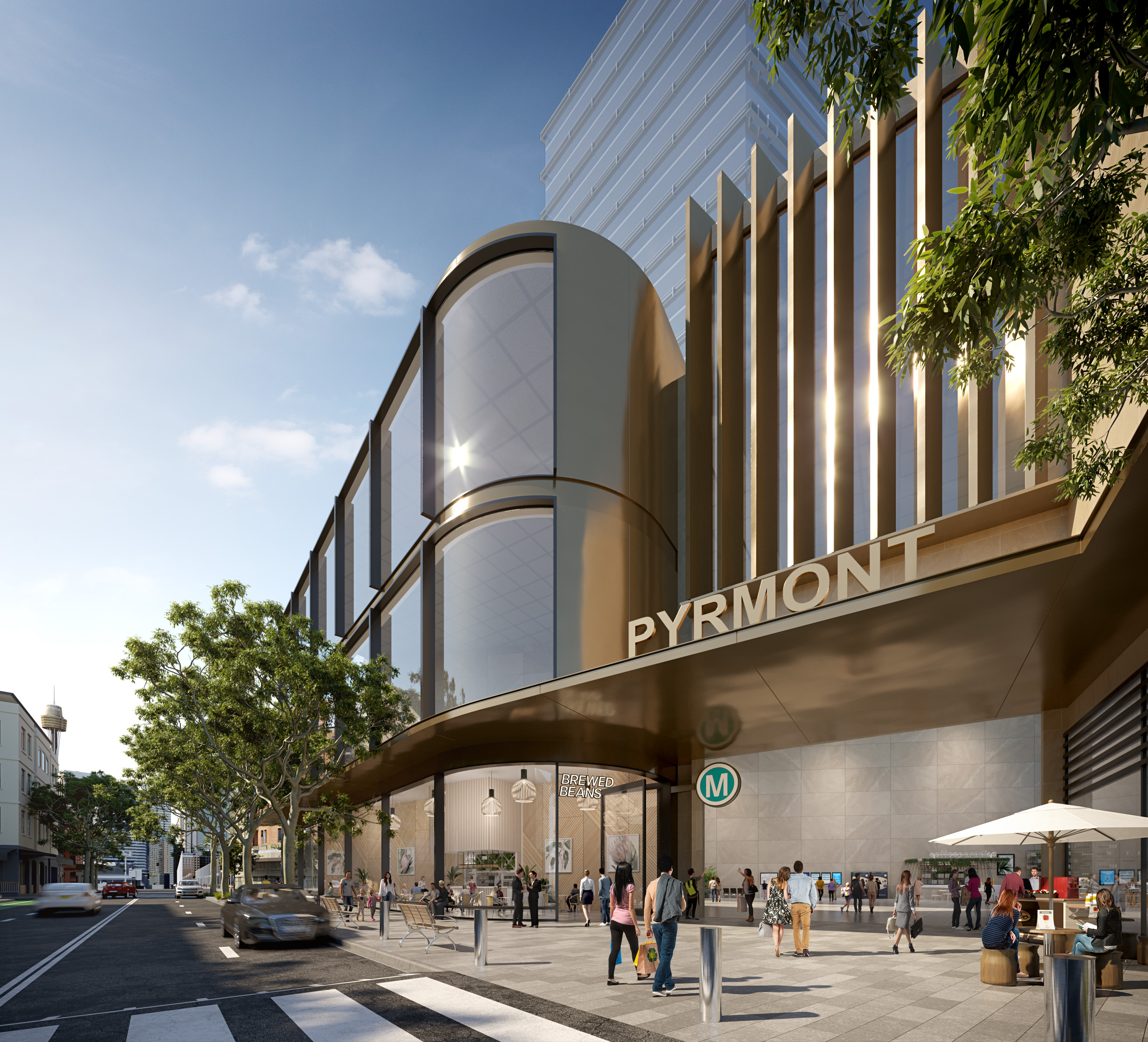
The NSW Government is continuing to assess an optional station at Pyrmont and further planning is underway to determine to location of a new metro station within the Sydney CBD.


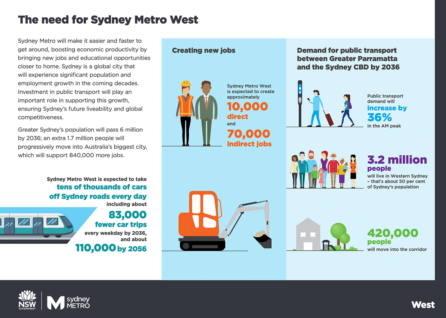
Over the next 20 years, The Bays will be transformed into Sydney’s newest destination and employment hub.
In preparation for this transformation, which would include The Bays station, road works are proposed to be undertaken near the port at White Bay. This would ensure reliability of the road network in the area and ongoing access to the White Bay Cruise Terminal and other port related businesses within Glebe Island and White Bay.
Sydney Metro West would deliver these works, with construction planned to start in late 2020.
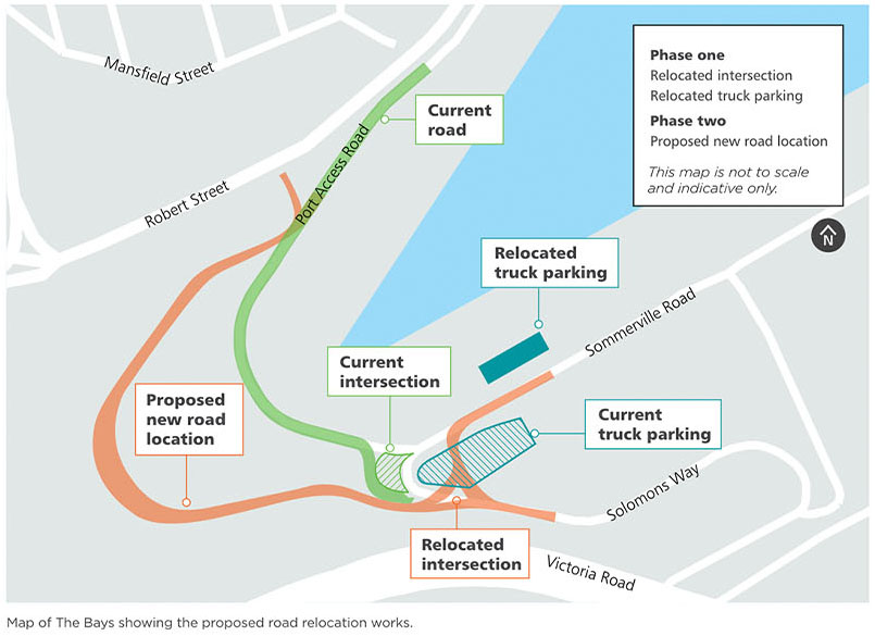

Key features
The proposal would include phased improvements at the intersection of Part Access Road, Sommerville Road and Solomons Way (the White Bay intersection).
Phase one – relocating White Bay intersection, including changes to line markings and signage and truck parking for Cement Australia.
Phase two – potential relocation of Port Access Road subject to further design development and stakeholder engagement.
These works are proposed to be undertaken during the day and are not expected to impact traffic flows on public roads outside White Bay.
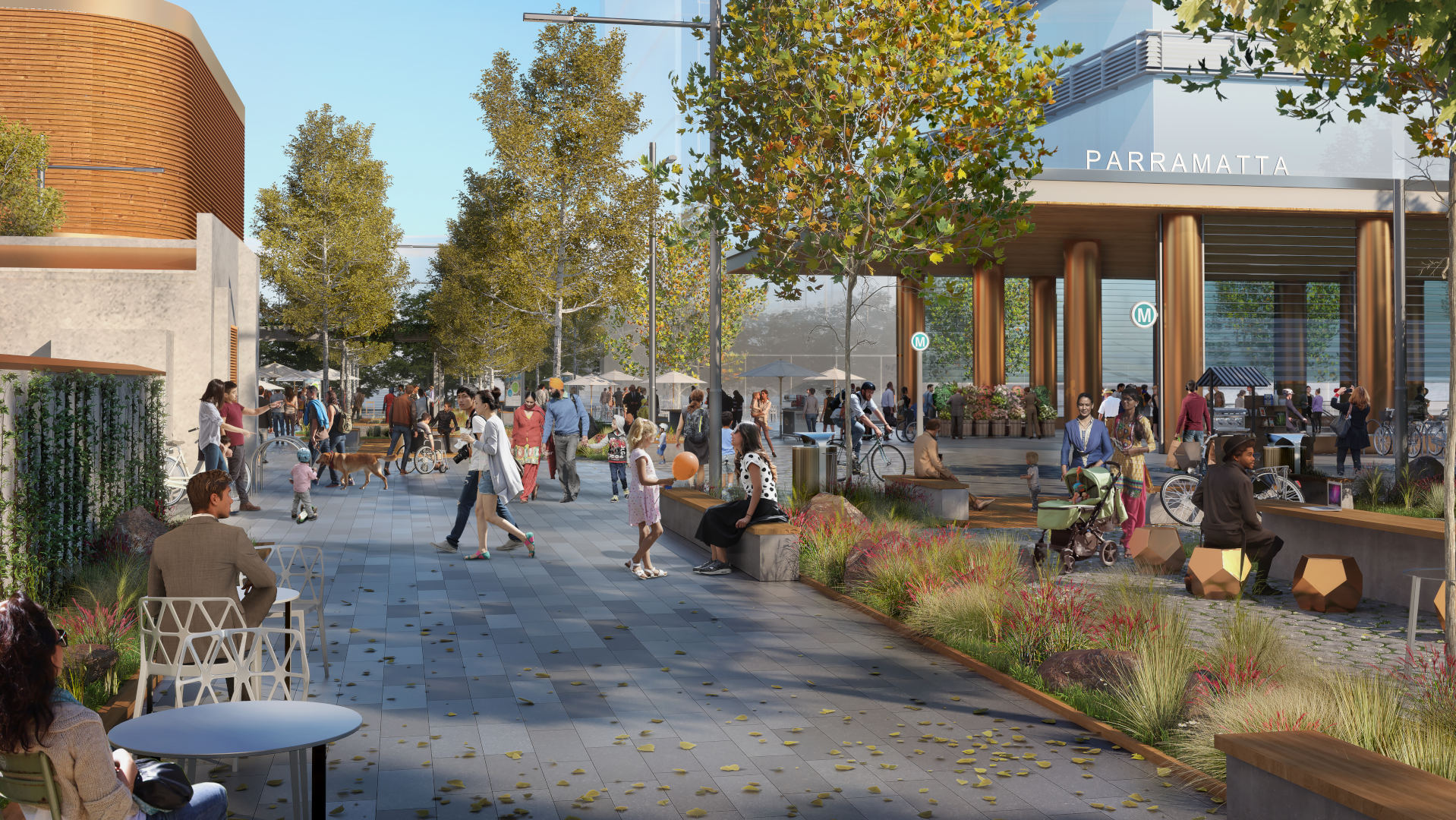
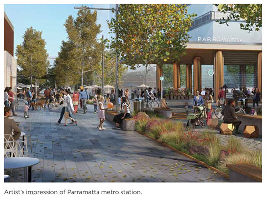
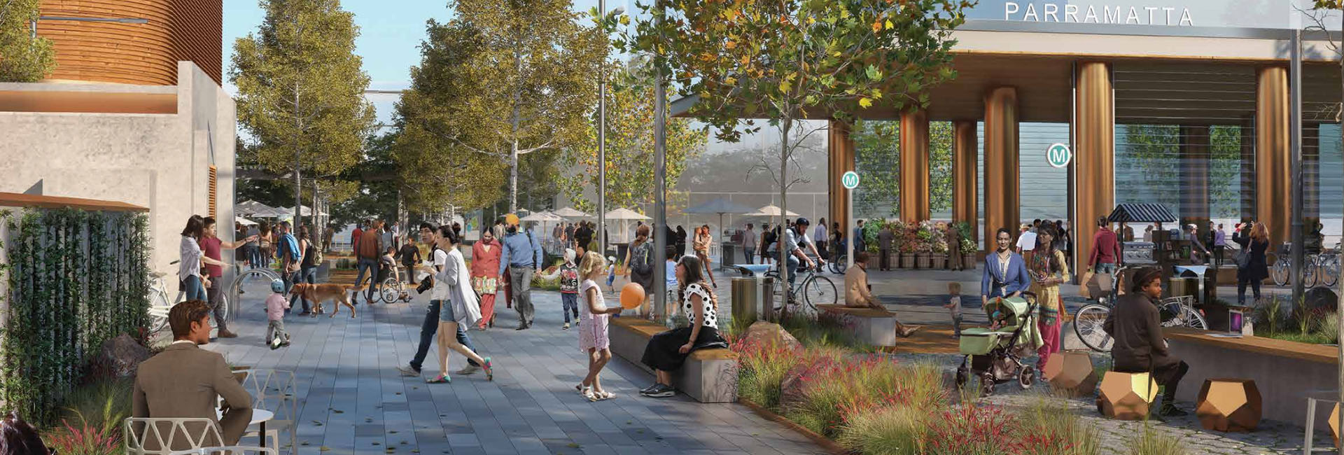
The proposed Parramatta metro station would be on the block bounded by George, Macquarie, Church and Smith streets with an entrance on the Horwood Place.
Strategically located to the north of the existing Parramatta Station, the new metro would be within the commercial core of the Parramatta CBD, taking pressure off the existing station and giving customers a second rail option.
Parramatta metro station would support Parramatta CBD as a major employment growth centre, boosting jobs and improving connections across Greater Sydney. It would provide easy, efficient and accessible interchange with buses and Parramatta Light Rail.
The new metro station would integrate with the proposed Civic Link – a green, pedestrianised public space stretching from Parramatta Square in the south to Parramatta River in the north.
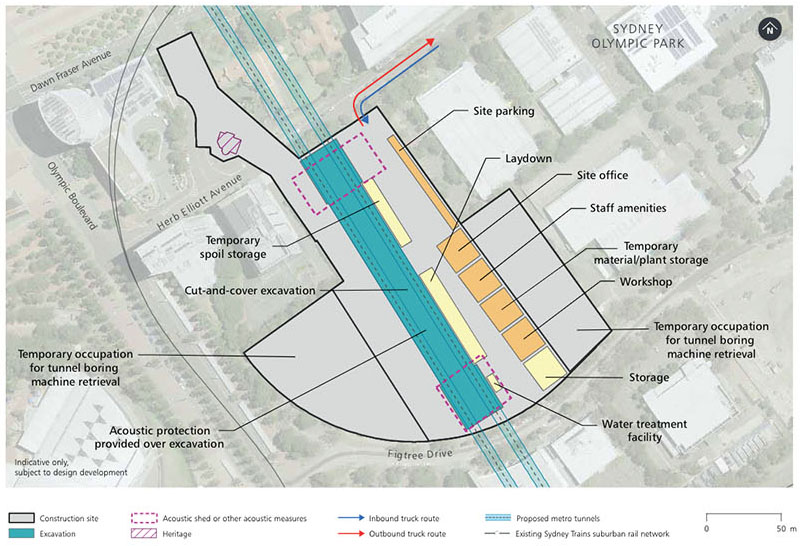
Construction site map
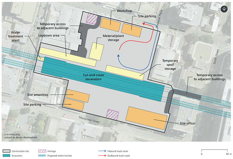
Indicative construction timeframe for Stage 1 works*


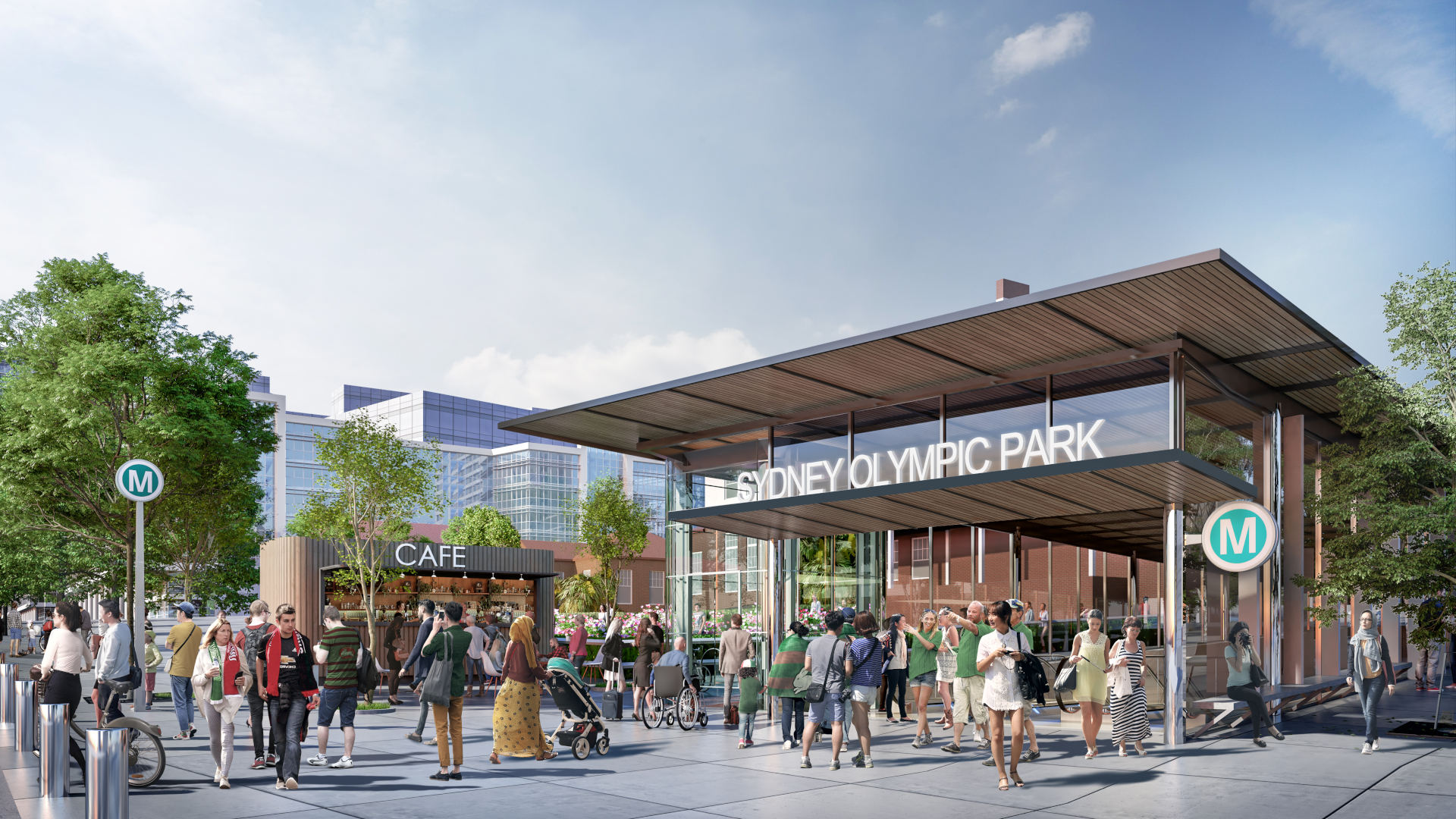
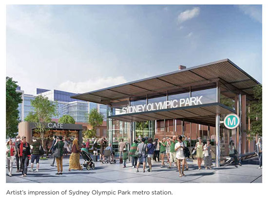
The proposed Sydney Olympic Park metro station would be located to the south of the existing Sydney trains Olympic Park Station.
Located in the heart of the growing town centre, the station would sit to the east of Olympic Boulevard with the main station entrances between Herb Elliot Avenue and Figtree Drive, and off Dawn Fraser Avenue.
The station would provide for easy connections with the planned Parramatta Light Rail, the T7 Olympic Park Line and buses.
A metro station at Sydney Olympic Park would reinforce its status as Australia’s premier events, sporting and entertainment precinct – supporting the transit of more than 10 million people who visit or stay each year.
Indicative construction timeframe for Stage 1 works*

Construction site map

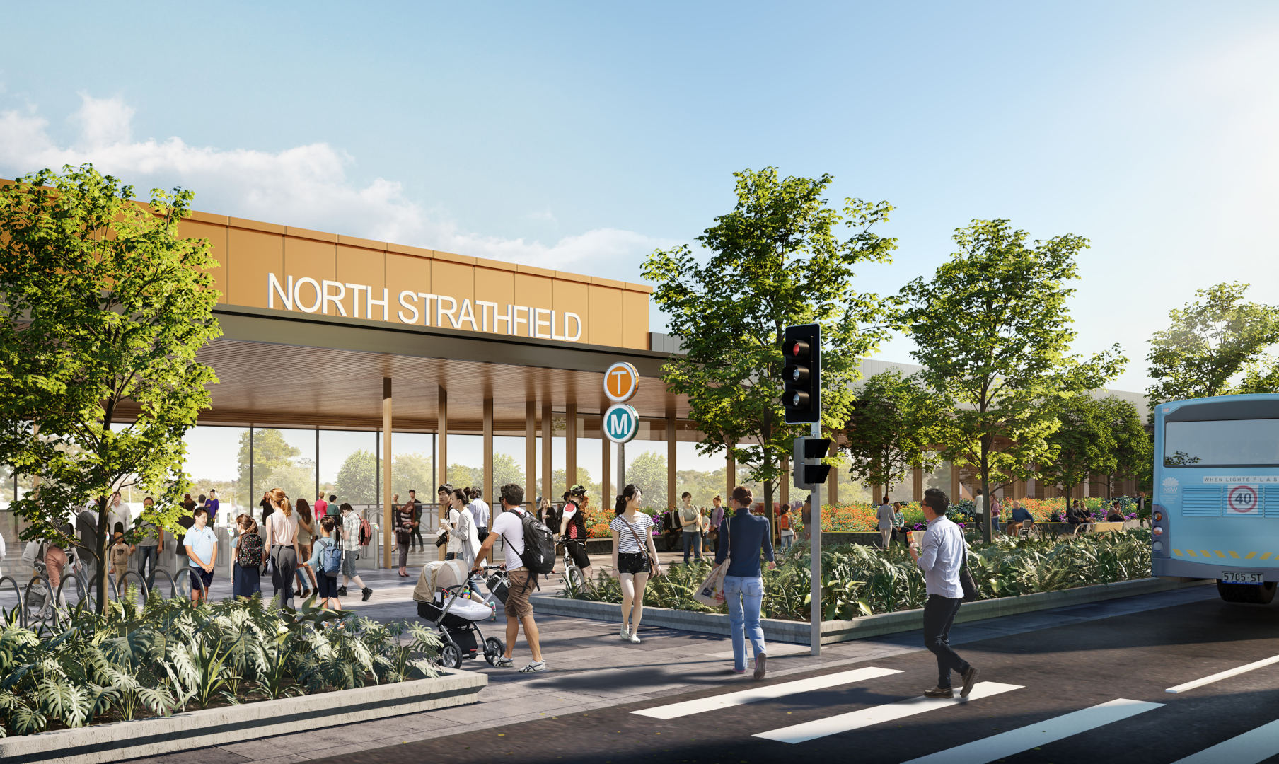
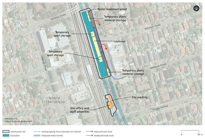
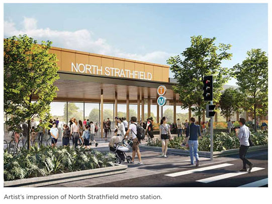
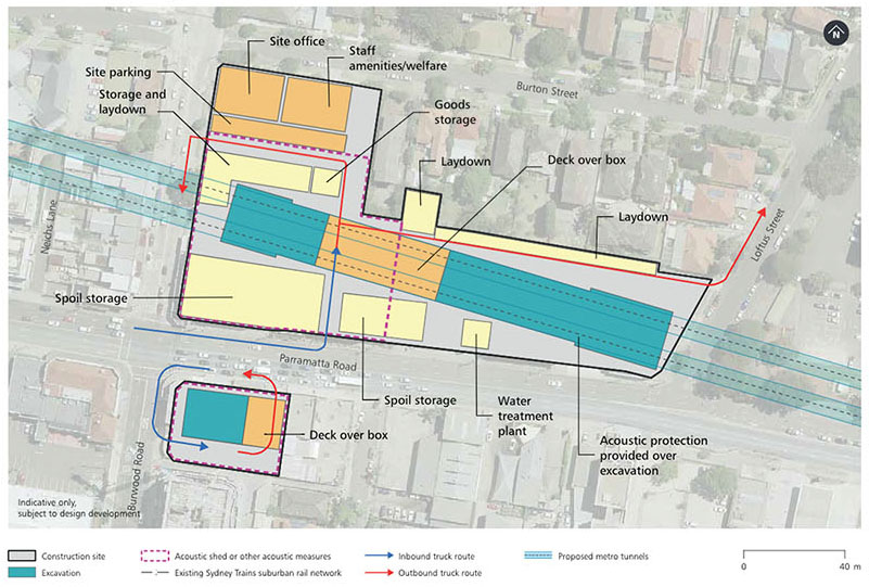
The proposed North Strathfield metro station would be adjacent to the existing Sydney Trains North Strathfield Station.
New metro platforms would sit alongside the existing station and entry to the station would be from a new entrance on Queen Street.
The station would improve connections to key employment and education precincts, taking the pressure off Strathfield Station. It would provide for an easy interchange with the T9 Northern Line, opening up access to key centres in the North West like Norwest and Castle Hill via Epping. The metro station would help to service the growing Homebush precinct. It would also complement local placemaking strategies to revitalise public areas and retain and attract new business and residents, building on the vibrancy of this growing hub.
Indicative construction timeframe for Stage 1 works*

Construction site map

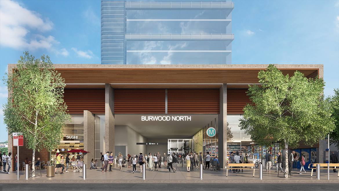
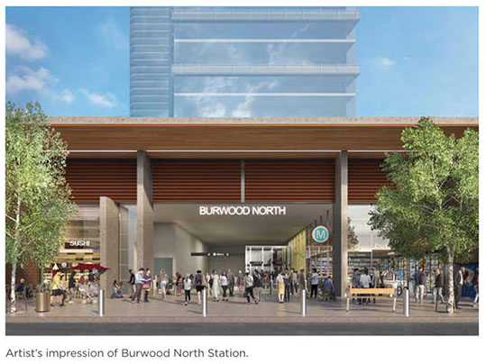
Burwood North Station will be located at the corner of Burwood and Parramatta roads, with entrances proposed on both the north and south sides of Parramatta Road. A new metro station at Burwood North will take the pressure off the existing bus network along Parramatta and Burwood roads as well as Burwood Station.
Burwood North Station will strengthen the thriving business and retail centre to the south of Parramatta Road, and provide a new, fast, frequent and reliable transport link for the community north of Parramatta Road. The station will support the Parramatta Road Corridor Urban Transformation Strategy which includes streetscape upgrades and the creation of new and improved open spaces; urban plazas and town squares; new walking and cycling links.
The station would support the Parramatta Road Corridor Urban Transformation Strategy which includes streetscape upgrades and the creation of new and improved open spaces; urban plazas and town squares; and new walking and cycling links.
Indicative construction timeframe for Stage 1 works*

Construction site map

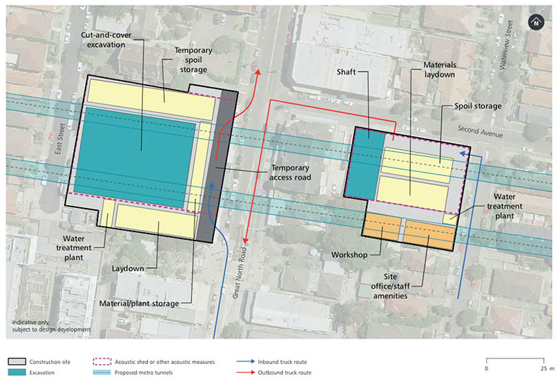
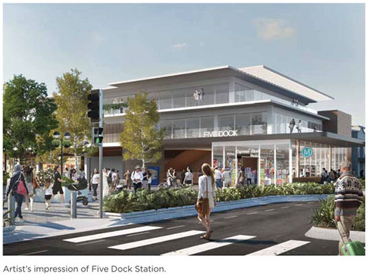
The proposed Five Dock Station will be made up of two sites – one located on Great North Road, between East Street (western site) and the other located at the corner of Second Avenue and Waterview Street (eastern site).
The station entrance will be located at Fred Kelly Place, off Great North Road. The project will deliver rail to this area for the first time, providing for a fast and direct trip into the Sydney CBD. The new metro station will also provide for an easy interchange with the local bus network along Great North Road. The metro station will be integrated into the area and support recommendations of the local council’s ‘Five Dock Town Centre Urban Design Study’, building on Five Dock as a vibrant and friendly village to live, work and visit.
Indicative construction timeframe for Stage 1 works*

Construction site map

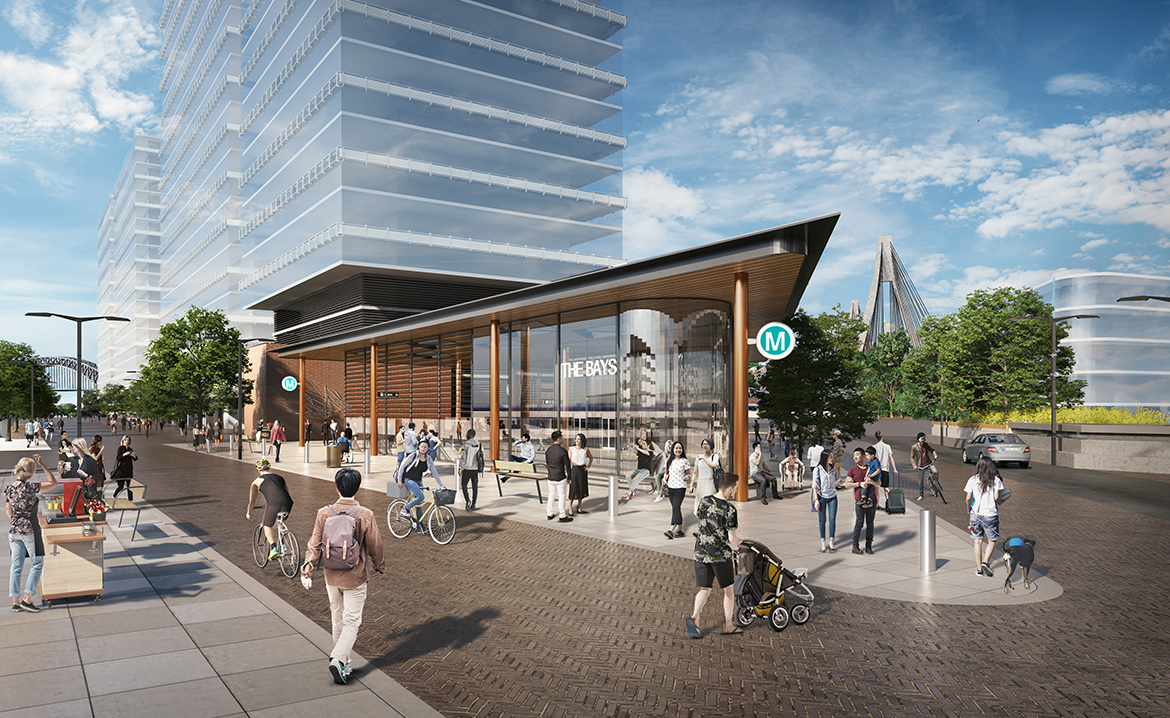
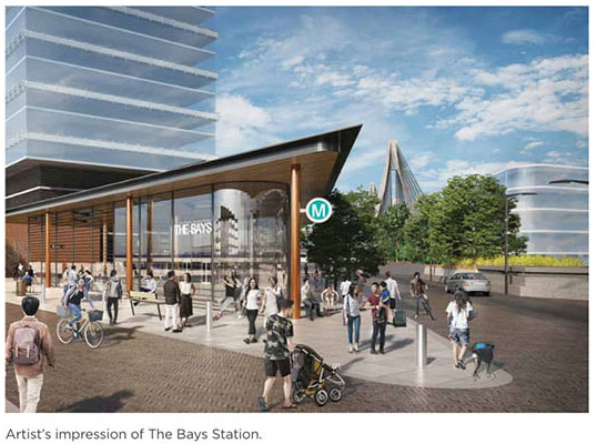
The Bays Station will be located between Glebe Island and White Bay Power Station with an entrance proposed to the south of White Bay. It will provide direct access to the proposed future Bays Waterfront Promenade, which will run north to south along White Bay. The Bays Station will be the main link into this new precinct as well as serving the communities of Balmain, Rozelle and Blackwattle Bay. Almost 100 hectares of land at The Bays will be regenerated to become Sydney’s newest harbourside business, technology and education hub, with new homes, retail and lifestyle opportunities. The transformation will happen over the next 20 – 30 years.
Indicative construction timeframe for Stage 1 works*

Construction site map
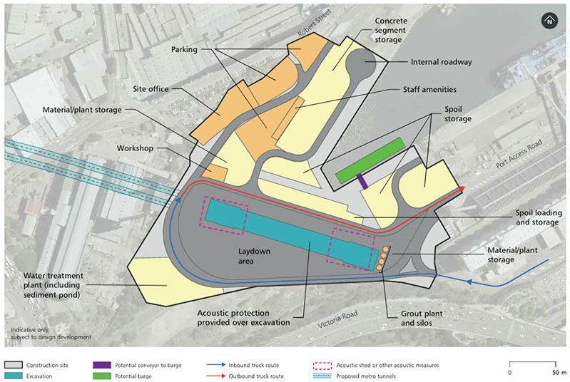

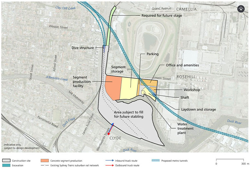
A stabling and maintenance facility is proposed to be located in the Clyde and Rosehill industrial estate bounded by James Ruse Drive, the M4 Western Motorway, Unwin Street and Shirley Street.
Inside the facility a traction substation would provide power to the metro line, and a water treatment plant would treat and recycle all wastewater from the tunnels, stations and underground facilities. The facility would also include offices, parking and storage.
Indicative construction timeframe for Stage 1 works*
Construction site map
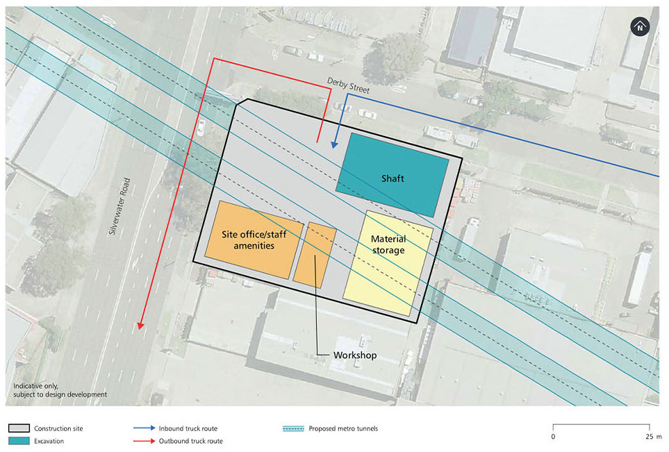
A services facility is proposed to be built at Silverwater on the corner of Derby Street and Silverwater Road. The Facility would provide fresh air ventilation into the tunnels and emergency exits out of them.
Further planning is underway to determine the location of another service facility between Five Dock and The Bays.
Indicative construction timeframe for Stage 1 works*

Construction site map
Click on the tiles below to learn how to make a submission.