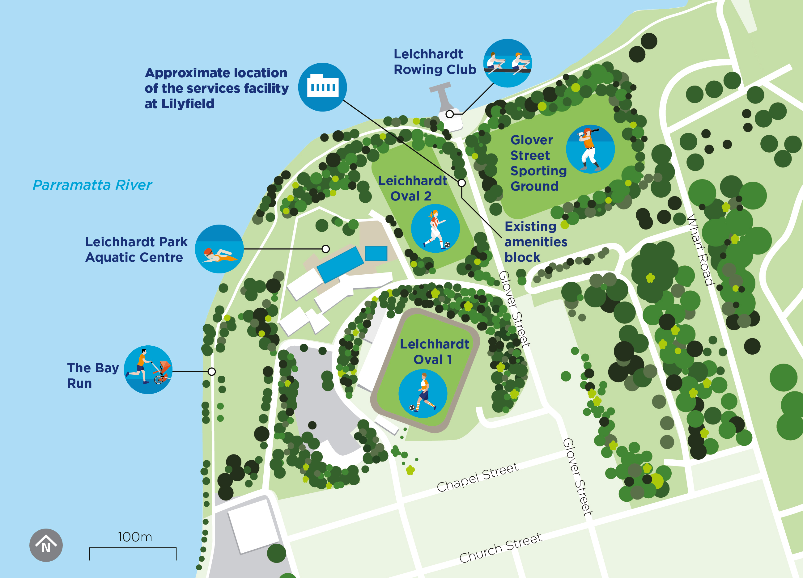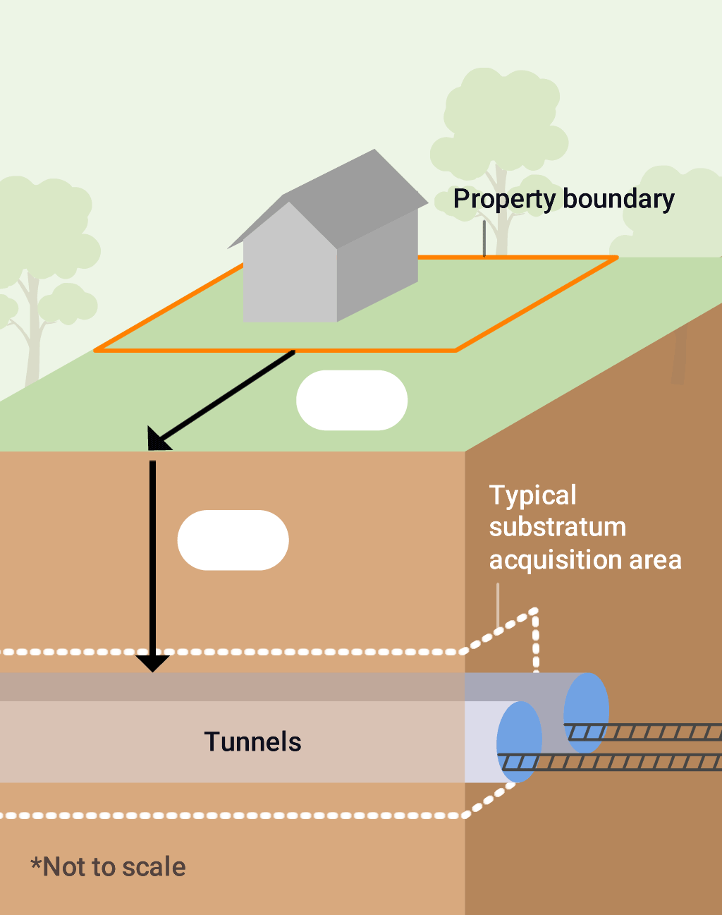
Select a property
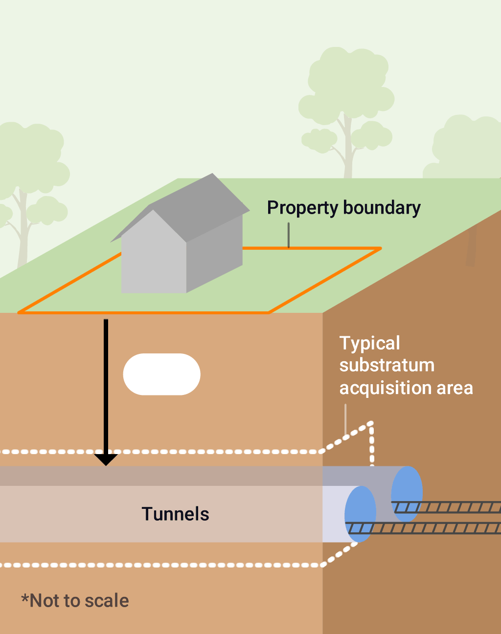
- -Tunnel feature depth, cross section and substratum acquisition zone is indicative only and may vary due to ground conditions and detailed design.
This image indicates the nearest underground metro tunnel feature, other tunnel features may be located deeper below the surface.
Typically a seven metre zone above, below and either side of the tunnels forms part of any substratum acquisition however this will vary from property to property and may be up to 10 metres.
Map key
Return to map
-
 Sydney Metro Station
-
 Sydney Trains Station
-
 Light Rail Station
- Station under consideration by NSW Government