Frequently asked questions
Choose a question below to see the answer and find helpful links to more information.
Smart Motorways, also known as managed motorways, use real-time information, communication and traffic control systems incorporated into and alongside the road to improve traffic flow.
Smart motorway technologies are being used on Melbourne's M1 motorway and introduced in southern Queensland on several roads including the Ipswich Motorway. Some individual elements of the technology are already in place on Sydney roads including the M1, M2, M5 and M7 Motorways.
Yes, studies have reported a significant reduction in motorway incidents and improved traffic flow. On Melbourne's M1 Motorway reports have shown:
- Travel times have been reduced by up to 42 percent
- Crash rates have decreased by 30 percent
- Vehicle emissions have been reduced by 11 percent.
The project aims to lessen congestion and keep traffic moving across the M4 Motorway network. Less stop-start traffic reduces fuel consumption and reduces CO2 emissions.
The concept design and environmental assessment phase of the M4 Smart Motorway project was jointly funded by the NSW and Australian governments.
The project is being developed as part of the National Smart Managed Motorways Programme, which targets major economic routes and aims to improve freight, business and commuter connections with key locations, including employment centres and major transport centres like the airport.
The NSW Government has allocated $395 million towards the M4 Smart Motorway project along with $75 million from Roads and Maritime Services’ consolidated fund.
For more information visit the Department of Infrastructure and Regional Development website.
The first stage of work commenced in October 2017.
We anticipate the complete managed motorway system will be operational by 2020.
Ramp meters, or ramp signals, on entry ramps are quick change traffic lights that manage the flow of vehicles entering the motorway. They make merging safer and easier and reduce the risk of drivers having to brake suddenly.
Ramp metering will operate during peak periods or in heavy traffic, for example, as a result of an incident. A sign at the beginning of the entry ramp will tell you if ramp metering is in operation.
Traffic sensors along the motorway, and on entry and exit ramps, will continually monitor traffic conditions. The sensors will detect changes in traffic conditions early and switch the ramp meters on before the motorway reaches capacity.
The timing of the ramp meters change with the demand at each entry ramp and on the motorway itself. The timing is coordinated with other entry ramp meters along the motorway.
No, entry ramp meters will operate in peak periods or in heavy traffic, for example, as a result of an incident.
The system may operate all, some or none of the ramp meters, depending on traffic conditions. Due to the dynamic nature of the system, it will continuously monitor traffic conditions and operate automatically at any time in response to changing traffic conditions.
No, it is anticipated that for most journeys, the travel time saved on the motorway would be greater than any minimal delay that may be experienced at an entry ramp.
We are modifying entry and exit ramps to ensure there is enough space to manage traffic volumes without impacting traffic already on the motorway or on approach roads.
No, the motorway will still be called M4 Motorway.
No, there will be no permanent change to speed limits on the M4 Motorway. Variable speed limits will be in operation if there is heavy traffic, an incident or other adverse conditions.
There will be no toll introduced to this section of the M4 as part of this project. However, the section of the M4 east of Church Street will be tolled as part of the WestConnex project.

Ramp signal and metering system
Ramp signals, are quick change traffic lights on motorway entry ramps to manage the flow of vehicles entering the motorway. When the red lights appear, drivers stop and wait for the green signal. When lights turn green, one vehicle per lane will be able to drive along the ramp and merge onto the motorway.
The ramp signals only operate during busy periods to improve traffic flow; they stay off at other times. Sensors in the road detect when traffic becomes heavy, and the system turns on the ramp signals to regulate the total traffic flow entering the motorway. This prevents congestion and flow breakdown on the highly trafficked motorway and better manages the conflict between vehicles merging and motorway traffic.
Ramp signals run on a fast cycle, with only a few seconds between green lights, as compared to standard traffic lights which can take up to one to three minutes.
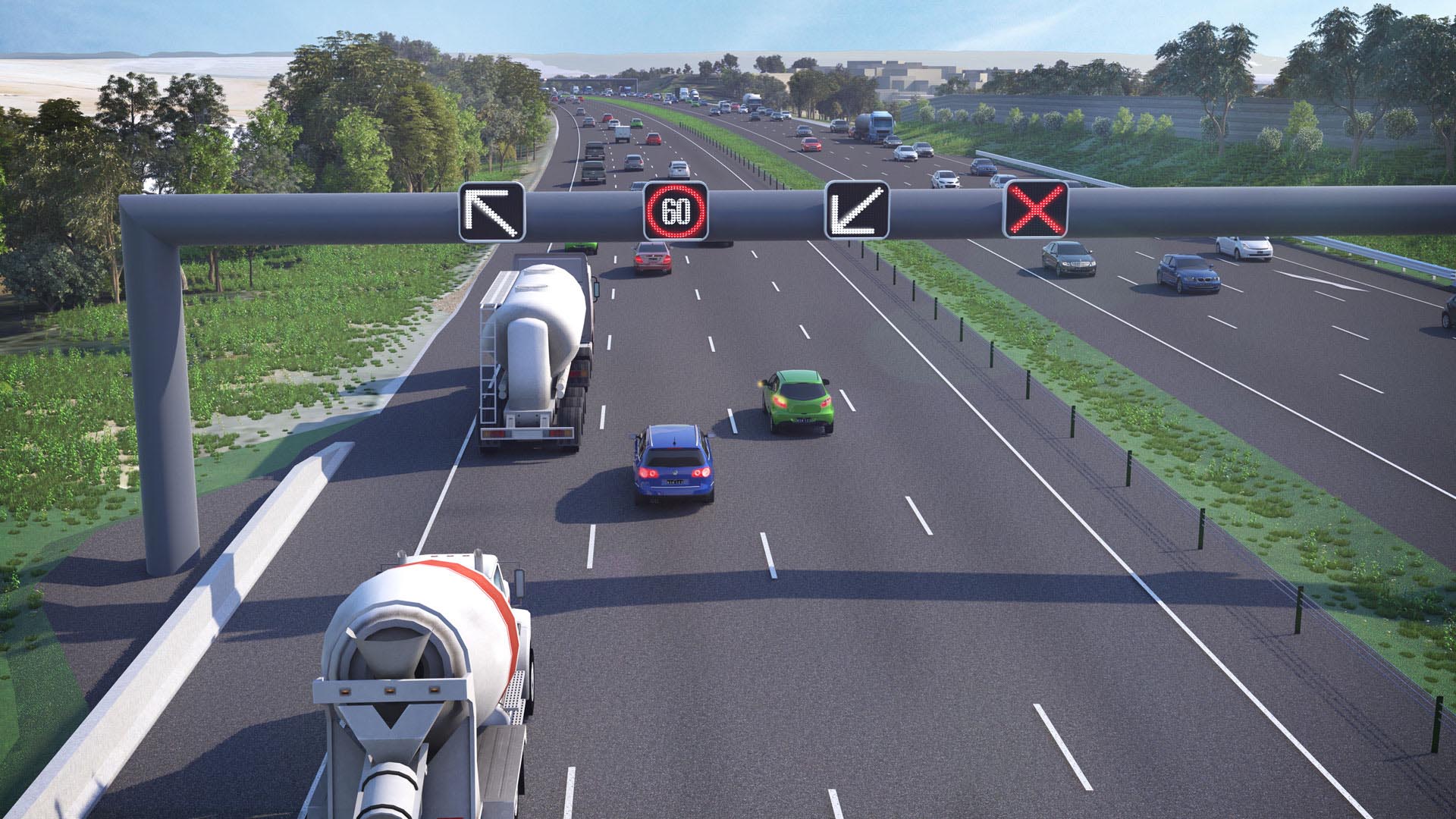
Lane use management signs
Speed and lane use signs are used to deliver real time information to drivers by allocating and managing lane use across the motorway. Speed limits can be changed in response to traffic conditions to improve road safety, traffic flow and provide a consistent journey. Speed limits may change in response to busy periods, incidents, roadworks or weather conditions such as high winds or flooding.
The speed and lane use signs also display arrows and crosses to direct traffic around incidents or hazards that may be on the motorway.
New lanes
Some sort of simple, easy to understand paragraph or two of information here about this particular feature. Lorem ipsum dolor sit amet, consectetur adipiscing elit, sed do eiusmod tempor incididunt ut labore et dolore magna aliqua.
Ut enim ad minim veniam, quis nostrud exercitation ullamco laboris nisi ut aliquip ex ea commodo consequat. Duis aute irure dolor in reprehenderit in voluptate velit esse cillum dolore eu fugiat nulla pariatur. Excepteur sint occaecat cupidatat non proident, sunt in culpa qui officia deserunt mollit anim id est laborum.
Improved interchanges
Some sort of simple, easy to understand paragraph or two of information here about this particular feature. Lorem ipsum dolor sit amet, consectetur adipiscing elit, sed do eiusmod tempor incididunt ut labore et dolore magna aliqua.
Ut enim ad minim veniam, quis nostrud exercitation ullamco laboris nisi ut aliquip ex ea commodo consequat. Duis aute irure dolor in reprehenderit in voluptate velit esse cillum dolore eu fugiat nulla pariatur. Excepteur sint occaecat cupidatat non proident, sunt in culpa qui officia deserunt mollit anim id est laborum.
Safer merging
By controlling the timing of vehicles entering the motorway, ramp meters enable safer merging while maintaining a smooth flow of traffic on the motorway. They help people travelling on the motorway to enjoy more consistent speeds and predictable travel times with less congestion. It also means less stop-start traffic and less sudden braking, meaning less wear and tear on vehicles and a reduction in the risk of crashes.

to your destination
It will also display travel destinations along your chosen route.
Variable message signs
Variable message signs (VMS) will be located at key decision making points along your journey to provide real-time information about traffic conditions and expected travel times. This will help you to make decisions about which route to take before entering the motorway and once on the motorway.
M4 Smart Motorway - Community Roadshow
We will be carrying out a community roadshow where you can learn about Smart Motorways and ask questions about the project. Please feel free to drop in at the following locations:
Westfield Mt Druitt
Ground floor, Cnr Carlisle Avenue and Luxford Road Mt Druitt NSW 2770 - MAP
Friday 13 October 10:00am-2:00pm
Saturday 14 October 10:00am-2:00pm
Westpoint Blacktown
Level 2, 17 Patrick Street Blacktown NSW 2148 - MAP
Thursday 19 October 4:00pm-6:00pm
Friday 20 October 10:00am-2:00pm
Saturday 21 October 10:00am-2:00pm
Westfield Penrith
Ground floor, 585 High Street Penrith NSW 2750 - MAP
Thursday 26 October 4:00pm-6:00pm
Friday 27 October 10:00am-2:00pm
Saturday 28 October 10:00am-2:00pm
M4 Smart Motorway - Register for Updates
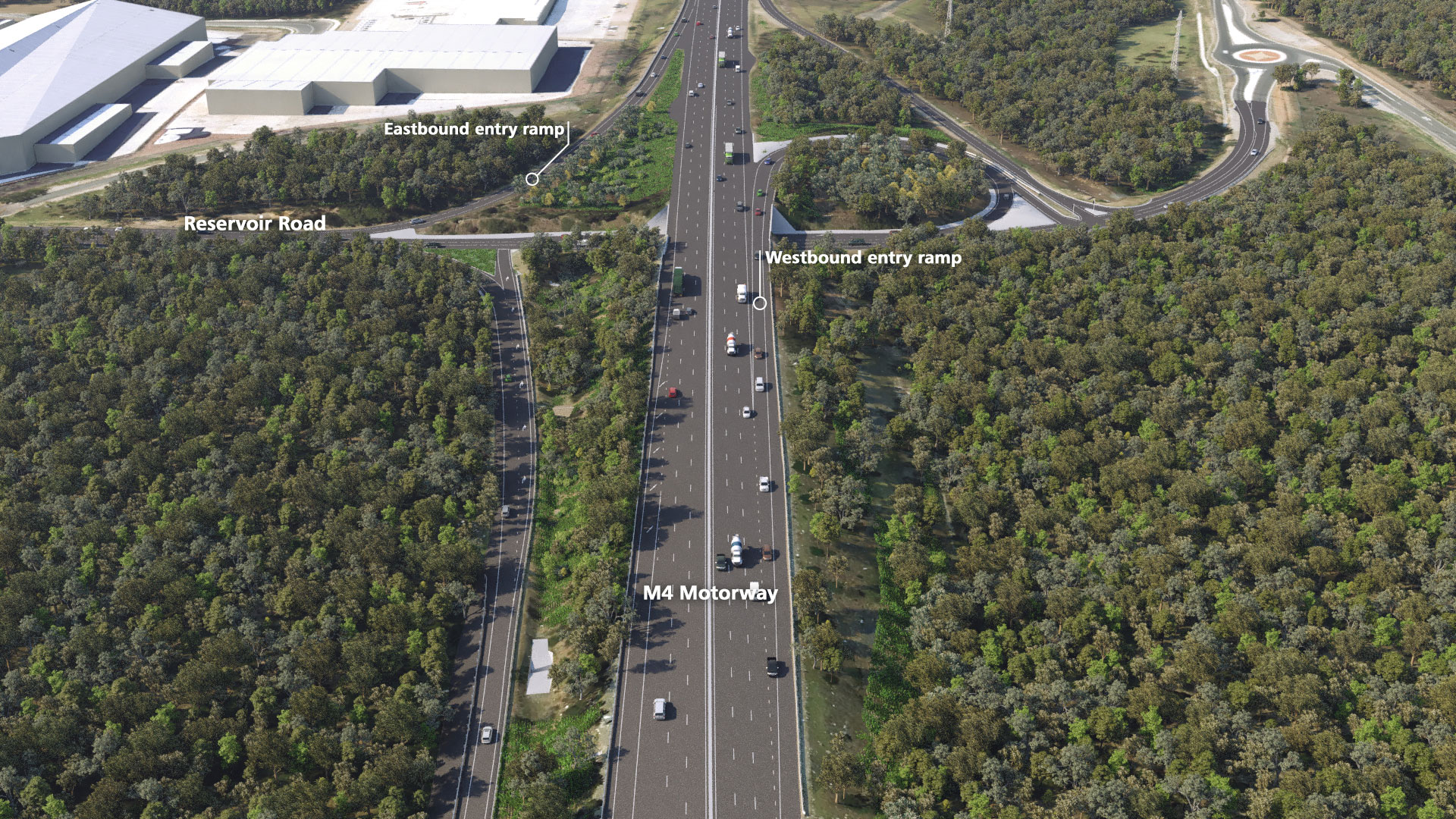
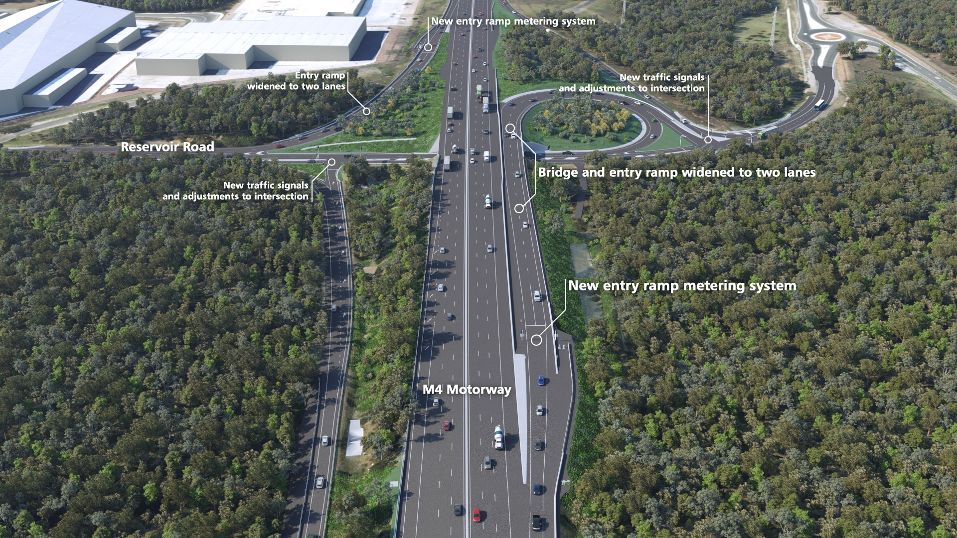
Original vs Design: Reservoir Road
Drag the slider from the left to right to compare the original road layout to the designed road layout. Drag all the way to the right to see the entire original road layout, and all the way to the left to see the entire designed road layout.
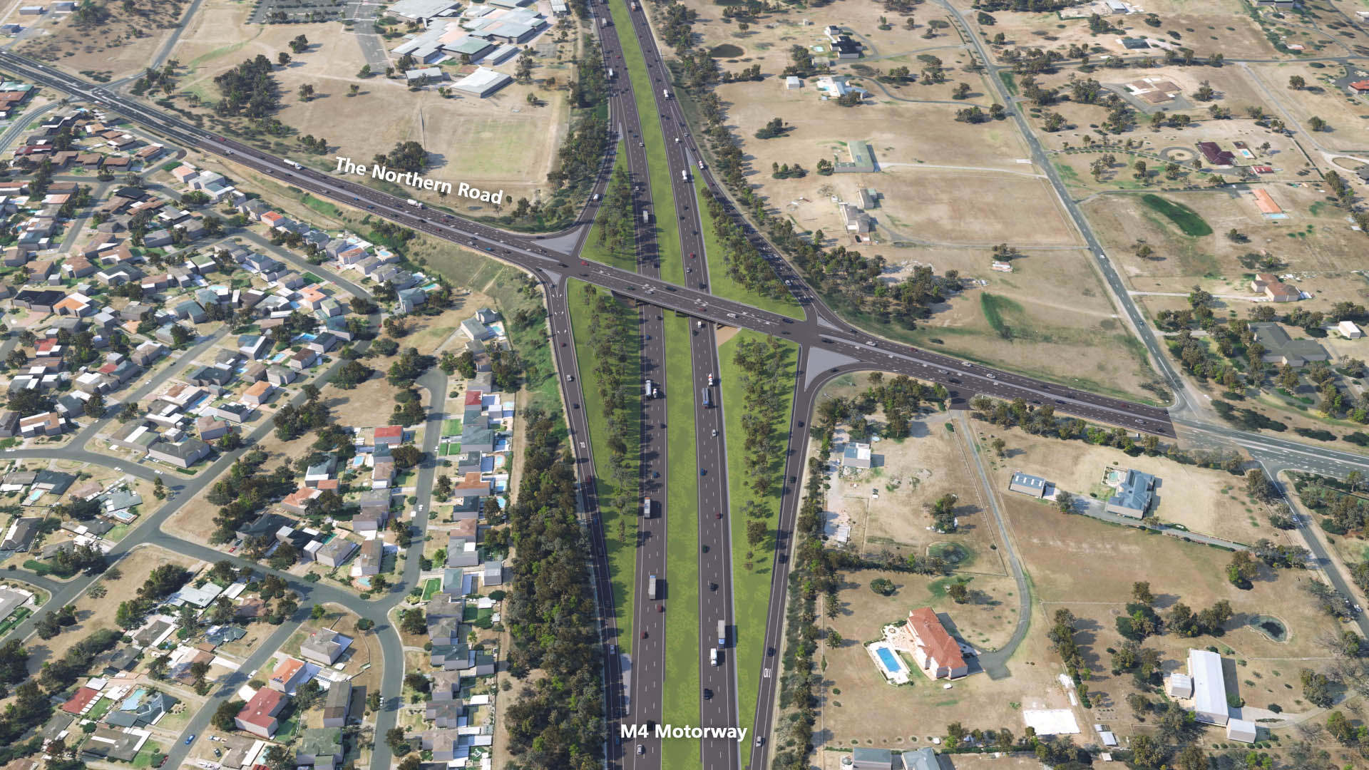
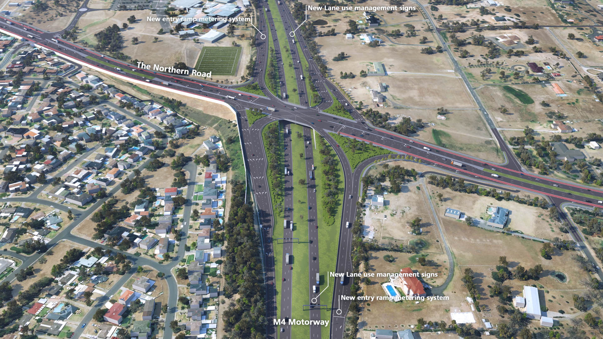
Original vs Design: The Northern Road
Drag the slider from the left to right to compare the original road layout to the designed road layout. Drag all the way to the right to see the entire original road layout, and all the way to the left to see the entire designed road layout.
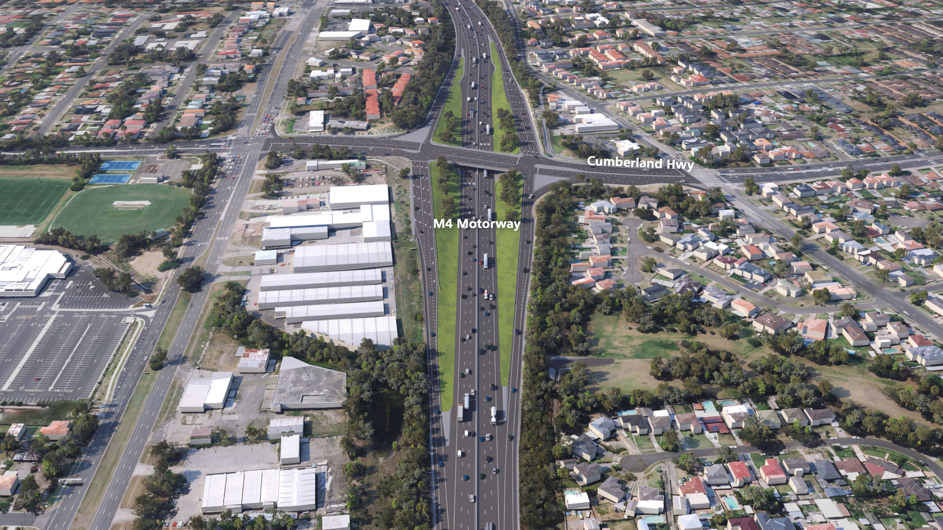
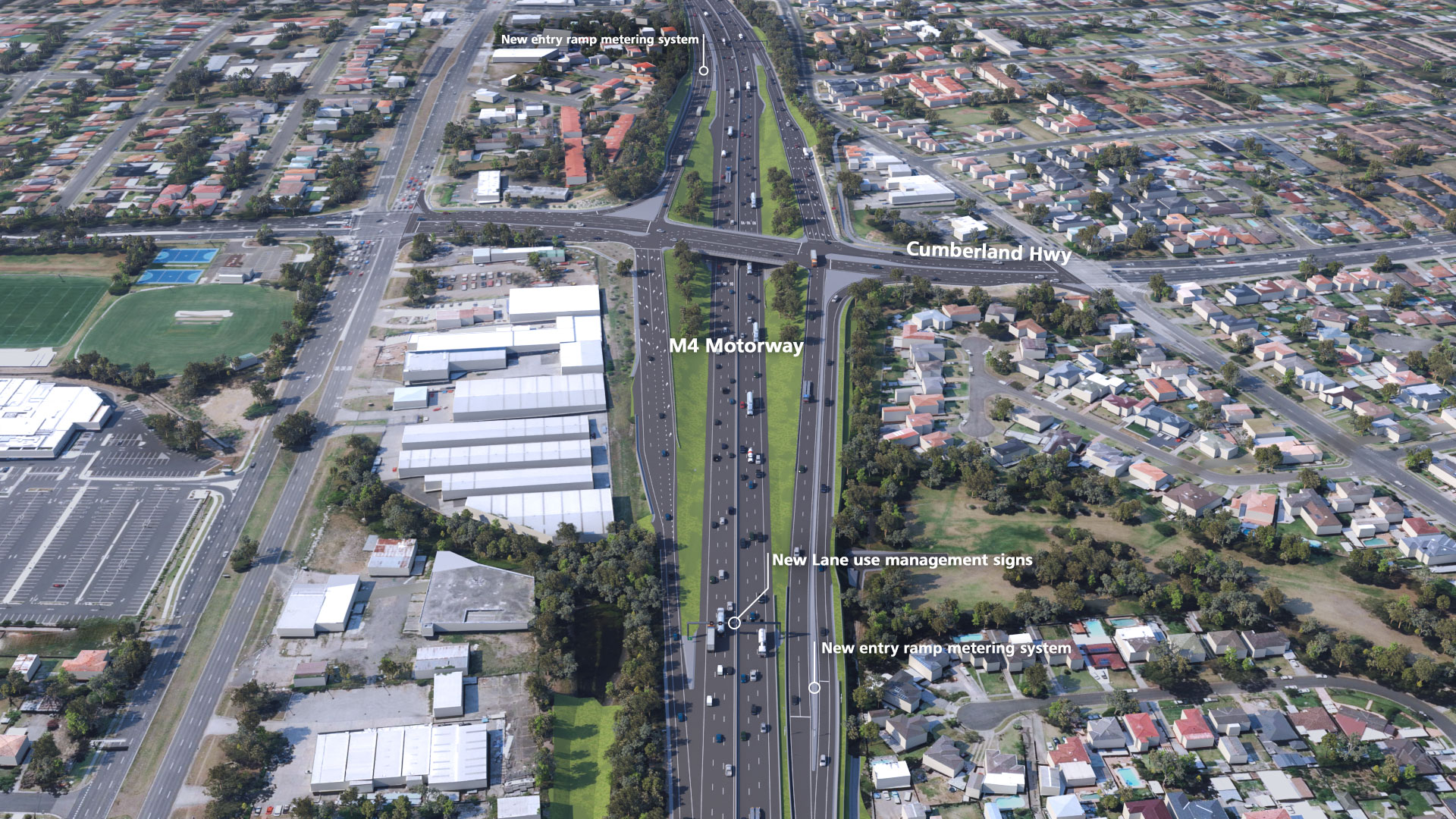
Original vs Design: Cumberland Highway
Drag the slider from the left to right to compare the original road layout to the designed road layout. Drag all the way to the right to see the entire original road layout, and all the way to the left to see the entire designed road layout.
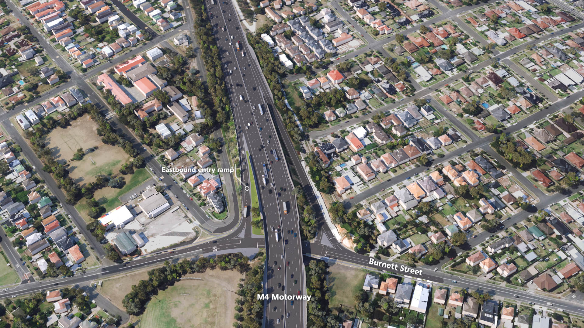
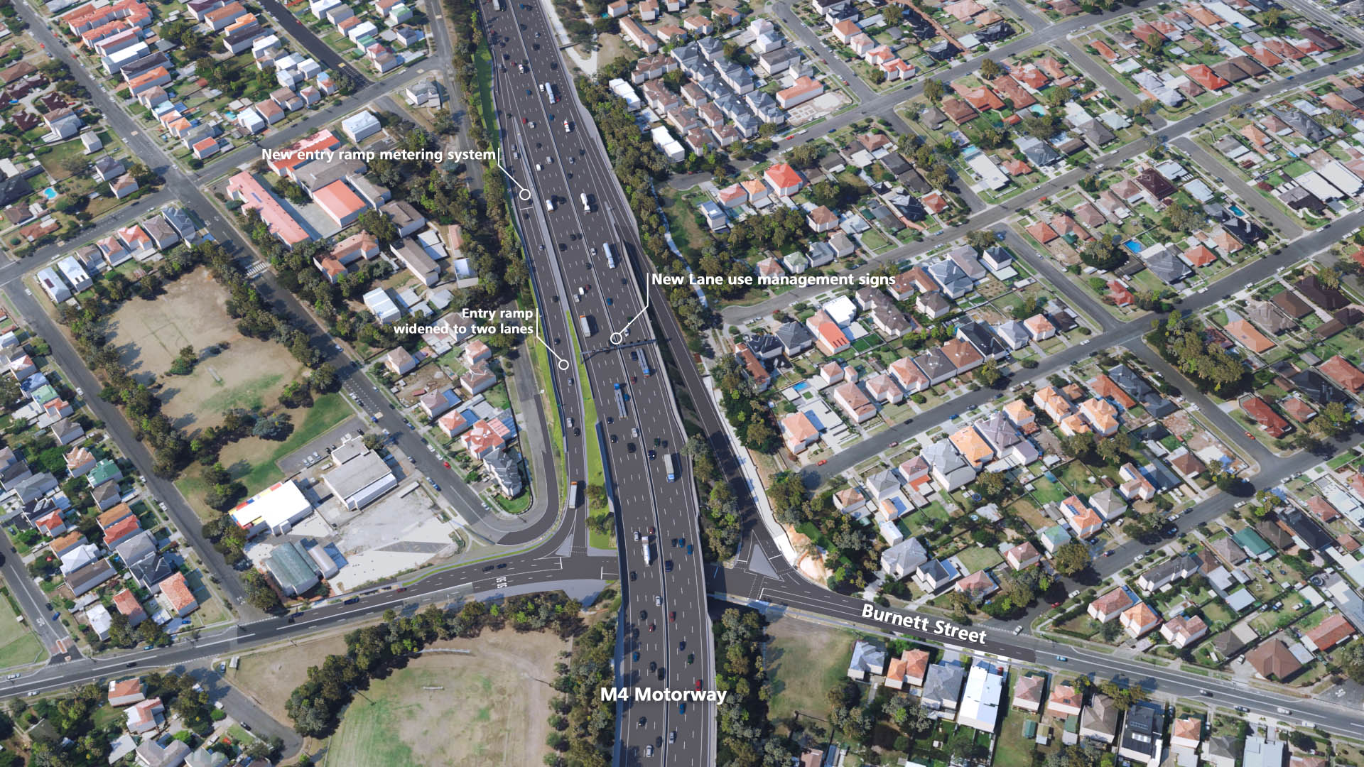
Original vs Design: Burnett Street
Drag the slider from the left to right to compare the original road layout to the designed road layout. Drag all the way to the right to see the entire original road layout, and all the way to the left to see the entire designed road layout.


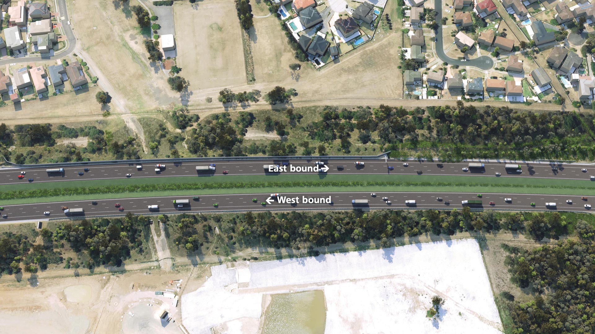
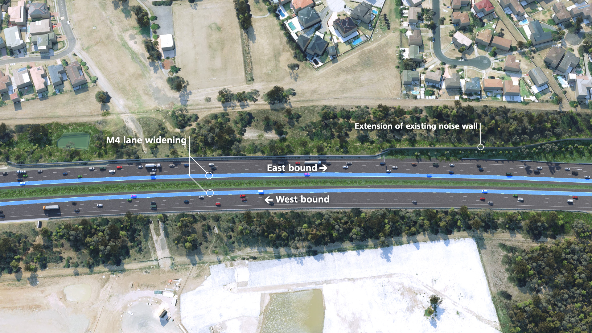
Original vs Design: M4 Motorway widening
Drag the slider from the left to right to compare the original road layout to the designed road layout. Drag all the way to the right to see the entire original road layout, and all the way to the left to see the entire designed road layout.
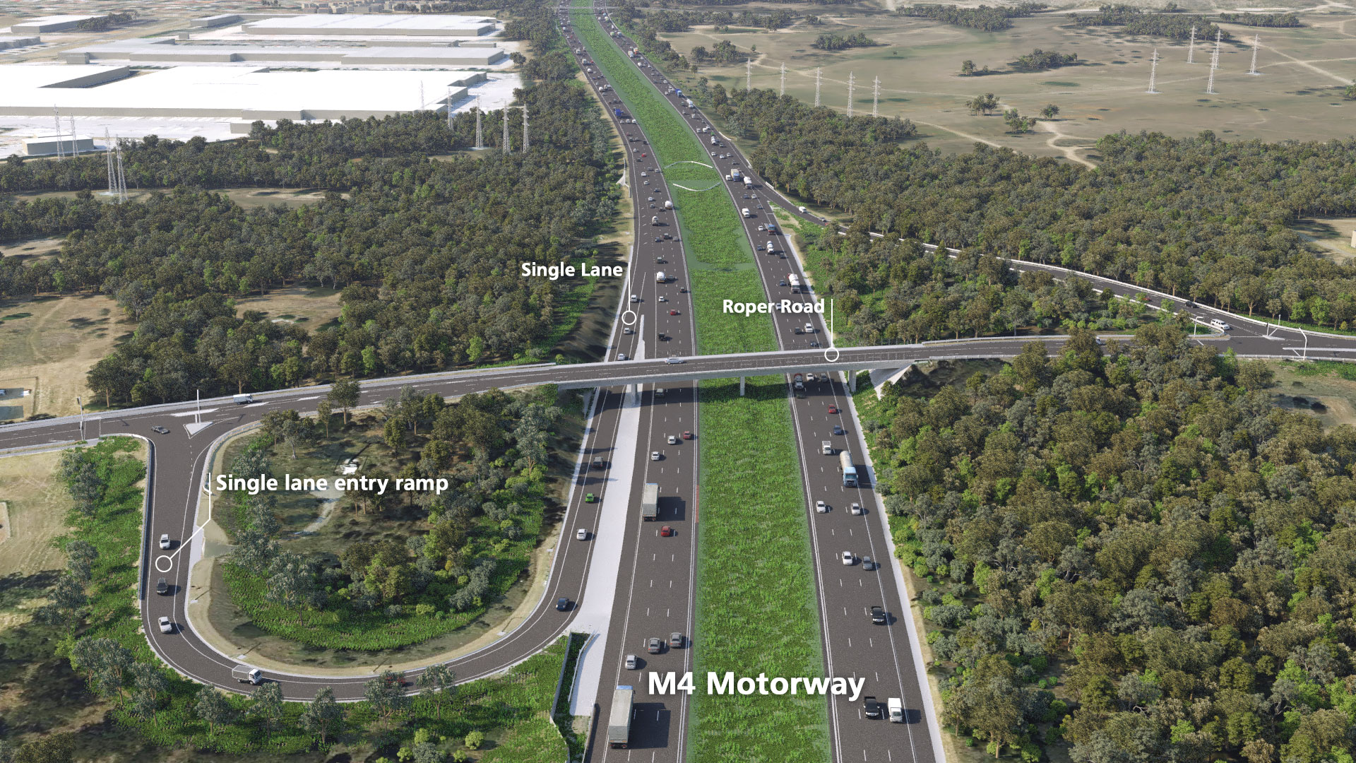
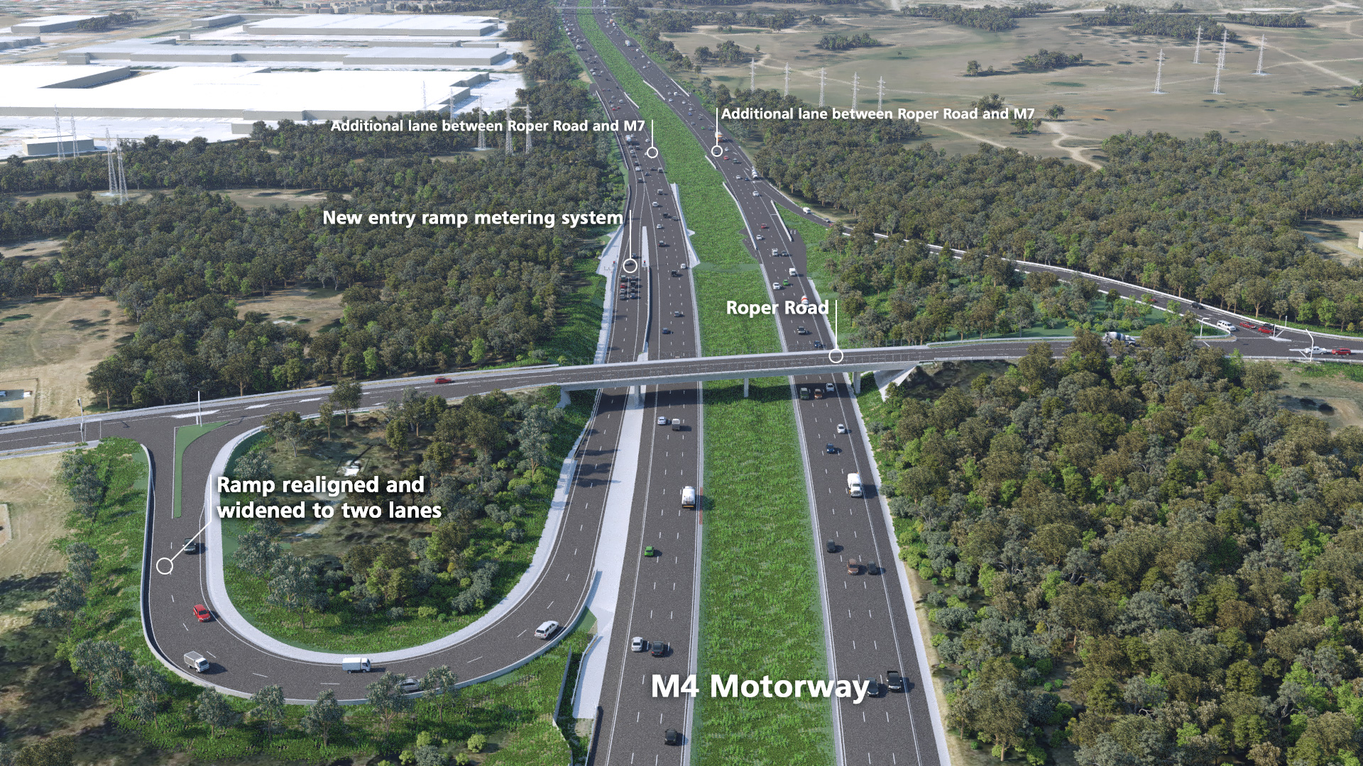
Original vs Design: Roper Road
Drag the slider from the left to right to compare the original road layout to the designed road layout. Drag all the way to the right to see the entire original road layout, and all the way to the left to see the entire designed road layout.
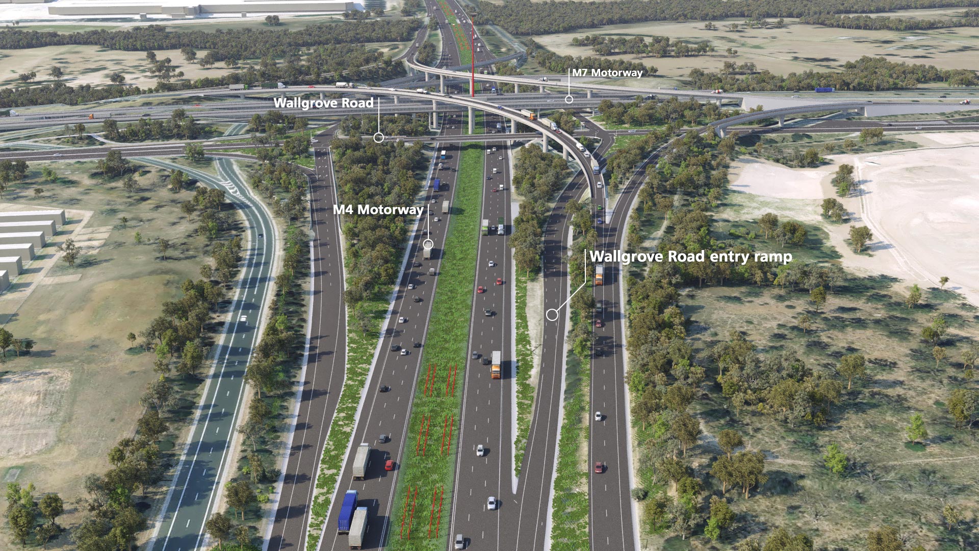
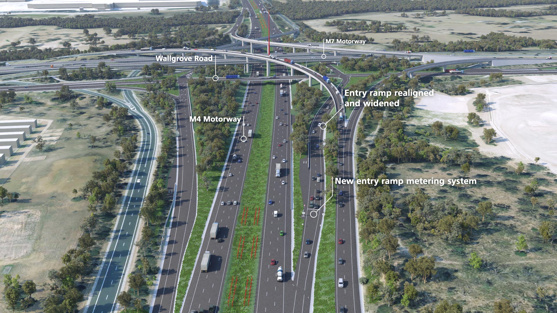
Original vs Design: Wallgrove Road
Drag the slider from the left to right to compare the original road layout to the designed road layout. Drag all the way to the right to see the entire original road layout, and all the way to the left to see the entire designed road layout.

