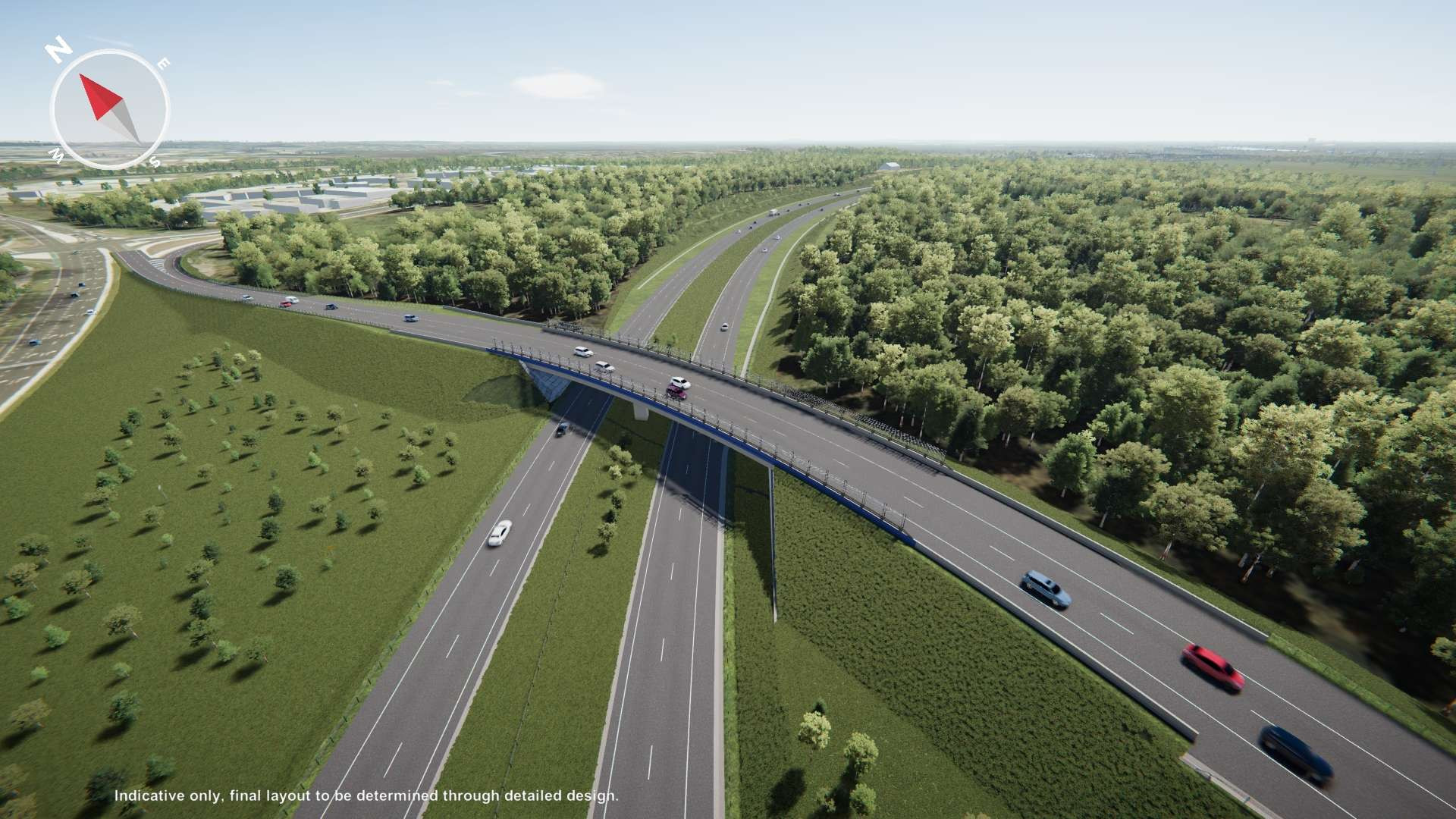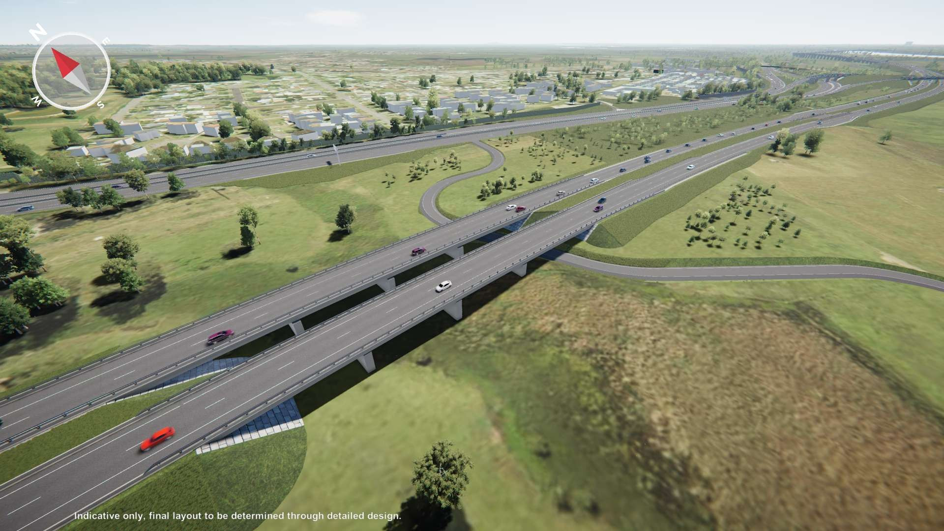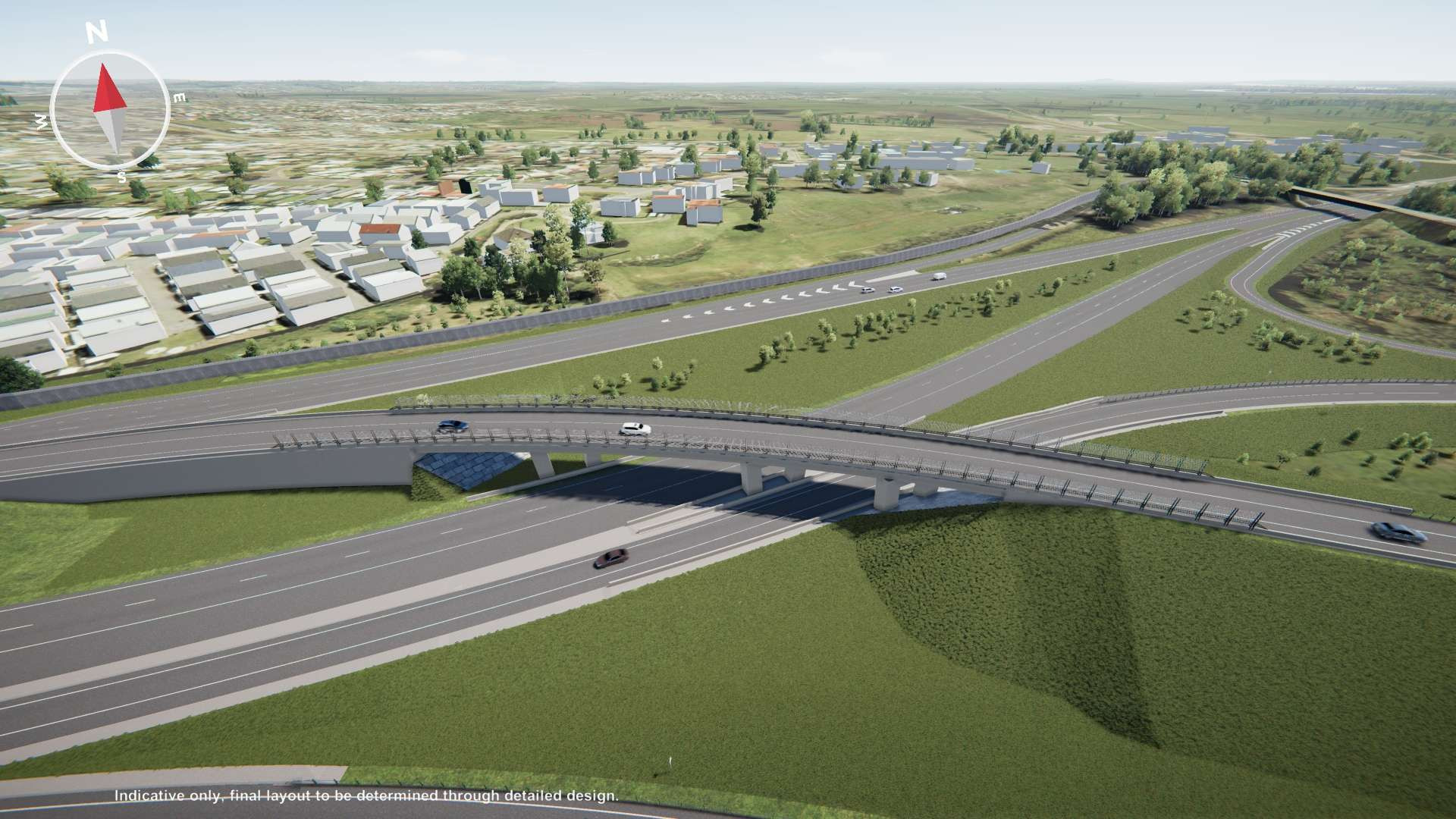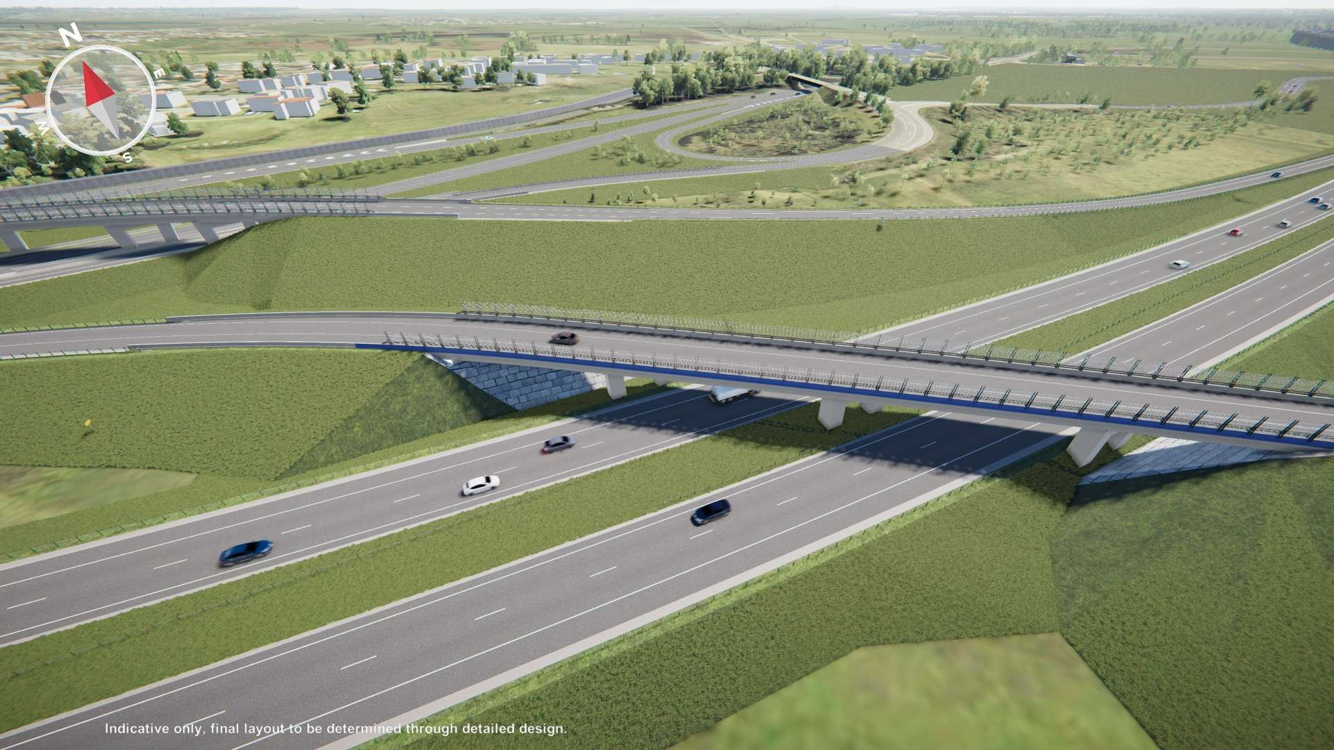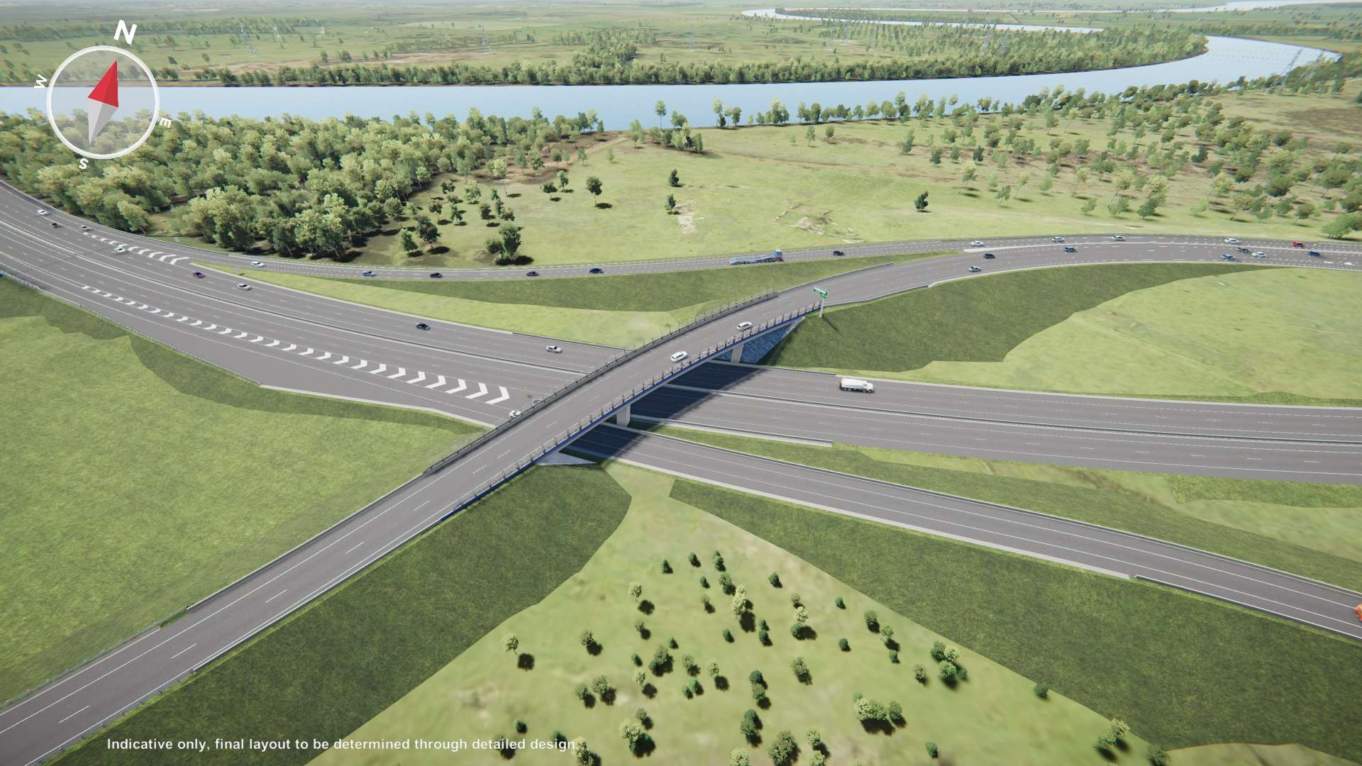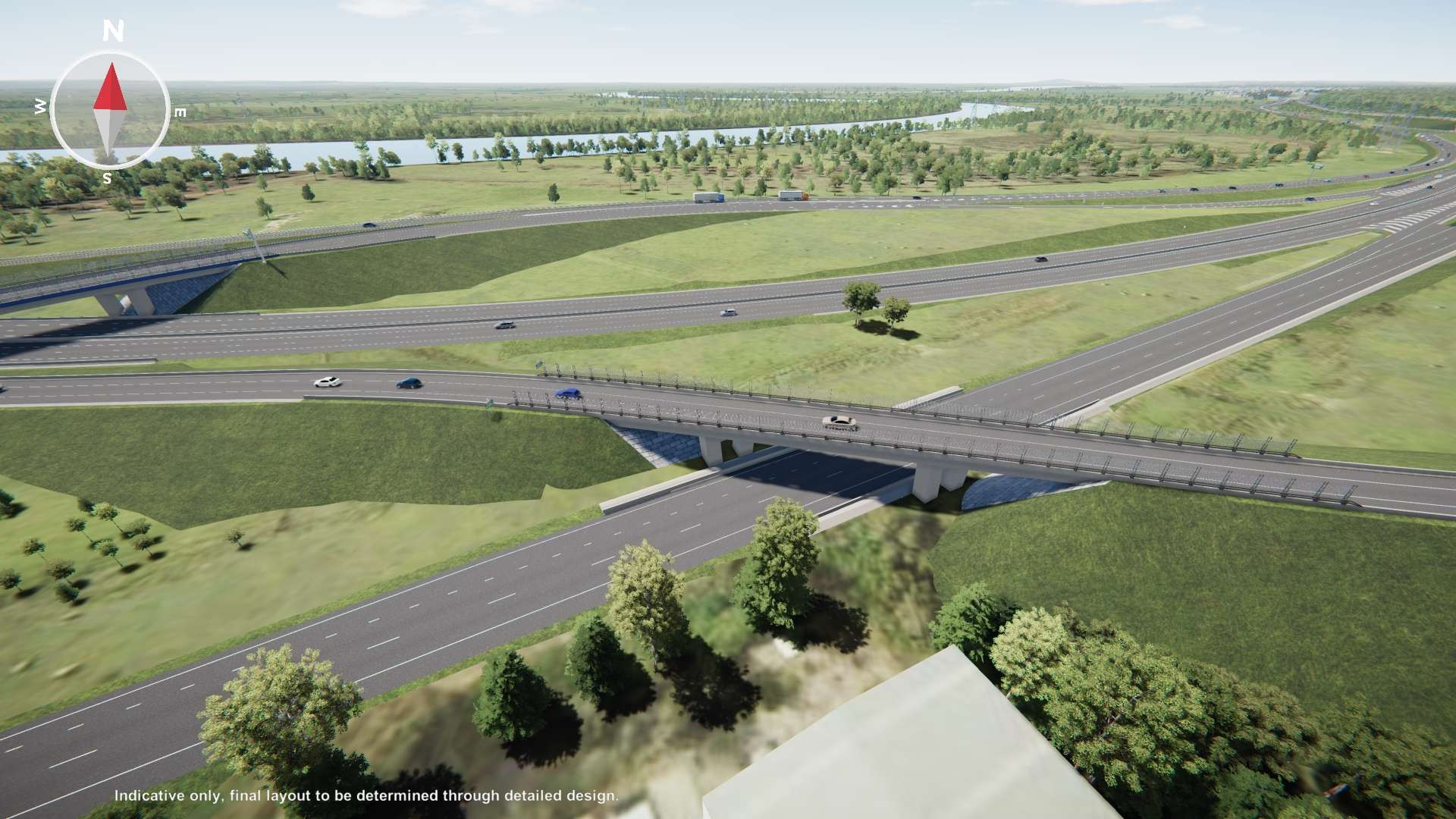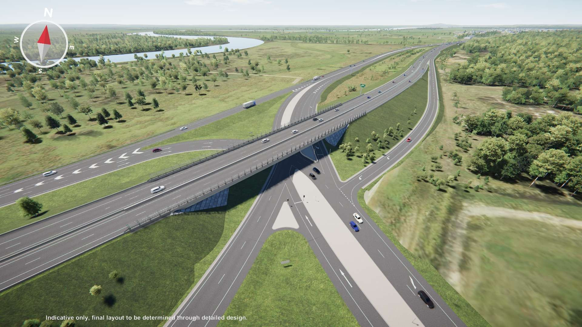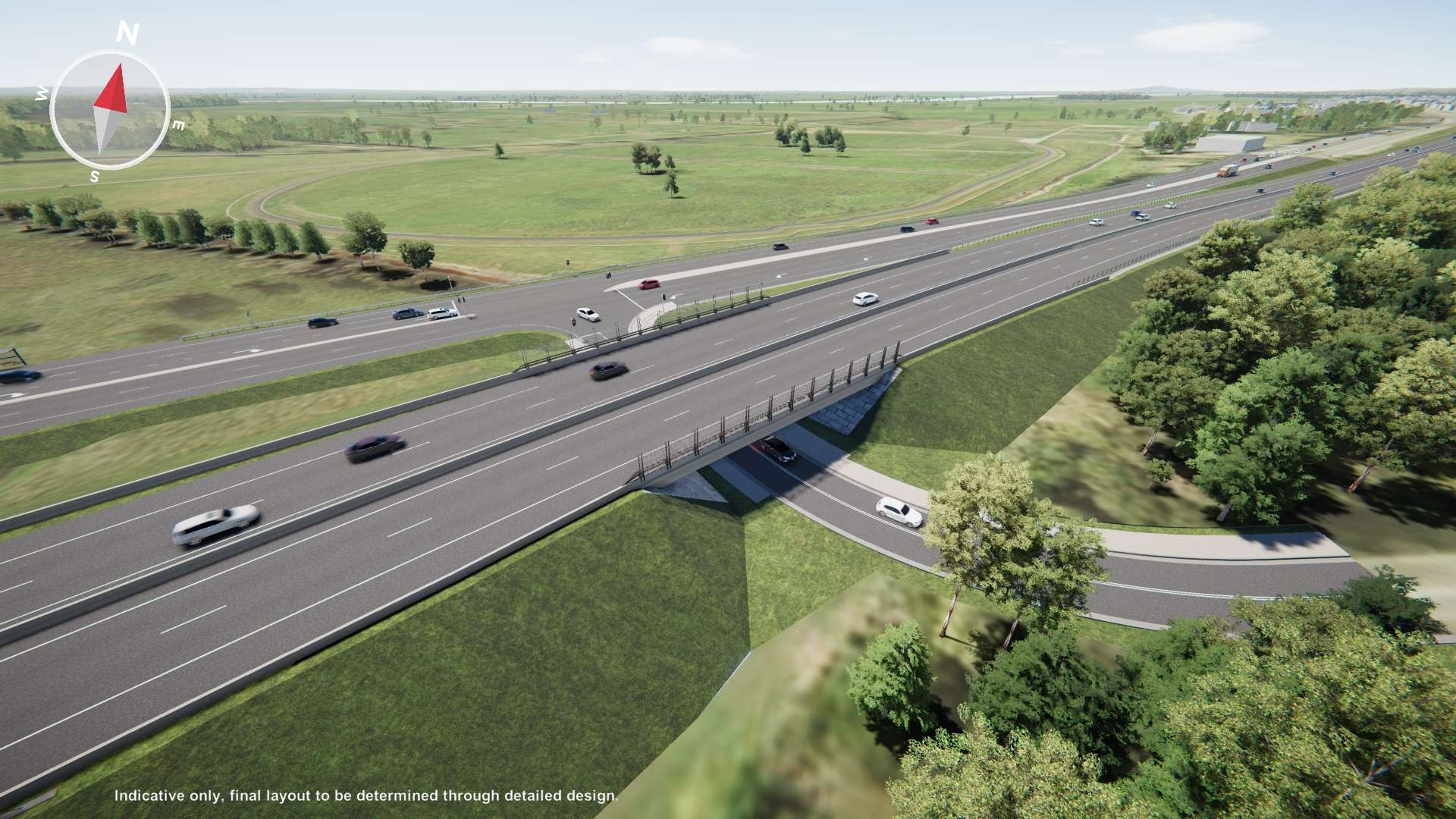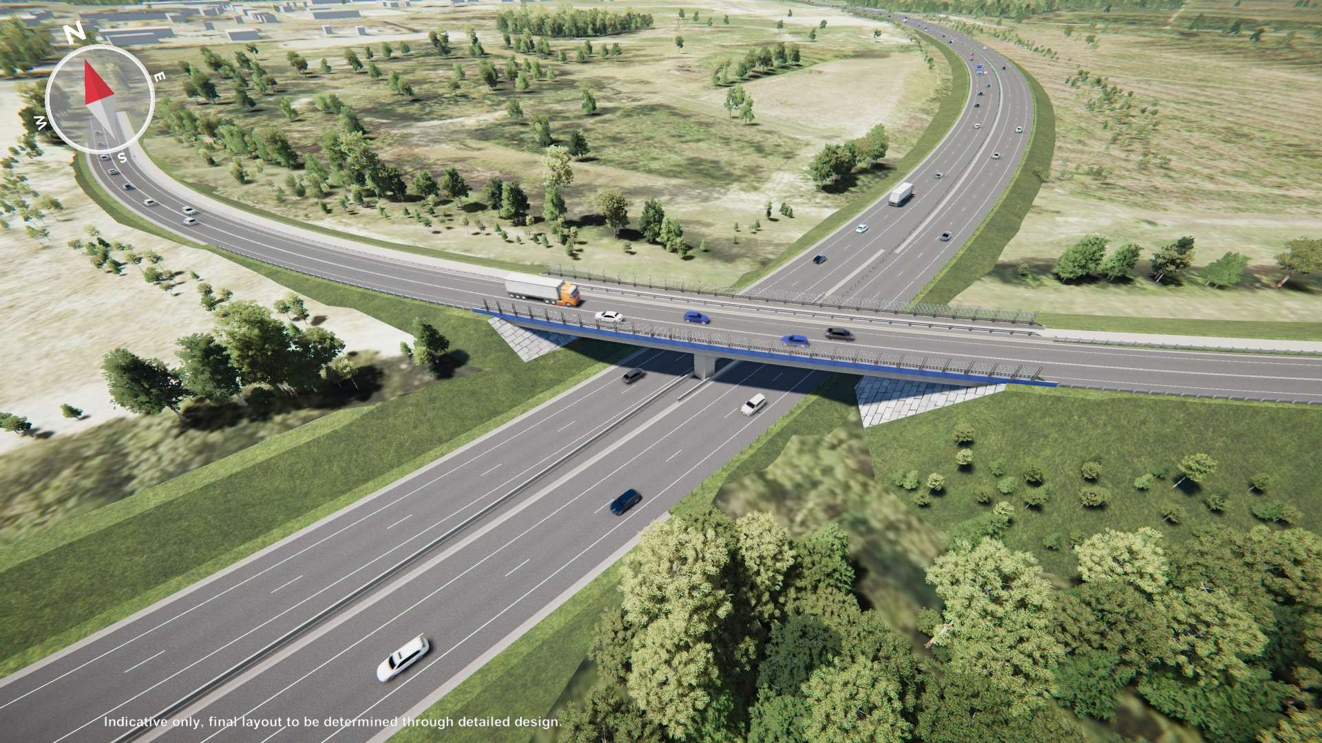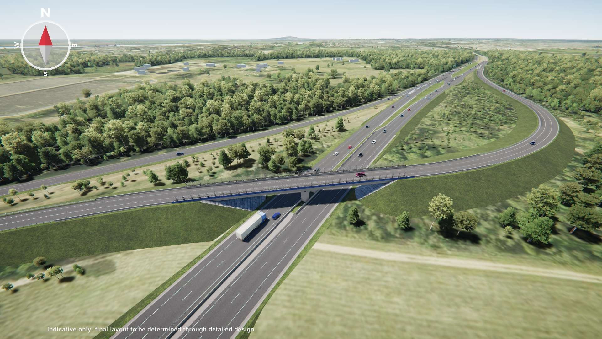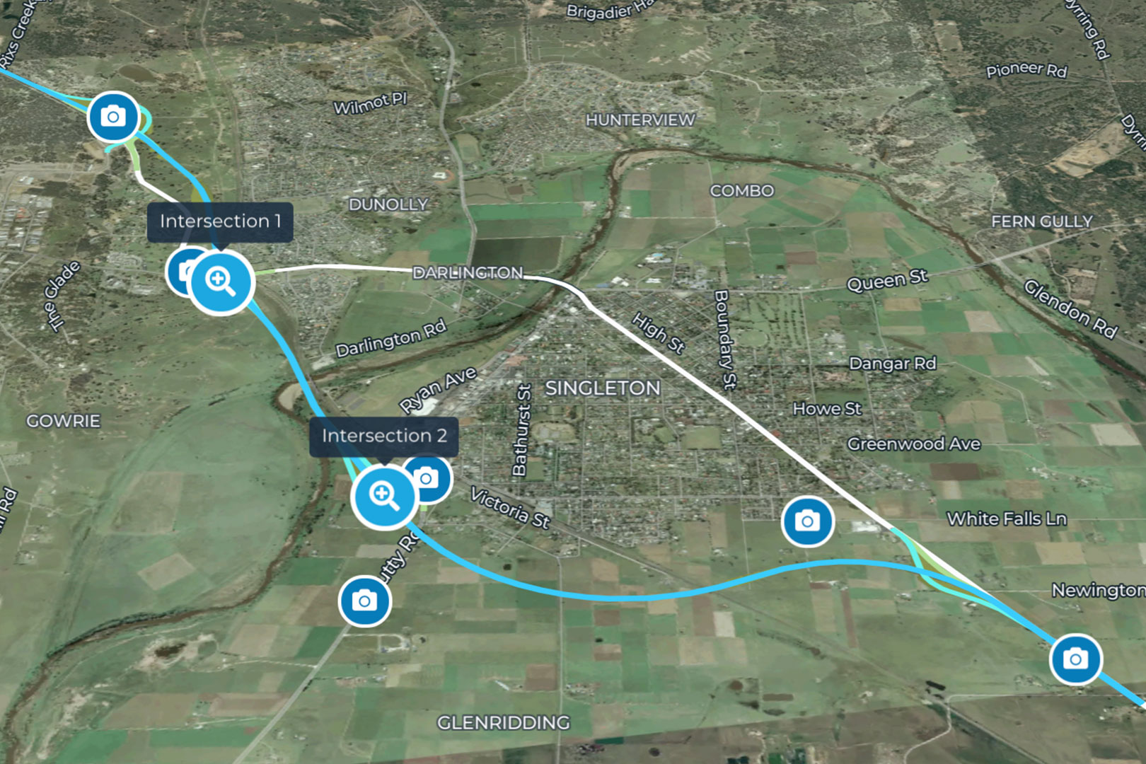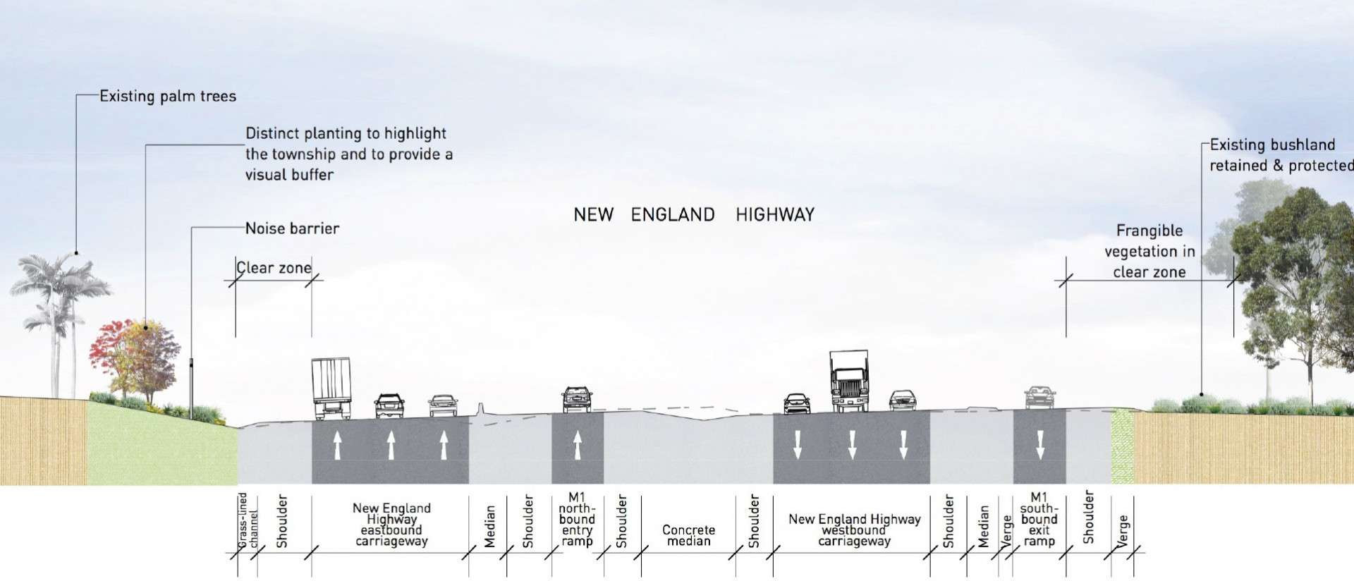
Improved bridge structure which relocates the M1 Motorway northbound entry ramp over the New England Highway, with no change to the previous design footprint.

- Improved direct access in and out of the Hunter Region Botanic Gardens for motorists, pedestrians and cyclists
- Centralised interchange located at Old Punt Road to improve connectivity, road transport efficiency and safety for all motorists, and minimise impact with the proposed AGL Power Plant infrastructure project
- Improved access to the northbound Motorway entry ramp at Tomago which allows motorists from Newcastle to access the motorway sooner
Map layers
The M1 Pacific Motorway and A1 Pacific Highway are critical links in the National Land Transport Network and among the busiest transport corridors in Australia. The M1 Pacific Motorway extension to Raymond Terrace project addresses a key 'missing link' between Sydney and Brisbane.
Project features
The project connects the existing M1 Pacific Motorway at Black Hill and the A1 Pacific Highway at Raymond Terrace. It includes the following key features:
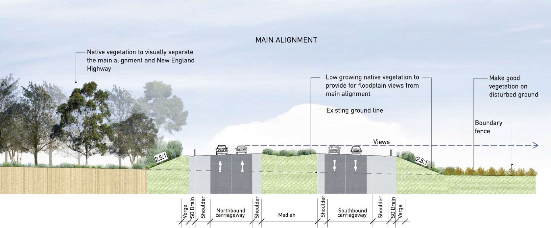
- A 15km motorway comprised of a four lane divided road (two lanes in each direction)
- Motorway access from the existing road network via four new interchanges at Black Hill, Tarro, Tomago and Raymond Terrace
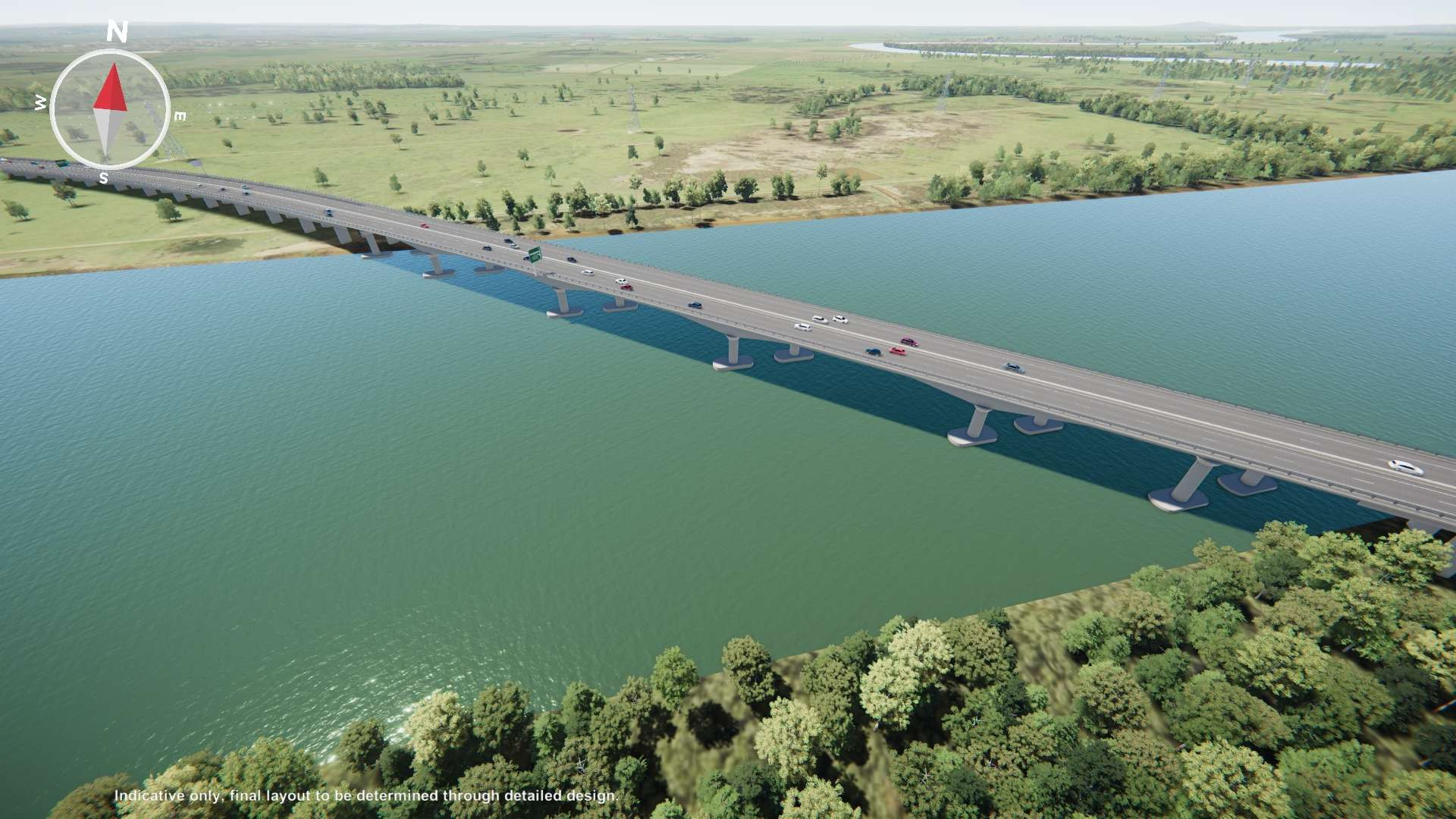
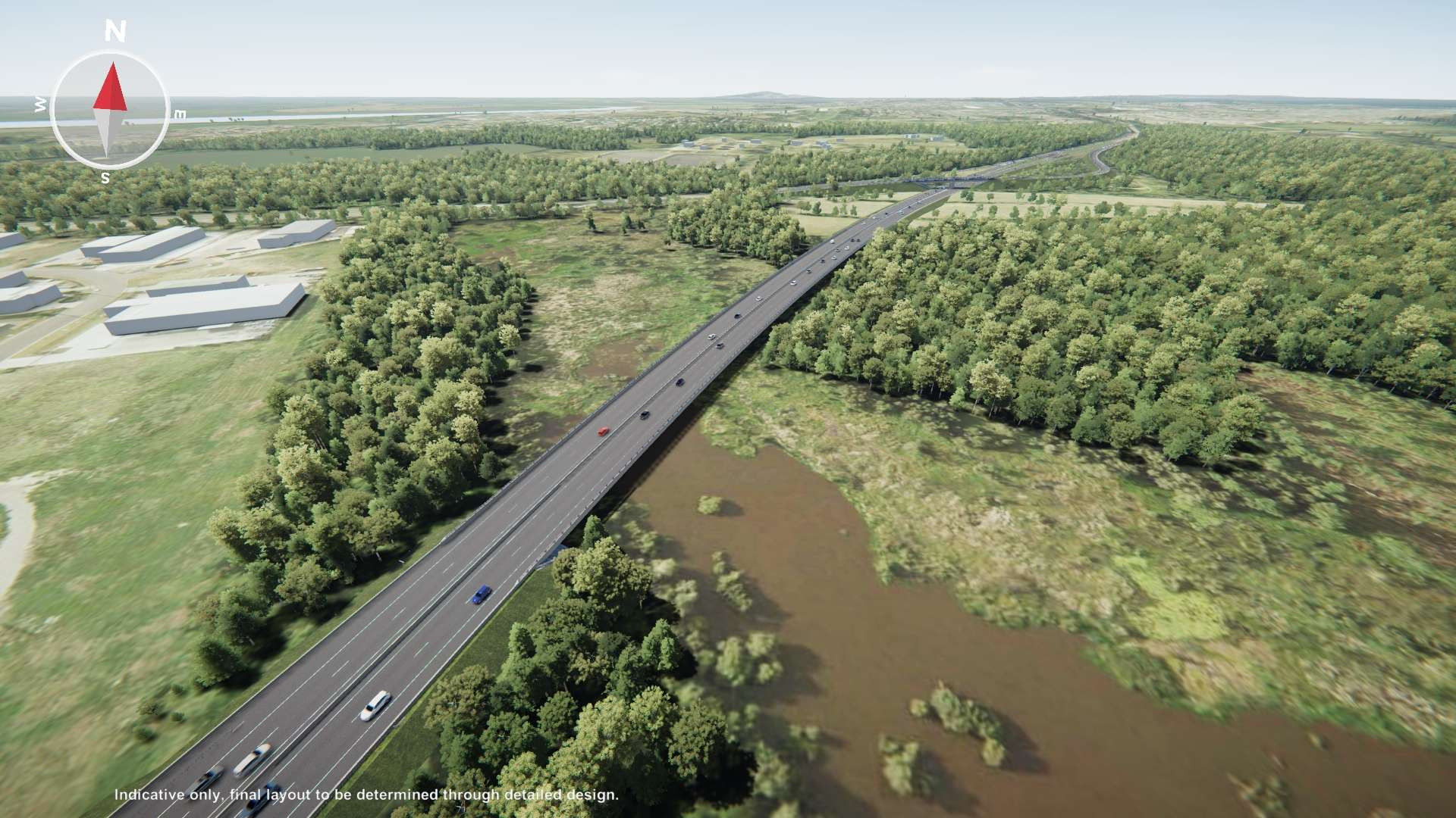
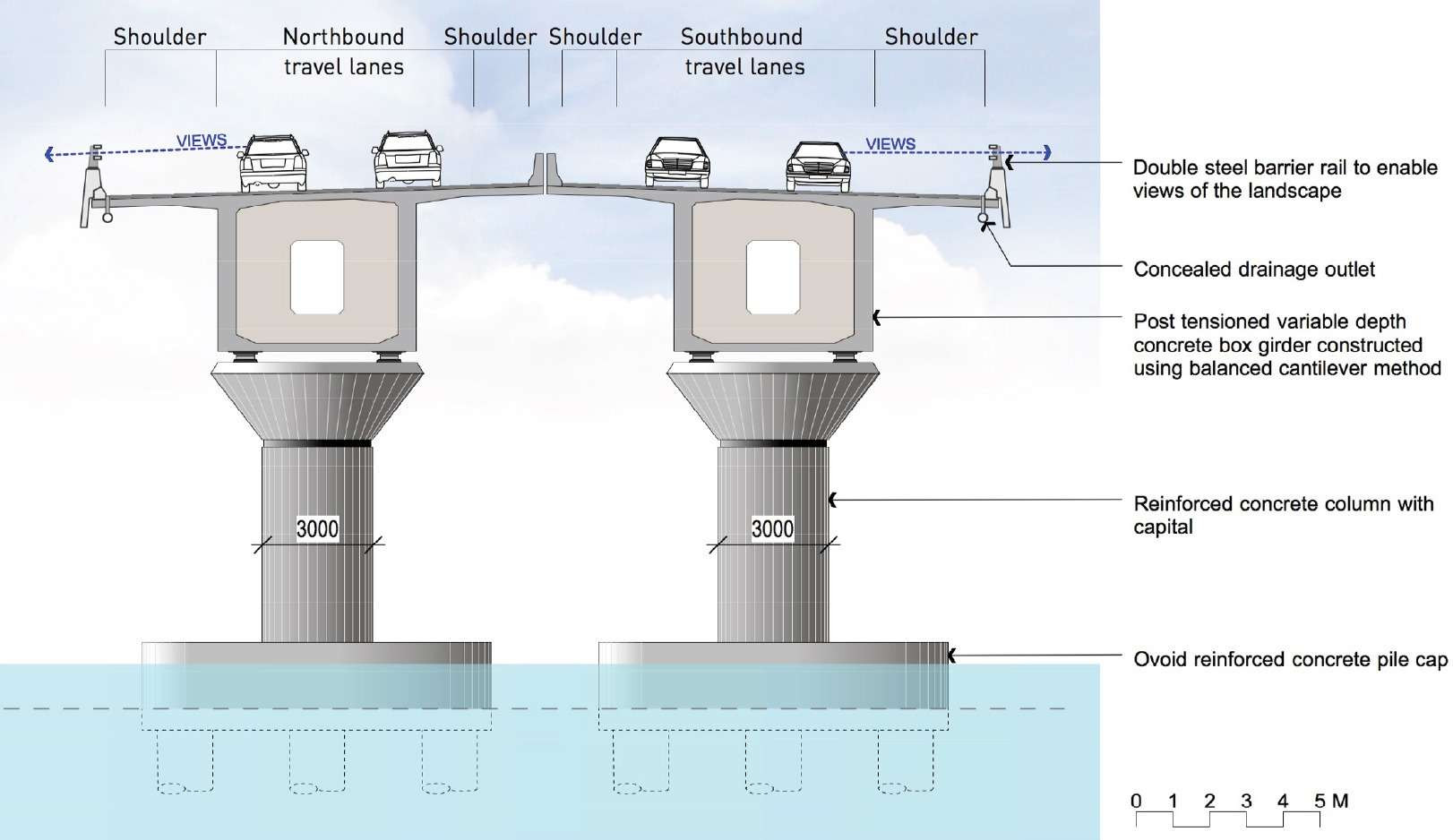
- A 2.6km viaduct over the Hunter River flood plain including new bridge crossings over the Main North Rail Line, the New England Highway and the Hunter River
The M1 Pacific Motorway extension would bypass congestion and merge points along the existing Pacific Highway and New England Highway corridors. The proposed extension would reduce traffic volumes on the New England Highway which would improve traffic flow and access for motorists travelling between Newcastle and Maitland.
Design
Black Hill Interchange
A new interchange would be provided at Black Hill connecting the M1 Motorway extension to John Renshaw Drive and Weakleys Drive. The new north-facing entry and exit ramps tie-in to the recently upgraded Weakleys Drive and John Renshaw Drive signalised intersection.
Tarro interchange
A new interchange would be provided at Tarro connecting the New England Highway to the M1 Motorway extension. The new west-facing ramps allow traffic with an origin or destination at Beresfield and Maitland to enter and exit the project. The project would upgrade the New England Highway to six lanes between John Renshaw Drive and Anderson Drive.
Tomago interchange
A new interchange would be provided at Tomago connecting the Pacific Highway and Old Punt Road with the M1 Motorway extension.
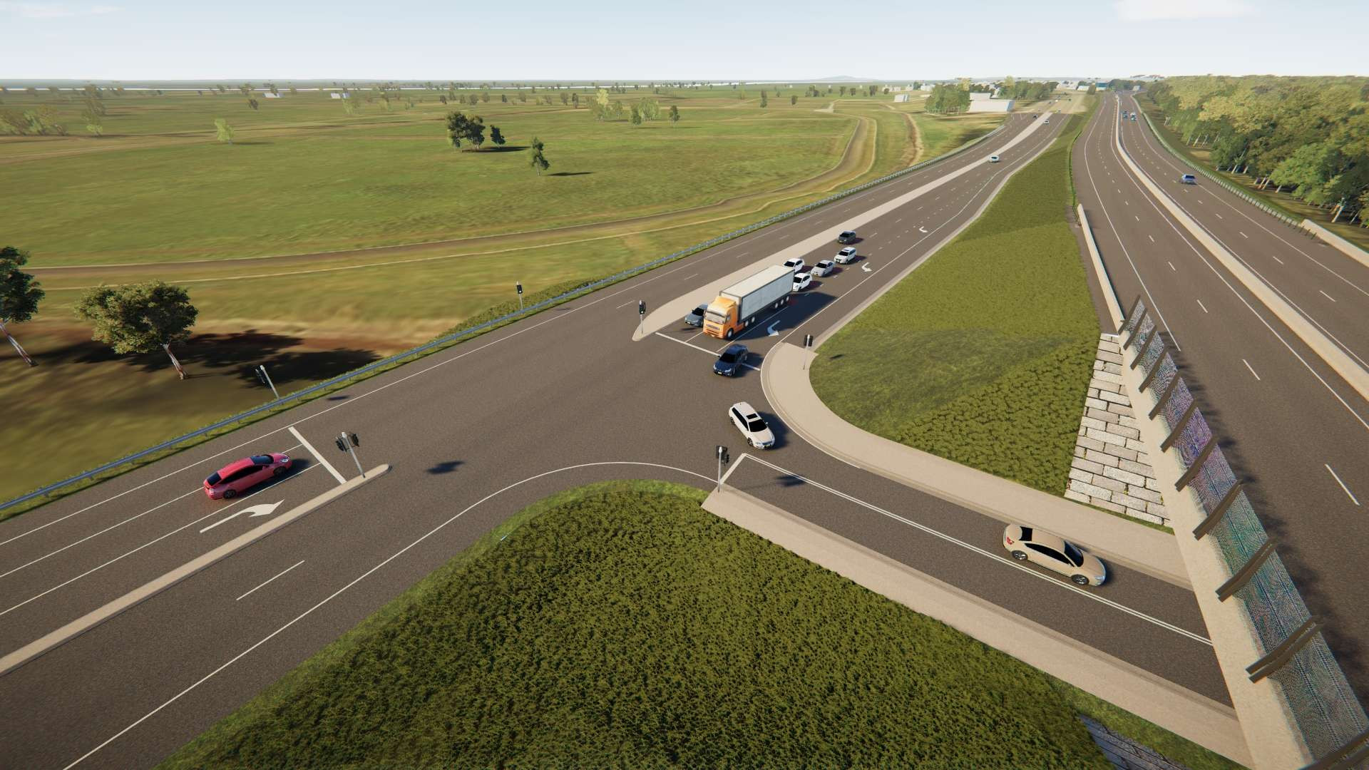
The Pacific Highway would be realigned for northbound and southbound traffic, and allow for traffic to enter and exit the M1 Motorway extension from all directions. Includes minor upgrades to Tomago Road and Old Punt Road, including provision for a right turn from Tomago Road and the Pacific Highway.
Hunter Region Botanic Gardens Access
New traffic signals, bus and pedestrian facilities would be provided on the realigned Pacific Highway to cater for access to the Hunter Region Botanic Gardens.
Raymond Terrace Interchange
A new interchange would be provided at Raymond Terrace connecting the M1 Motorway extension to the Pacific Highway. The new south-facing entry and exit ramps allow traffic to access the existing Pacific Highway, as well as the key areas of Heatherbrae and Raymond Terrace.
Map layers
The project would result in the removal of about 174 hectares of native vegetation, including 136 hectares of vegetation classified as threatened ecological communities.
Summary of impacts
There would be removal of four threatened plant species (Diuris arenaria (about 161 individuals), Callistemon linearifolius (about 157 individuals), Eucalyptus parramattensis (about 34 individuals), Persicaria elatior (about 3 individuals)), minor fragmentation of native vegetation, minor impacts to riparian habitat, and temporary impacts to key fish habitats.
Koala
Targeted koala surveys were carried out in 2015, 2016 and 2019. There were no observations of koalas during these surveys, and no evidence of koala activity in potential habitat areas within the construction footprint.
Although the project would result in minimal impact to fauna connectivity, the project would remove 51.12 hectares of vegetation types that contain koala feed tree species in the Tomago to Heatherbrae area of the project.
The project has been designed to be located close to adjoining existing roads and industrial areas, resulting in minimal impacts on the movements of koalas.
The project is not expected to significantly impact on the Koala.
Mitigation measures
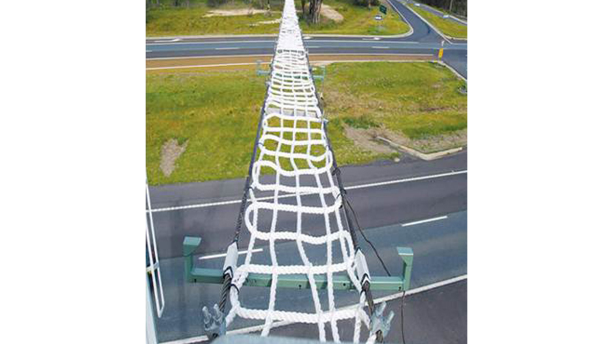
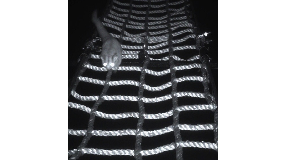
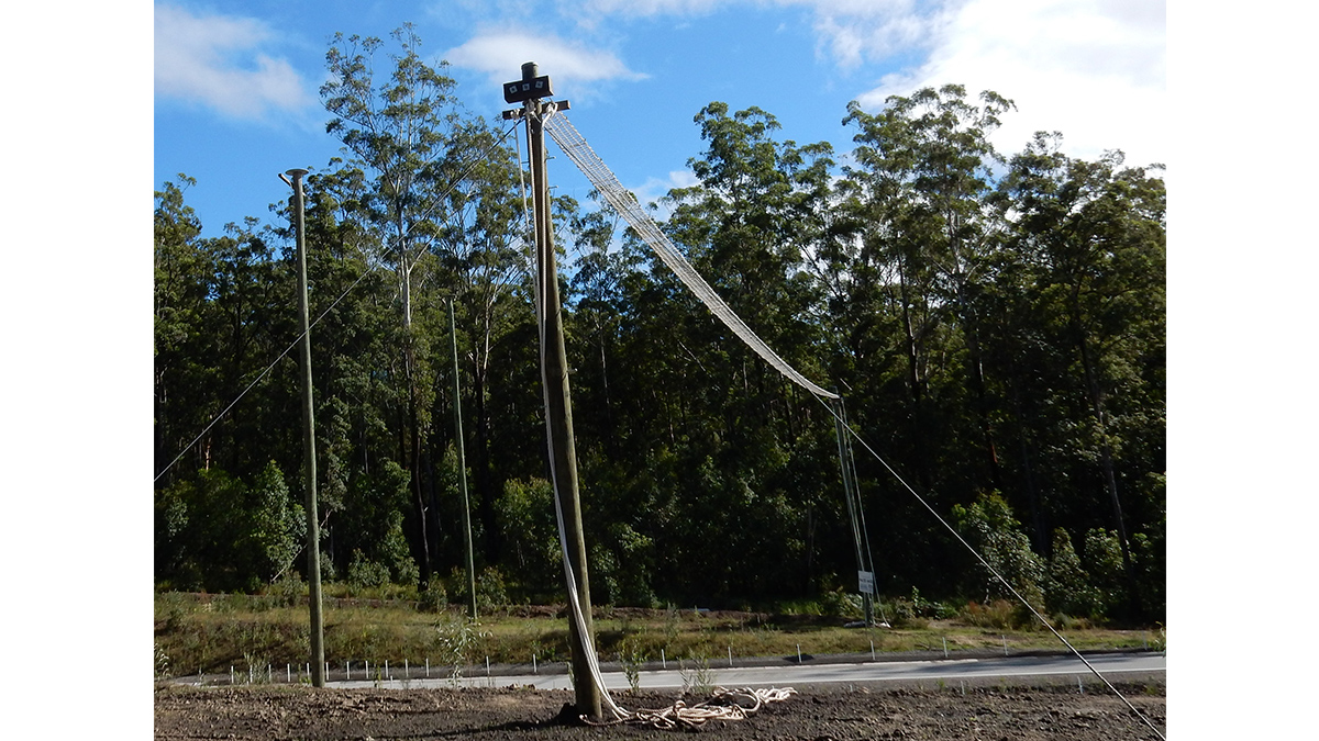
Biodiversity impacts have been avoided and minimised, where possible, by locating the project within or next to existing development and infrastructure corridors, or in areas modified by agriculture. Additional measures and strategies proposed to avoid and minimise impacts include the provision of fauna connectivity structures, fencing to prevent injury to fauna, and appropriate revegetation of areas disturbed by construction.
A biodiversity offset strategy has been prepared for the project to address unavoidable residual impacts.
Map layers
Cycling connections
The project would result in improved traffic performance outcomes in the area, including improvements to network-wide speeds, travel times, intersection level of service and safety.
The project is expected to reduce traffic volumes on the existing road network by about 13 to 50 per cent when it opens to traffic, saving motorists between 7 and 9 minutes of travel time during peak periods. The project will bypass five sets of traffic lights, and remove up to 25,000 vehicles per day from the existing road network.
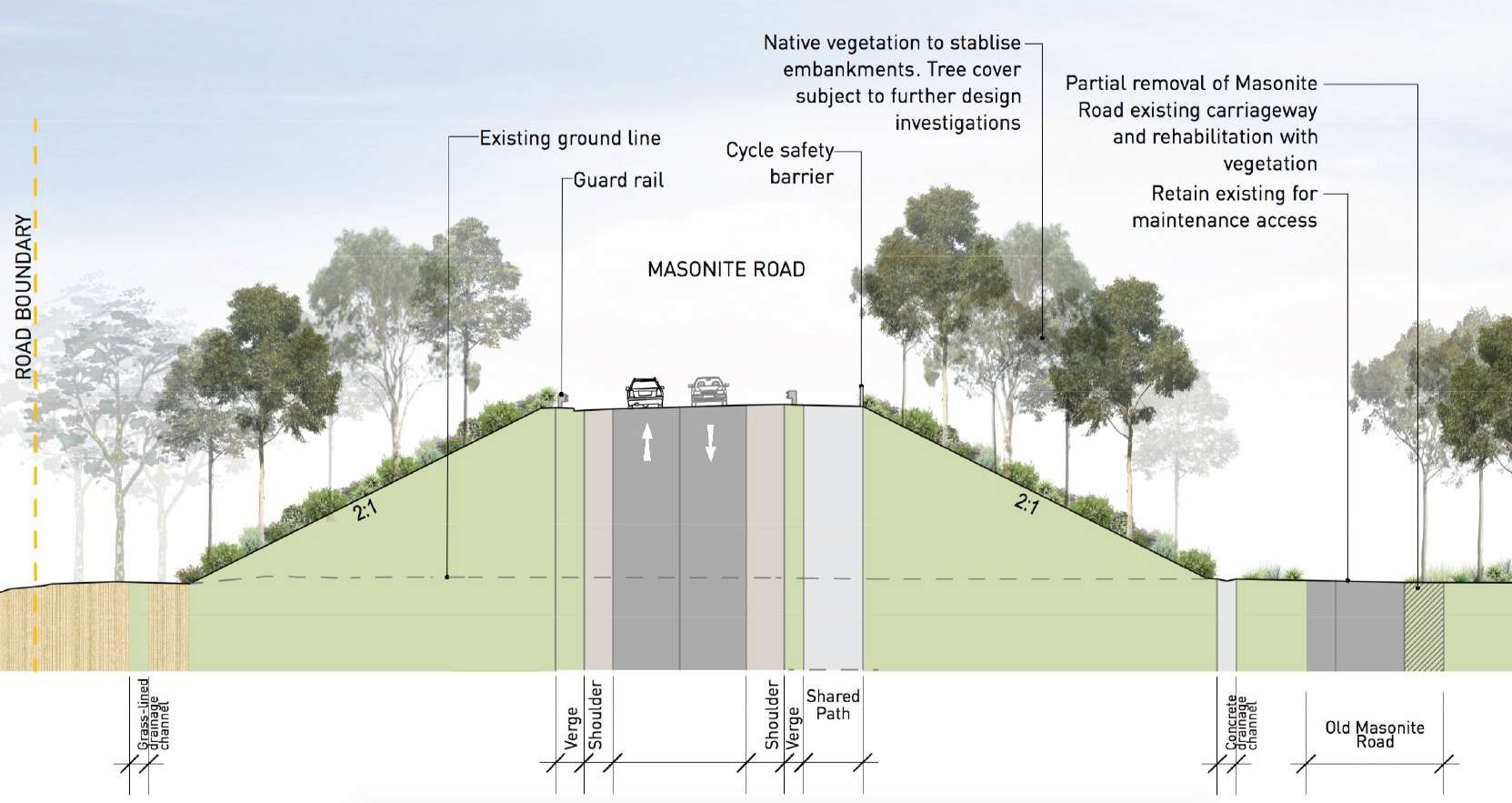
The project would deliver improved access at the Hunter Region Botanic Gardens and Masonite Road, as well as to cyclist connectivity and crossing points. Together with the reduction in traffic volumes on the existing road network, the project is expected to improve road safety in the area.
Construction activities are anticipated to cause minor disruptions to general traffic, public transport, pedestrian and cyclist, rail and maritime traffic in the area.
A construction traffic and transport management plan would be prepared as part of the construction environmental management plan (CEMP) and would outline measures to maintain access to properties and manage traffic during construction.
Overall, the project would contribute positively to the transport network in the Hunter region.
Chapter 7: Traffic and transport
The project will result in changes to the landscape and spatial character in the area, with impacts including built form changes and clearing of remnant vegetation.
The project would result in a number of beneficial landscape character outcomes including enhanced access and connectivity, improved flood immunity, enhanced town centre amenity, reduced congestion and reduction in freight movements through existing urban centres.
A number of environmental management measures and urban design opportunities have been identified to mitigate landscape character and visual impacts, including further consideration of how major project elements such as bridges can be refined to potentially further reduce the project’s impacts.
Chapter 15: Urban design and visual amenity
This layer presents property lots which are not owned by Transport for NSW and impacted by the project.
Property
Acquisition (some partial and some full) and property adjustments (access, fences and infrastructure) for the project would directly impact some properties. Some temporary leases of land would also be required to accommodate construction facilities.
Socio-economic
During construction the project would have positive outcome for local employment and businesses by supporting and average of 2,700 direct and indirect jobs annually. Negative impacts during construction would be short term and mainly associated with changed amenity for community and business near construction activities, and potential impacts due to changed road conditions and construction traffic.
Once operational, the project would improve road safety and driving conditions, reduce travel times, improve access and connectivity to social infrastructure, and improve local amenity within Heatherbrae due to reduced traffic volumes on the Pacific Highway. The project would however result in a possible decreases in passing trade for some businesses in Heatherbrae. The project may also result in impacts on local character and visual amenity for the community located near proposed interchanges. A Construction Environmental Management Plan would be implemented to manage impacts associated with noise and vibration, air quality, traffic, and visual amenity. Further, a Community Communication Strategy will be implemented to ensure effective communication with local community, business and other stakeholders.
Map layers - Construction Noise
Map layers - Operational Noise Mitigation
During construction
Construction noise impacts have been assessed on a realistic worst-case basis, in accordance with the construction noise guidelines.
During construction there would be noise impacts at residential receivers located near the construction work or near construction ancillary facilities, including those at Black Hill, Tarro, Tomago and Heatherbae.
A construction noise and vibration management plan will be prepared to mitigate and manage noise and vibration impacts during the construction of the project. Information about potential out-of-hours work will be communicated to impacted residents as required during construction.
During operation
The change in road traffic noise exposure as a result of the project is predicted to be less than 2 dB(A) at 83 per cent of sensitive receivers. A total of 189 sensitive receivers (out of 1671 receiver buildings assessment within the operational study area) were identified as being eligible for consideration for additional noise mitigation.
The project has assessed additional management measures such as quieter pavements, noise barriers and at-property noise mitigation treatment to aid in reducing traffic noise levels at affected residential receivers. These treatments are determined in accordance with Transport guidelines and would be investigated further during detailed design.
Noise and vibration fact sheet Chapter 8: Noise and vibration
Map layers - Water
Map layers - other water
The project has adopted a 2.6km long floodplain and river bridge (viaduct) to avoid substantial upstream flooding impacts, including impacts to drainage capacity, flood storage and conveyance. Once operational, the project would improve accessibility of the Pacific Highway between Black Hill and Raymond Terrace including across the Hunter River floodplain during flood events, by improving the flood immunity of the roadway compared to the existing condition.
The completed project would be built to withstand a minimum 1 in 20 year flood event and provide an alternate flood emergency and evacuation route to the existing road network.
Impacts on flooding and hydrology from the project are mainly associated with minor increases in flood levels and impact on some properties during both construction and operation. Management measures to further reduce the impacts of the project include ongoing design development in the detailed design stage where feasible. Transport will continue to consult with affected property owners during detailed design to manage and minimise land use and property impacts.
Existing water quality in the project area is generally poor, with elevated nutrient levels and heavy metal concentration typical of a catchment that has been impacted by urbanisation, industrial and commercial use, and land clearing. The project’s design has incorporated a number of measures such as water quality basins to ensure that the quality of stormwater runoff from the M1 Motorway extension during construction and operation contributes toward the achievement of the NSW Water Quality Objectives.
During construction, detailed erosion and sediment control plans will be prepared as part of the Construction Soils and Water Management Plan, and include regular monitoring of key waterways downstream of project discharge locations.
Chapter 10: Hydrology and flooding
Map layers
There are a number of Aboriginal and Non-Aboriginal heritage items that would be directly impacted by the project. The project would have a major impact on some of these heritage items.
Management plans will be prepared as part of the Construction Environmental Management Plan (CEMP), and will include procedures and exclusion zones for avoiding impacts on known Aboriginal and non-Aboriginal heritage items where possible.
Chapter 12: Aboriginal cultural heritage Chapter 17: Non-Aboriginal heritage
-
Current Design
-
Bridges
-
Construction Footprint
-
Operational Footprint
-
Construction Ancillary Facilities
-
Point of interest
-
Project information
-
Flyover/orbit video
-
Before/after image
-
Upgrade to existing road
-
Project information
-
Design detail
- Biodiversity
-
Native vegetation
-
Fauna connectivity
-
Coastal wetland
-
Overhead fauna crossing (rope)
-
Overhead fauna crossing (glider)
- Traffic and transport
-
Existing north-south route
-
Existing public transport route
-
Construction traffic routes
-
Daily traffic volumes
-
Cycling connection difficulty - Low
-
Cycling connection difficulty - Medium
-
Cycling connection difficulty - High
-
Proposed cycling connections
-
Proposed cycling connections - pathways
- Socio-economic, land use and property
-
Impacted Properties
-
Point of interest
- Urban design and visual amenity
-
Current Design
-
Bridges
-
Point of interest
-
Before and after images
- Noise and vibration
-
>= 85 dBA
-
80 dBA
-
75 dBA
-
70 dBA
-
65 dBA
-
60 dBA
-
55 dBA
-
<= 50 dBA
-
Existing noise barriers
-
Proposed noise barriers
-
Proposed quieter pavement treatments
- Water
-
100 year floodplain
-
Waterways / Water quality basins
- Heritage
-
Non-Aboriginal Heritage Items
-
Point of interest


